Enable Location

We need your location to show you interesting places around you

Discover nearby places

Find interesting locations and hidden gems around you

Precise directions

Get accurate directions and distances to places

Your location is never shared with other users. It's only used when you tap the location button.

Sandusky County

Log in to your account

Start exploring — it's free

Trusted by 61,865 travelers worldwide

Continue with Google
Continue with Apple
or

We will send you a code to connect

By continuing, you accept our Terms and Conditions and our Privacy Policy

Check your inbox

We've sent a pincode in your inbox. Please enter the code below.

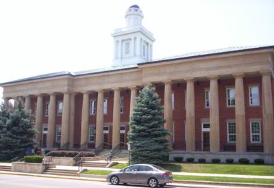
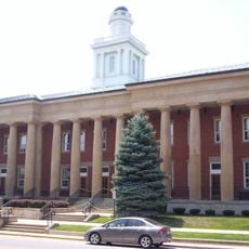
Sandusky County, Administrative county in northwestern Ohio, United States.

Description

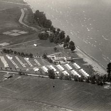
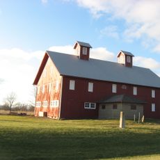
Sandusky County spreads across northwestern Ohio and includes the city of Fremont along with multiple townships situated near the Sandusky River as it flows toward Lake Erie. The landscape is shaped by waterways that define the region's geography.

History

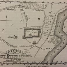
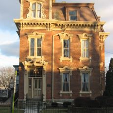
The area was established as a separate county in 1820 from parts of neighboring Huron County. Its name comes from a Wyandot word for water, preserving a connection to the Native American peoples who inhabited the region for centuries.

Culture

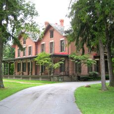
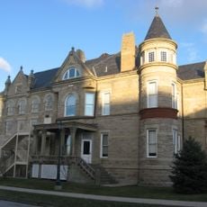
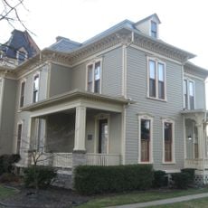
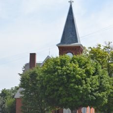
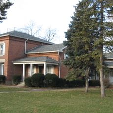
The Rutherford B. Hayes Presidential Center in Fremont displays exhibits and documents connected to a 19th-century American president who had ties to the area. Visitors can explore the personal and political story of this historical figure through the museum's collection.

Practical

The area connects well through Interstate 80 and U.S. Route 6, which serve as major transportation corridors for travelers. Several regional airports nearby provide options for air travel and getting around.

Did you know?

A major food company produces one of the world's most recognized condiments here on a massive scale. The facility has shaped the local economy and employment for decades.

Location
Inception
February 12, 1820
Capital city
Fremont
Shares border with
Ottawa County, Seneca County, Erie County, Huron County, Wood County
GPS coordinates
41.36000,-83.15000
Latest update
December 7, 2025 19:22

AroundUs brings together thousands of curated places, local tips, and hidden gems, enriched daily by 60,000 contributors worldwide. Discover all places nearby (Ohio).

Around this place
Spiegel Grove
United States of America

Spiegel Grove

2.7 km
Rutherford B. Hayes Presidential Center
United States of America

Rutherford B. Hayes Presidential Center

2.7 km
African Safari Wildlife Park
United States of America

African Safari Wildlife Park

30.5 km
Ottawa National Wildlife Refuge
United States of America

Ottawa National Wildlife Refuge

29 km
Edison Bridge
United States of America

Edison Bridge

29.5 km
Seneca Caverns
United States of America

Seneca Caverns

27.4 km
Fort Stephenson
United States of America

Fort Stephenson

3.3 km
Sandusky County Jail and Sheriff's House
United States of America

Sandusky County Jail and Sheriff's House

3 km
Liberty Aviation Museum
United States of America

Liberty Aviation Museum

29 km
Magee Marsh Wildlife Area
United States of America

Magee Marsh Wildlife Area

28.3 km
Erie Proving Ground
United States of America

Erie Proving Ground

22.1 km
Mull Covered Bridge
United States of America

Mull Covered Bridge

11.4 km
Port Clinton Light
United States of America

Port Clinton Light

24.9 km
Port Clinton Public Swimming Beach
United States of America

Port Clinton Public Swimming Beach

25.4 km
The Octagon
United States of America

The Octagon

27.1 km
Old School Privy
United States of America

Old School Privy

24.6 km
The Watering Hole Safari and Waterpark
United States of America

The Watering Hole Safari and Waterpark

31.3 km
Overmyer–Waggoner–Roush Farm
United States of America

Overmyer–Waggoner–Roush Farm

8.6 km
Frederick Fabing House
United States of America

Frederick Fabing House

3.2 km
Joseph and Rachel Bartlett House
United States of America

Joseph and Rachel Bartlett House

3.2 km
Soldiers and McKinley Memorial Parkways
United States of America

Soldiers and McKinley Memorial Parkways

2.6 km
Sandusky County Courthouse
United States of America

Sandusky County Courthouse

3.1 km
Aigler Alumni Building
United States of America

Aigler Alumni Building

27.1 km
Pleasant Ridge United Methodist Church and Cemetery
United States of America

Pleasant Ridge United Methodist Church and Cemetery

21.8 km
United States of America

Black Student Union Center

27.4 km
Georg Cronenwett House
United States of America

Georg Cronenwett House

21 km
Paramount Cinema
United States of America

Paramount Cinema

3.5 km
Mad River and Lake Erie Railroad
United States of America

Mad River and Lake Erie Railroad

27 km
Show the full map
Administrative divisions
« Sandusky County - Administrative county in northwestern Ohio, United States » is provided by Around Us (aroundus.com). Images and texts are derived from Wikimedia project under a Creative Commons license. You are allowed to copy, distribute, and modify copies of this page, under the conditions set by the license, as long as this note is clearly visible.

Discover hidden gems everywhere you go!

From secret cafés to breathtaking viewpoints, skip the crowded tourist spots and find places that match your style. Our app makes it easy with voice search, smart filtering, route optimization, and insider tips from travelers worldwide. Download now for the complete mobile experience.

Around Us App Screenshot

A unique approach to discovering new places

Le Figaro

All the places worth exploring

France Info

A tailor-made excursion in just a few clicks

20 Minutes

Around Us
Travel Guide & Maps
Download

Send to your phone

QR Code
1

Open the camera app on your mobile.

2

Point at the QR code with your camera. A notification will appear.

3

Tap the notification to open the link.