White County

Log in to your account

AroundUs is a community-driven map of interesting places, built by curious explorers like you. It grows with every review, story, and photo you share.
Connect to save your favorite spots, contribute locations, and create personalized routes.
Continue with Google
Continue with Apple
Continue with X
Continue with Facebook
Continue with email
By continuing, you accept our Terms and Conditions and our Privacy Policy
Create an account
Add to collection
Map
Suggest a change
Share

White County, Administrative county in Northeast Georgia, United States

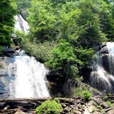
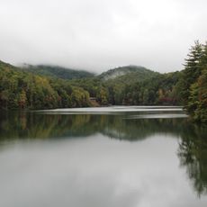
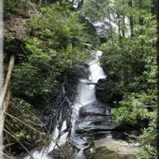
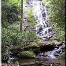
White County is an administrative county in Northeast Georgia covering roughly 626 square kilometers within the foothills of the Blue Ridge Mountains. The terrain consists of rolling highlands, dense forests, and river valleys that define the natural character of the region.

The county was established by the Georgia State Legislature in December 1857 after being separated from Habersham County. This division created a distinct administrative territory organized to serve the growing mountain communities.

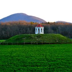
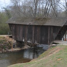
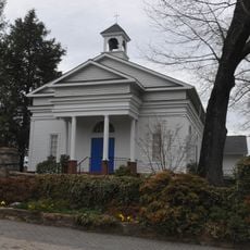
The region maintains strong ties to its mountain heritage, visible in how communities celebrate local traditions and gather in historic churches. Rural values shape daily life and bring neighbors together through seasonal celebrations and civic events.

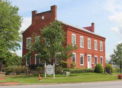
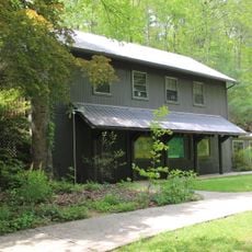
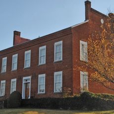
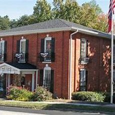
Cleveland serves as the county seat where governmental offices handle permits, licenses, and administrative matters during regular business hours. Visitors seeking county services should plan visits on weekdays when all offices operate at full capacity.

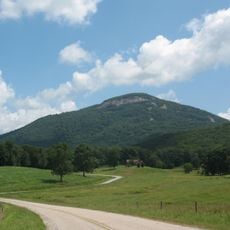
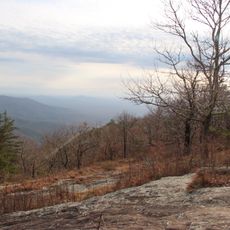
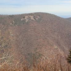
Mount Yonah rises about 960 meters and features steep rock faces on several sides, standing between Cleveland and Helen. The distinctive peak serves as a natural landmark visible across the region and draws hikers seeking river views from above.

Location: Georgia

Inception: 1857

Capital city: Cleveland

Shares border with: Towns County, Hall County, Habersham County, Lumpkin County, Union County

Website: http://whitecounty.net

GPS coordinates: 34.68333,-83.75000

Latest update: December 23, 2025 05:27

Photos
Around this place
Anna Ruby Falls
United States of America

Anna Ruby Falls

9.6 km
Yonah Mountain
United States of America

Yonah Mountain

6.1 km
Unicoi State Park
United States of America

Unicoi State Park

4.7 km
United States of America

Raven Cliff Falls

6.7 km
Nacoochee Mound
United States of America

Nacoochee Mound

3.8 km
Dukes Creek
United States of America

Dukes Creek

4.3 km
United States of America

Kenimer Site

6.4 km
Smithgall Woods Conservation Area
United States of America

Smithgall Woods Conservation Area

1.8 km
Raven Cliffs Wilderness
United States of America

Raven Cliffs Wilderness

8.6 km
United States of America

Mark Trail Wilderness

11.3 km
Horsetrough Falls
United States of America

Horsetrough Falls

12.6 km
Stovall Mill Covered Bridge
United States of America

Stovall Mill Covered Bridge

9 km
Wildcat Mountain
United States of America

Wildcat Mountain

9.1 km
Nacoochee Valley Historic District
United States of America

Nacoochee Valley Historic District

5.4 km
Old White County Courthouse
United States of America

Old White County Courthouse

9.9 km
United States of America

John Stovall House

10.6 km
White County Jail
United States of America

White County Jail

9.6 km
Sautee Valley Historic District
United States of America

Sautee Valley Historic District

8 km
United States of America

White County History Museum

9.7 km
United States of America

Grimes Nose

8.2 km
United States of America

Helen Arts & Heritage Center

2.7 km
United States of America

Sautee Nacoochee Center

6.8 km
United States of America

Hardman Farm State Historic Site

3.8 km
United States of America

Kelly's 19th Tee

14.5 km
United States of America

Mossy Creek Golf Course

19.4 km
United States of America

Innsbruck Golf Club

4.5 km
United States of America

Skylake Galleries

9 km
United States of America

Buck Shoals Beach

17.4 km
Show the full map
Reviews

Visited this place? Tap the stars to rate it and share your experience / photos with the community! Try now! You can cancel it anytime.

« White County - Administrative county in Northeast Georgia, United States » is provided by Around Us (aroundus.com). Images and texts are derived from Wikimedia project under a Creative Commons license. You are allowed to copy, distribute, and modify copies of this page, under the conditions set by the license, as long as this note is clearly visible.

Discover hidden gems everywhere you go!

From secret cafés to breathtaking viewpoints, skip the crowded tourist spots and find places that match your style. Our app makes it easy with voice search, smart filtering, route optimization, and insider tips from travelers worldwide. Download now for the complete mobile experience.

Around Us App Screenshot

A unique approach to discovering new places

Le Figaro

All the places worth exploring

France Info

A tailor-made excursion in just a few clicks

20 Minutes