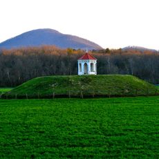
Nacoochee Mound, Platform mound in White County, Georgia
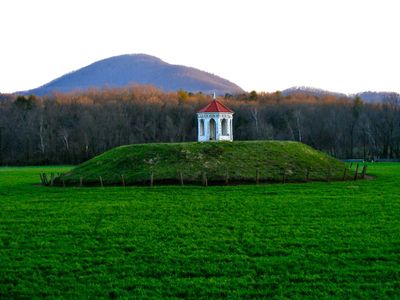
The Nacoochee Mound is a reconstructed earthen mound about 17 feet tall with a 70-foot diameter, located on private property two miles south of Helen on the banks of the Chattahoochee River. The site contains multiple construction layers and holds the remains of more than 75 people from different periods.
The site was inhabited over more than 1500 years by different cultures, starting with Early Woodland communities and later by the Mississippian civilization. Major excavations in 1915 exposed burial layers and construction phases that documented this extended period of occupation and use.
The burial site held deep meaning for the Mississippian community, where graves containing copper items and shell beads reveal how people marked social differences through their burials. These objects show how residents honored their dead and displayed their place in society.
The site sits on private property and is visible from the road but only accessible with permission. Visitors should inquire in advance about how to view the mound, since it is not located on public land.
The site shows rare evidence of continuous occupation by two distinct cultures separated by thousands of years. Recent research confirmed that Early Woodland people and later Mississippian inhabitants both chose this same location, suggesting its importance across a very long span of time.
The community of curious travelers
AroundUs brings together thousands of curated places, local tips, and hidden gems, enriched daily by 60,000 contributors worldwide.