Marion County

Log in to your account

AroundUs is a community-driven map of interesting places, built by curious explorers like you. It grows with every review, story, and photo you share.
Connect to save your favorite spots, contribute locations, and create personalized routes.
Continue with Google
Continue with Apple
Continue with X
Continue with Facebook
Continue with email
By continuing, you accept our Terms and Conditions and our Privacy Policy
Create an account
Add to collection
Map
Suggest a change
Share

Marion County, County in southeastern Tennessee, United States

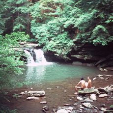
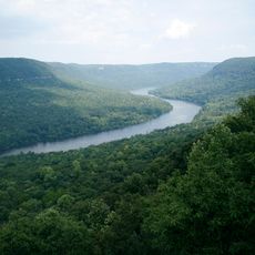
Marion County is located in southeastern Tennessee and encompasses portions of the Tennessee River Gorge. The county also includes sections of Nickajack Lake in Sequatchie Valley, with Jasper serving as its administrative center.

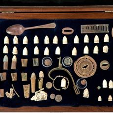
The county was established in 1817 and held strategic importance during the Civil War. Nickajack Cave became a key location where Confederate forces extracted saltpeter for producing gunpowder to support the war effort.

The yearly cornbread festival draws people to celebrate local food traditions through tastings, craft displays, and live performances. This gathering shows how deeply cornbread cooking is woven into the community's identity and daily customs.

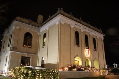
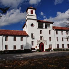
Jasper serves as the central hub where government services and public facilities are located for visitors needing information. The cornbread festival season offers the most vibrant time to experience the county's community spirit and local activities.

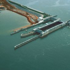
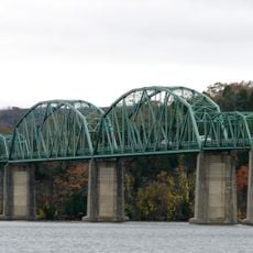
Hales Bar Dam was built between 1905 and 1913 and stands as one of the first major dams constructed across a navigable waterway in the nation. This engineering landmark reflects the county's early role in American hydroelectric development.

Location: Tennessee

Inception: 1817

Capital city: Jasper

Shares border with: Sequatchie County, Jackson County, Dade County, Hamilton County, Grundy County, Franklin County

Website: http://marioncountytn.net

GPS coordinates: 35.13000,-85.61000

Latest update: December 7, 2025 10:05

Photos
Around this place
Ruby Falls
United States of America

Ruby Falls

27.6 km
Nickajack Cave
United States of America

Nickajack Cave

15.6 km
RyeMabee
United States of America

RyeMabee

23.4 km
Fiery Gizzard Trail
United States of America

Fiery Gizzard Trail

12.5 km
Nickajack Lake
United States of America

Nickajack Lake

14 km
South Cumberland State Park
United States of America

South Cumberland State Park

21.7 km
Sewanee Natural Bridge
United States of America

Sewanee Natural Bridge

28.5 km
United States of America

Lost Cove Cave

27.4 km
P. R. Olgiati Bridge
United States of America

P. R. Olgiati Bridge

27.9 km
DuBose Conference Center
United States of America

DuBose Conference Center

23.3 km
Tennessee River Blueway
United States of America

Tennessee River Blueway

19.5 km
Marion Memorial Bridge
United States of America

Marion Memorial Bridge

12.9 km
Bridgeport Depot Museum
United States of America

Bridgeport Depot Museum

22.2 km
Bridgeport Historic District
United States of America

Bridgeport Historic District

22.1 km
Coalmont Bank Building
United States of America

Coalmont Bank Building

24.8 km
McKendree Methodist Episcopal Church
United States of America

McKendree Methodist Episcopal Church

6 km
Col. A.M. Shook House
United States of America

Col. A.M. Shook House

18.6 km
Nathan L. Bachman School
United States of America

Nathan L. Bachman School

26.5 km
Ochs Memorial Museum
United States of America

Ochs Memorial Museum

27.6 km
Russell Cave
United States of America

Russell Cave

25 km
Sewanee Fire Lookout Tower
United States of America

Sewanee Fire Lookout Tower

27.2 km
Moccasin Bend
United States of America

Moccasin Bend

27 km
Gilbert H. Grosvenor Visitor Center
United States of America

Gilbert H. Grosvenor Visitor Center

24.8 km
IMAX 3D Theater
United States of America

IMAX 3D Theater

28.4 km
Lookout Mountain Battlefield Visitor Center
United States of America

Lookout Mountain Battlefield Visitor Center

27.7 km
Point Park (Lookout Mountain)
United States of America

Point Park (Lookout Mountain)

27.6 km
Bridgeport Swing Bridge
United States of America

Bridgeport Swing Bridge

20.8 km
Danny Cove
United States of America

Danny Cove

8.4 km
Show the full map
Reviews

Visited this place? Tap the stars to rate it and share your experience / photos with the community! Try now! You can cancel it anytime.

Administrative divisions
« Marion County - County in southeastern Tennessee, United States » is provided by Around Us (aroundus.com). Images and texts are derived from Wikimedia project under a Creative Commons license. You are allowed to copy, distribute, and modify copies of this page, under the conditions set by the license, as long as this note is clearly visible.

Discover hidden gems everywhere you go!

From secret cafés to breathtaking viewpoints, skip the crowded tourist spots and find places that match your style. Our app makes it easy with voice search, smart filtering, route optimization, and insider tips from travelers worldwide. Download now for the complete mobile experience.

Around Us App Screenshot

A unique approach to discovering new places

Le Figaro

All the places worth exploring

France Info

A tailor-made excursion in just a few clicks

20 Minutes