Enable Location

We need your location to show you interesting places around you

Discover nearby places

Find interesting locations and hidden gems around you

Precise directions

Get accurate directions and distances to places

Your location is never shared with other users. It's only used when you tap the location button.

Caldwell County

Log in to your account

Start exploring — it's free

Trusted by 62,994 travelers worldwide

Continue with Google
Continue with Apple
or

We will send you a code to connect

By continuing, you accept our Terms and Conditions and our Privacy Policy

Check your inbox

We've sent a pincode in your inbox. Please enter the code below.

Discussion Reviews 1 Photos
11.9k Popularity

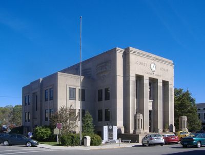
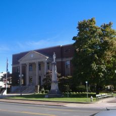
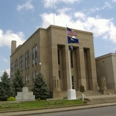
Caldwell County, Administrative county in Western Kentucky, United States

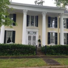
Caldwell County is an administrative division in Western Kentucky located within the Pennyrile region. Princeton serves as the county seat and main hub for local services and governance.

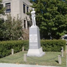
The county was created in 1809 from Livingston County and named after John Caldwell, Kentucky's second lieutenant governor. Caldwell was a veteran of the 1786 Indian Campaign and played a significant role in the region's early development.

The county holds marks of the Cherokee Trail of Tears, where Native Americans stopped during their winter journey in 1838. Visitors walking through the land can sense the weight of this historical passage.

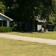
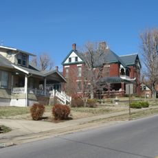
The county is accessible via main transportation routes that link Princeton with surrounding areas. Visitors can find basic services and local amenities throughout the region for general needs.

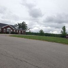
Hidden within the county is the University of Kentucky Research and Education Center, operating since 1925 with specialized research programs. This facility focuses on horticultural studies and biological sciences, contributing to local knowledge and innovation.

The community of curious travelers

AroundUs brings together thousands of curated places, local tips, and hidden gems, enriched daily by 60,000 contributors worldwide.

Start exploring
Location
Inception
January 31, 1809
Capital city
Princeton
Shares border with
Webster County, Hopkins County, Christian County, Trigg County, Lyon County, Crittenden County
GPS coordinates
37.15000,-87.87000
Latest update
December 7, 2025 20:48
Around this place
Land Between the Lakes National Recreation Area
United States of America

Land Between the Lakes National Recreation Area

37.4 km
Kentucky Lake
United States of America

Kentucky Lake

38.7 km
Kentucky State Penitentiary
United States of America

Kentucky State Penitentiary

21.6 km
Lake Barkley
United States of America

Lake Barkley

34.5 km
Kentucky Dam
United States of America

Kentucky Dam

38.6 km
Cave-in-Rock State Park
United States of America

Cave-in-Rock State Park

43.6 km
Lake Barkley State Resort Park
United States of America

Lake Barkley State Resort Park

34.3 km
Kentucky Dam Village State Resort Park
United States of America

Kentucky Dam Village State Resort Park

41 km
Adsmore
United States of America

Adsmore

4.5 km
University of Kentucky Research and Education Center Botanical Garden
United States of America

University of Kentucky Research and Education Center Botanical Garden

5.9 km
Confederate Soldier Monument in Caldwell
United States of America

Confederate Soldier Monument in Caldwell

4.7 km
Old Eddyville Historic District
United States of America

Old Eddyville Historic District

21.5 km
Confederate Monument of Cadiz
United States of America

Confederate Monument of Cadiz

32.2 km
Cadiz Downtown Historic District
United States of America

Cadiz Downtown Historic District

32.2 km
Fredonia Cumberland Presbyterian Church
United States of America

Fredonia Cumberland Presbyterian Church

18 km
Thomas Lawson House
United States of America

Thomas Lawson House

36.4 km
Madisonville Commercial Historic District
United States of America

Madisonville Commercial Historic District

38.4 km
Cadiz Main Street Residential District
United States of America

Cadiz Main Street Residential District

31.9 km
Beulah Lodge
United States of America

Beulah Lodge

20.9 km
Cadiz Masonic Lodge No. 121 F. and A.M.
United States of America

Cadiz Masonic Lodge No. 121 F. and A.M.

32.1 km
Webster County Courthouse
United States of America

Webster County Courthouse

43.8 km
L.B. Overby House
United States of America

L.B. Overby House

5.1 km
The Darby House
United States of America

The Darby House

15.8 km
Providence Commercial Historic District
United States of America

Providence Commercial Historic District

29.1 km
W.W. Kington House
United States of America

W.W. Kington House

36.6 km
Cave In Rock State Park
United States of America

Cave In Rock State Park

43.5 km
Capitol Cinemas
United States of America

Capitol Cinemas

4.7 km
Cranor School
United States of America

Cranor School

25.3 km
Show the full map
Reviews
Share your experience

No review yet

Discussions
Start a discussion...

No discussion yet

Administrative divisions
« Caldwell County - Administrative county in Western Kentucky, United States » is provided by Around Us (aroundus.com). Images and texts are derived from Wikimedia project under a Creative Commons license. You are allowed to copy, distribute, and modify copies of this page, under the conditions set by the license, as long as this note is clearly visible.

Discover hidden gems everywhere you go!

From secret cafés to breathtaking viewpoints, skip the crowded tourist spots and find places that match your style. Our app makes it easy with voice search, smart filtering, route optimization, and insider tips from travelers worldwide. Download now for the complete mobile experience.

Around Us App Screenshot

A unique approach to discovering new places

Le Figaro

All the places worth exploring

France Info

A tailor-made excursion in just a few clicks

20 Minutes

Around Us
Travel Guide & Maps
Download

Send to your phone

QR Code
1

Open the camera app on your mobile.

2

Point at the QR code with your camera. A notification will appear.

3

Tap the notification to open the link.