Bennett County

Log in to your account

AroundUs is a community-driven map of interesting places, built by curious explorers like you. It grows with every review, story, and photo you share.
Connect to save your favorite spots, contribute locations, and create personalized routes.
Continue with Google
Continue with Apple
Continue with X
Continue with Facebook
Continue with email
By continuing, you accept our Terms and Conditions and our Privacy Policy
Create an account
Add to collection
Map
Suggest a change
Share

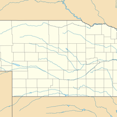
Bennett County, County division in South Dakota, United States

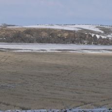
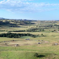
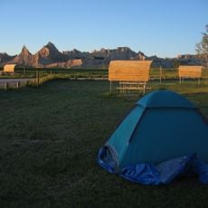
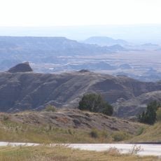
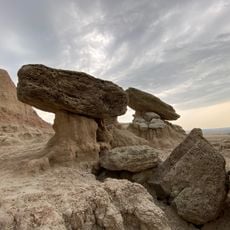
Bennett County is an administrative division in eastern South Dakota with gently rolling hills and deep erosion gullies. The Little White River flows through the central southern area, shaping the landscape around Martin, the county seat.

The region was established in 1909 when land was separated from Fall River County. The first county commission took office following elections in April 1912.

The demographic composition of Bennett County reflects a strong Native American presence, with over 60 percent of residents identifying as American Indian as of 2020.

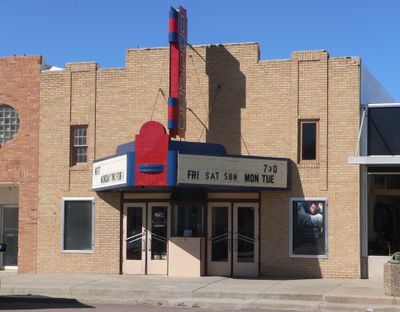
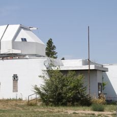
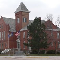
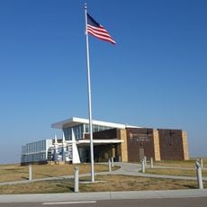
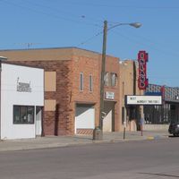
The county administration in Martin offers services such as government offices, public records, and property assessments for residents. Visitors can easily find basic administrative facilities and local services there.

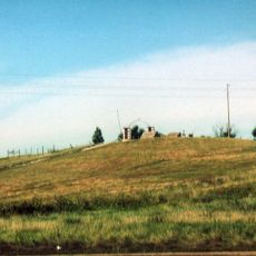
The area contains the North American pole of inaccessibility, the geographical point furthest from any ocean coastline. This location is marked on maps but remains largely unnoticed by most travelers passing through.

Location: South Dakota

Inception: 1909

Capital city: Martin

Shares border with: Jackson County, Todd County, Cherry County, Oglala Lakota County, Mellette County

GPS coordinates: 43.18000,-101.66000

Latest update: December 7, 2025 20:45

Photos
Around this place
Wall Drug
United States of America

Wall Drug

102 km
Minuteman Missile National Historic Site
United States of America

Minuteman Missile National Historic Site

92.9 km
Wounded Knee National Historic Landmark
United States of America

Wounded Knee National Historic Landmark

57.4 km
St. Francis Mission
United States of America

St. Francis Mission

61.5 km
Camp Sheridan
United States of America

Camp Sheridan

95.5 km
Lacreek National Wildlife Refuge
United States of America

Lacreek National Wildlife Refuge

10.8 km
Badlands Observatory
United States of America

Badlands Observatory

97.9 km
Prairie Homestead
United States of America

Prairie Homestead

71.9 km
Cherry County Courthouse
United States of America

Cherry County Courthouse

96.4 km
Valentine Public School
United States of America

Valentine Public School

96.7 km
Adamson Bridge
United States of America

Adamson Bridge

90.5 km
Plains Theatre
United States of America

Plains Theatre

83.1 km
Inland Theater
United States of America

Inland Theater

6.2 km
Mt. Moriah Masonic Lodge No. 155
United States of America

Mt. Moriah Masonic Lodge No. 155

74.1 km
Quinn Methodist Church
United States of America

Quinn Methodist Church

97.7 km
Sheridan County Courthouse
United States of America

Sheridan County Courthouse

83 km
F.M. Walcott House
United States of America

F.M. Walcott House

96.1 km
Spotted Tail Gravesite
United States of America

Spotted Tail Gravesite

65.8 km
Lee and Gottliebe Fritz House
United States of America

Lee and Gottliebe Fritz House

60.9 km
Wounded Knee cemetery
United States of America

Wounded Knee cemetery

57.4 km
Distrito electoral de Valentine (condado de Cherry, Nebraska)
United States of America

Distrito electoral de Valentine (condado de Cherry, Nebraska)

98.8 km
Ben Reifel Visitor Center
United States of America

Ben Reifel Visitor Center

67.3 km
Sage Creek Campground
United States of America

Sage Creek Campground

100.1 km
Cedar Pass Campground
United States of America

Cedar Pass Campground

67 km
Minuteman Missile National Historic Site Visitor Center
United States of America

Minuteman Missile National Historic Site Visitor Center

76.5 km
Ancient Hunters Overlook
United States of America

Ancient Hunters Overlook

89 km
Yellow Mounds Overlook
United States of America

Yellow Mounds Overlook

85.5 km
Saddle Pass Trailhead
United States of America

Saddle Pass Trailhead

69.2 km
Show the full map
Reviews

Visited this place? Tap the stars to rate it and share your experience / photos with the community! Try now! You can cancel it anytime.

Administrative divisions
« Bennett County - County division in South Dakota, United States » is provided by Around Us (aroundus.com). Images and texts are derived from Wikimedia project under a Creative Commons license. You are allowed to copy, distribute, and modify copies of this page, under the conditions set by the license, as long as this note is clearly visible.

Discover hidden gems everywhere you go!

From secret cafés to breathtaking viewpoints, skip the crowded tourist spots and find places that match your style. Our app makes it easy with voice search, smart filtering, route optimization, and insider tips from travelers worldwide. Download now for the complete mobile experience.

Around Us App Screenshot

A unique approach to discovering new places

Le Figaro

All the places worth exploring

France Info

A tailor-made excursion in just a few clicks

20 Minutes