Enable Location

We need your location to show you interesting places around you

Discover nearby places

Find interesting locations and hidden gems around you

Precise directions

Get accurate directions and distances to places

Your location is never shared with other users. It's only used when you tap the location button.

Bartholomew County

Log in to your account

Start exploring — it's free

Trusted by 63,736 travelers worldwide

Continue with Google
Continue with Apple
or

We will send you a code to connect

By continuing, you accept our Terms and Conditions and our Privacy Policy

Check your inbox

We've sent a pincode in your inbox. Please enter the code below.

Discussion Reviews 1 Photos
20.4k Popularity

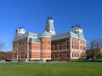
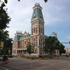
Bartholomew County, County seat in southeastern Indiana, United States.

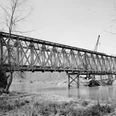
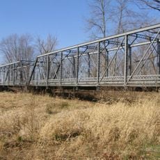
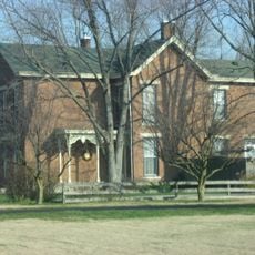
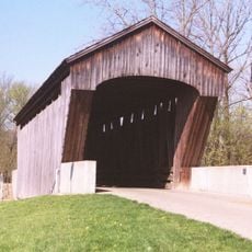
Bartholomew County is an administrative division in southeastern Indiana covering level land around the East Fork of White River. The county includes several townships, with Columbus serving as the main population center and Hope as another significant community.

Bartholomew County was established in 1821 and named after Lieutenant Colonel Joseph Bartholomew, who was wounded during the Battle of Tippecanoe. The county's creation reflected the expanding settlement of the region during the early 19th century.

The Bartholomew Consolidated School Corporation and Flat Rock-Hawcreek School Corporation provide education services to residents across the county's districts.

Interstate 65 and U.S. Highway 31 pass through the county, making travel and trade connections easy for residents and visitors. Both highways provide convenient access to neighboring areas and regional destinations.

In 1900, the U.S. Census Bureau identified this county as the geographic center of the nation's population. This statistical point represented where the balance of American inhabitants fell at that moment in time.

The community of curious travelers

AroundUs brings together thousands of curated places, local tips, and hidden gems, enriched daily by 60,000 contributors worldwide.

Start exploring
Location
Inception
February 12, 1821
Capital city
Columbus
Shares border with
Johnson County, Shelby County, Decatur County, Jennings County, Jackson County, Brown County
GPS coordinates
39.21000,-85.90000
Latest update
December 7, 2025 10:06
Around this place
Camp Atterbury
United States of America

Camp Atterbury

15.1 km
Miller House and Garden
United States of America

Miller House and Garden

2.8 km
North Christian Church
United States of America

North Christian Church

2.5 km
First Christian Church
United States of America

First Christian Church

1.8 km
Cummins Corporate Office Building
United States of America

Cummins Corporate Office Building

2.1 km
Cleo Rogers Memorial Library
United States of America

Cleo Rogers Memorial Library

1.8 km
Irwin Conference Center
United States of America

Irwin Conference Center

2 km
Crump Theatre
United States of America

Crump Theatre

2 km
United States of America

The Republic Newspaper Office

2.2 km
United States of America

Mill Race Park

2.4 km
Bartholomew County Courthouse
United States of America

Bartholomew County Courthouse

2.1 km
The Arch
United States of America

The Arch

1.8 km
Mabel McDowell Adult Education Center
United States of America

Mabel McDowell Adult Education Center

1.1 km
Columbus Power House
United States of America

Columbus Power House

2.5 km
Columbus Historic District
United States of America

Columbus Historic District

1.6 km
Grandview Apostolic Church
United States of America

Grandview Apostolic Church

18.6 km
McEwen-Samuels-Marr House
United States of America

McEwen-Samuels-Marr House

1.9 km
New Hope Bridge
United States of America

New Hope Bridge

5.8 km
Columbus City Hall
United States of America

Columbus City Hall

1.9 km
Brownsville Covered Bridge
United States of America

Brownsville Covered Bridge

2.6 km
Bartholomew County Annex building
United States of America

Bartholomew County Annex building

1.5 km
South Walnut Street Historic District
United States of America

South Walnut Street Historic District

16.7 km
Pugh Ford Bridge
United States of America

Pugh Ford Bridge

14.1 km
David Aikens House
United States of America

David Aikens House

4.8 km
Robert N. Stewart Bridge
United States of America

Robert N. Stewart Bridge

2.5 km
Jonathan Moore Pike I-65 Bridge
United States of America

Jonathan Moore Pike I-65 Bridge

5.1 km
Clifty Creek Bridge
United States of America

Clifty Creek Bridge

4 km
New Brownsville Bridge
United States of America

New Brownsville Bridge

2.6 km
Show the full map
Reviews
Share your experience

No review yet

Discussions
Start a discussion...

No discussion yet

Administrative divisions
« Bartholomew County - County seat in southeastern Indiana, United States » is provided by Around Us (aroundus.com). Images and texts are derived from Wikimedia project under a Creative Commons license. You are allowed to copy, distribute, and modify copies of this page, under the conditions set by the license, as long as this note is clearly visible.

Discover hidden gems everywhere you go!

From secret cafés to breathtaking viewpoints, skip the crowded tourist spots and find places that match your style. Our app makes it easy with voice search, smart filtering, route optimization, and insider tips from travelers worldwide. Download now for the complete mobile experience.

Around Us App Screenshot

A unique approach to discovering new places

Le Figaro

All the places worth exploring

France Info

A tailor-made excursion in just a few clicks

20 Minutes

Around Us
Travel Guide & Maps
Download

Send to your phone

QR Code
1

Open the camera app on your mobile.

2

Point at the QR code with your camera. A notification will appear.

3

Tap the notification to open the link.