Chest opened
+${chestReward.xp} XP
Explorer
NOUVEAU ×${chestReward.collectible.quantity}
tapez pour fermer
Chest locked

Open chests in the app

Around Us is built for your phone — chests unlock when you walk, explore and capture nearby places.

Enable Location

We need your location to show you interesting places around you

Discover nearby places

Find interesting locations and hidden gems around you

Precise directions

Get accurate directions and distances to places

Your location is never shared with other users. It's only used when you tap the location button.

Steelville

Log in to your account

Start exploring — it's free

Trusted by 72,932 travelers worldwide

Continue with Google
Continue with Apple
or

We will send you a code to connect

By continuing, you accept our Terms and Conditions and our Privacy Policy

Check your inbox

We've sent a pincode in your inbox. Please enter the code below.

Discussion Reviews 1 Photos
11.5k Popularity

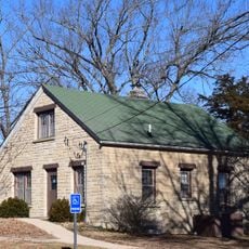
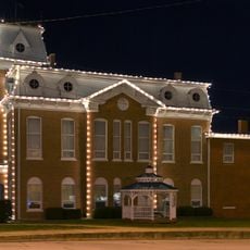
Steelville, County seat in Crawford County, Missouri

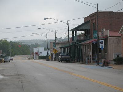
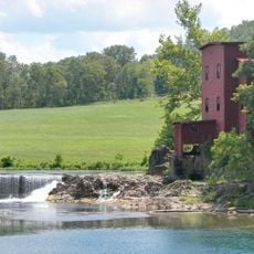
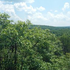
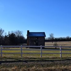
Steelville is the county seat of Crawford County, Missouri, positioned where routes 8 and 19 intersect. The town is set among forests and river valleys that shape its rural setting.

The settlement began in 1835 when James Steel and William Britton established a trading post at this location. This early commercial hub gradually developed into the town that exists today.

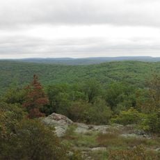
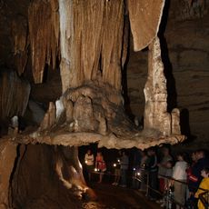
The town maintains active community traditions through local festivals, educational programs, and outdoor recreational activities along the Meramec River.

The town is easily accessible via routes 8 and 19, making navigation straightforward for visitors. Outdoor activities along the Meramec River and surrounding woodlands are readily available year-round.

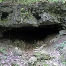
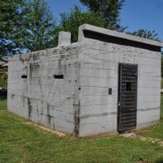
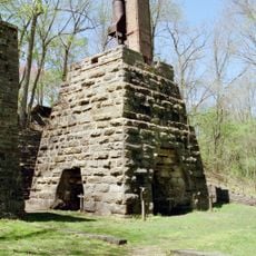
Iron mining operations at the Cherry Valley Iron Mines ran from 1878 to 1924 near Steelville and shaped the region's industrial past. This period of extractive activity remains largely overlooked in discussions about the town's development.

The community of curious travelers

AroundUs brings together thousands of curated places, local tips, and hidden gems, enriched daily by 60,000 contributors worldwide.

Start exploring
GPS coordinates
37.96810,-91.35487
Latest update
December 8, 2025 13:40
Around this place
Meramec Caverns
United States of America

Meramec Caverns

38.1 km
Onondaga Cave State Park
United States of America

Onondaga Cave State Park

14.9 km
Maramec Spring
United States of America

Maramec Spring

15.7 km
Bell Mountain Wilderness
United States of America

Bell Mountain Wilderness

56.3 km
Meramec State Park
United States of America

Meramec State Park

34.6 km
Dillard Mill State Historic Site
United States of America

Dillard Mill State Historic Site

30.8 km
Allgood–Bailey Stadium
United States of America

Allgood–Bailey Stadium

37.4 km
Fort Wyman
United States of America

Fort Wyman

37.1 km
Meramec Conservation Area
United States of America

Meramec Conservation Area

38.4 km
Bootleg Access
United States of America

Bootleg Access

54.5 km
Maries County Jail and Sheriff's House
United States of America

Maries County Jail and Sheriff's House

57.2 km
George B. Hamilton House
United States of America

George B. Hamilton House

11.4 km
Rolla Ranger Station Historic District
United States of America

Rolla Ranger Station Historic District

38.3 km
Dent County Courthouse
United States of America

Dent County Courthouse

39.3 km
Phelps County Courthouse
United States of America

Phelps County Courthouse

36.8 km
Hotel Cuba
United States of America

Hotel Cuba

11.8 km
Cuba City Jail
United States of America

Cuba City Jail

11.2 km
Washington County Courthouse
United States of America

Washington County Courthouse

49.9 km
Panhorst Feed Store
United States of America

Panhorst Feed Store

53.3 km
Cuba High School Annex
United States of America

Cuba High School Annex

11.6 km
St. James Chapel
United States of America

St. James Chapel

22.9 km
John Manson Munro House
United States of America

John Manson Munro House

11.4 km
Caledonia Historic District
United States of America

Caledonia Historic District

56.1 km
Uptown Cuba Historic District
United States of America

Uptown Cuba Historic District

11.3 km
Harrison Queen House
United States of America

Harrison Queen House

53.2 km
Cuba Lodge No. 312 A.F. and A.M.
United States of America

Cuba Lodge No. 312 A.F. and A.M.

11.5 km
Jesse James Wax Museum
United States of America

Jesse James Wax Museum

40.3 km
Maramec Iron Works
United States of America

Maramec Iron Works

16.2 km
Show the full map
Reviews
Share your experience

No review yet

Discussions
Start a discussion...

No discussion yet

« Steelville - County seat in Crawford County, Missouri » is provided by Around Us (aroundus.com). Images and texts are derived from Wikimedia project under a Creative Commons license. You are allowed to copy, distribute, and modify copies of this page, under the conditions set by the license, as long as this note is clearly visible.

Discover hidden gems everywhere you go!

From secret cafés to breathtaking viewpoints, skip the crowded tourist spots and find places that match your style. Our app makes it easy with voice search, smart filtering, route optimization, and insider tips from travelers worldwide. Download now for the complete mobile experience.

Around Us App Screenshot

A unique approach to discovering new places

Le Figaro

All the places worth exploring

France Info

A tailor-made excursion in just a few clicks

20 Minutes

Around Us
Travel Guide & Maps
Download

Send to your phone

QR Code
1

Open the camera app on your mobile.

2

Point at the QR code with your camera. A notification will appear.

3

Tap the notification to open the link.