Chest opened
+${chestReward.xp} XP
Explorer
NOUVEAU ×${chestReward.collectible.quantity}
tapez pour fermer
Chest locked

Open chests in the app

Around Us is built for your phone — chests unlock when you walk, explore and capture nearby places.

Enable Location

We need your location to show you interesting places around you

Discover nearby places

Find interesting locations and hidden gems around you

Precise directions

Get accurate directions and distances to places

Your location is never shared with other users. It's only used when you tap the location button.

Forestville

Log in to your account

Start exploring — it's free

Trusted by 72,887 travelers worldwide

Continue with Google
Continue with Apple
or

We will send you a code to connect

By continuing, you accept our Terms and Conditions and our Privacy Policy

Check your inbox

We've sent a pincode in your inbox. Please enter the code below.

Discussion Reviews 1 Photos
11.4k Popularity

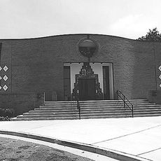
Forestville, Residential census area in Prince George's County, Maryland, United States.

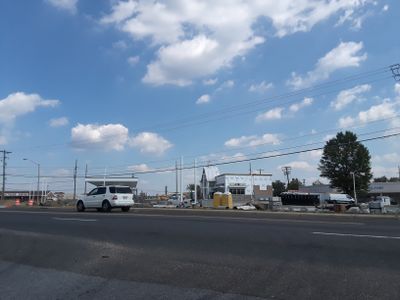
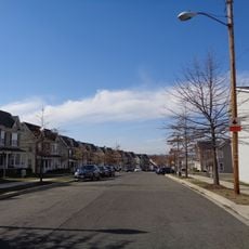
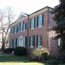
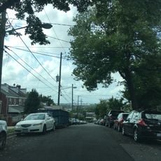
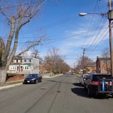
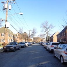
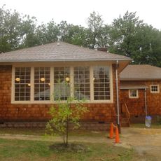
Forestville is a residential community in Prince George's County, Maryland, where single-family homes, garden apartments, and small commercial centers sit side by side. The area spans across a defined landscape and provides a mixed residential setting with different types of buildings.

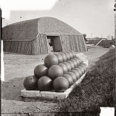
The area was once called Long Old Fields and served as a military encampment during the War of 1812 before a major regional conflict. It later developed into a modern residential community.

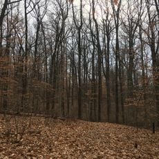
The place takes its name from the wooded landscape that defines the area, and today it is home to people from many different backgrounds. The community continues to evolve as residents build their lives in this diverse neighborhood.

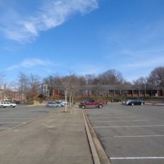
The community sits along Maryland Route 4 and the Interstate 95/495 corridor, making it easy to reach other areas in the region. Being near these major roads means travelers can quickly reach surrounding neighborhoods and employment centers.

The community is home to notable figures, including a U.S. congressman and the creator of a widely read children's book series. These connections show how significant creative and political figures have emerged from this local area.

The community of curious travelers

AroundUs brings together thousands of curated places, local tips, and hidden gems, enriched daily by 60,000 contributors worldwide.

Start exploring
Elevation above the sea
85 m
Shares border with
Joint Base Andrews
GPS coordinates
38.84500,-76.87500
Latest update
December 8, 2025 13:41
Around this place
Northwest Stadium
United States of America

Northwest Stadium

7 km
Southeast
United States of America

Southeast

8.9 km
United States of America

Paul E. Garber Preservation, Restoration, and Storage Facility

5.9 km
Deanwood
United States of America

Deanwood

8.4 km
Anacostia Community Museum
United States of America

Anacostia Community Museum

8.9 km
Suitland-Silver Hill
United States of America

Suitland-Silver Hill

4.2 km
Capitol View
United States of America

Capitol View

6.6 km
H.D. Woodson High School
United States of America

H.D. Woodson High School

7.1 km
Fort Dupont Park
United States of America

Fort Dupont Park

7.4 km
His Lordship's Kindness
United States of America

His Lordship's Kindness

7.9 km
Dupont Park
United States of America

Dupont Park

8.2 km
Benning
United States of America

Benning

8.3 km
Benning Ridge
United States of America

Benning Ridge

6.8 km
Fairfax Village
United States of America

Fairfax Village

7 km
Fort Stanton
United States of America

Fort Stanton

9 km
Francis A. Gregory Neighborhood Library
United States of America

Francis A. Gregory Neighborhood Library

7.2 km
John Philip Sousa Junior High School
United States of America

John Philip Sousa Junior High School

8 km
Melwood Park
United States of America

Melwood Park

6.2 km
Launch Family Entertainment Prince George's County
United States of America

Launch Family Entertainment Prince George's County

3.9 km
Strand Theater
United States of America

Strand Theater

7.4 km
St. Matthew's Church
United States of America

St. Matthew's Church

7 km
Concord
United States of America

Concord

3.7 km
Benning / Dorothy I. Height Neighborhood Library
United States of America

Benning / Dorothy I. Height Neighborhood Library

8.3 km
Ridgley Methodist Episcopal Church
United States of America

Ridgley Methodist Episcopal Church

5.5 km
Deanwood Neighborhood Library
United States of America

Deanwood Neighborhood Library

8.7 km
Fairmount Heights Historic District
United States of America

Fairmount Heights Historic District

7.1 km
Ridgeley School
United States of America

Ridgeley School

5.1 km
Nannie Helen Burroughs School
United States of America

Nannie Helen Burroughs School

7.4 km
Show the full map
Reviews
Share your experience

No review yet

Discussions
Start a discussion...

No discussion yet

« Forestville - Residential census area in Prince George's County, Maryland, United States » is provided by Around Us (aroundus.com). Images and texts are derived from Wikimedia project under a Creative Commons license. You are allowed to copy, distribute, and modify copies of this page, under the conditions set by the license, as long as this note is clearly visible.

Discover hidden gems everywhere you go!

From secret cafés to breathtaking viewpoints, skip the crowded tourist spots and find places that match your style. Our app makes it easy with voice search, smart filtering, route optimization, and insider tips from travelers worldwide. Download now for the complete mobile experience.

Around Us App Screenshot

A unique approach to discovering new places

Le Figaro

All the places worth exploring

France Info

A tailor-made excursion in just a few clicks

20 Minutes

Around Us
Travel Guide & Maps
Download

Send to your phone

QR Code
1

Open the camera app on your mobile.

2

Point at the QR code with your camera. A notification will appear.

3

Tap the notification to open the link.