Enable Location

We need your location to show you interesting places around you

Discover nearby places

Find interesting locations and hidden gems around you

Precise directions

Get accurate directions and distances to places

Your location is never shared with other users. It's only used when you tap the location button.

Capitol View

Log in to your account

Start exploring — it's free

Trusted by 61,859 travelers worldwide

Continue with Google
Continue with Apple
or

We will send you a code to connect

By continuing, you accept our Terms and Conditions and our Privacy Policy

Check your inbox

We've sent a pincode in your inbox. Please enter the code below.

Capitol View

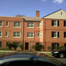
Capitol View, Residential neighborhood in Southeast, Washington DC, United States.

Description

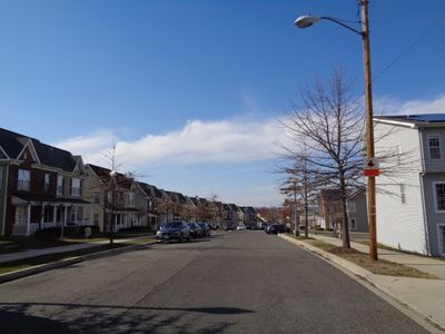
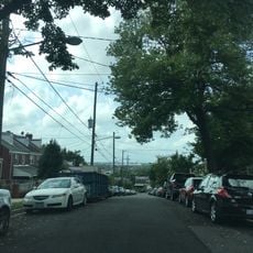
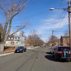
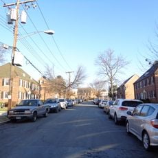
Capitol View is a residential neighborhood in Southeast Washington D.C. that spans between East Capitol Street and Central Avenue SE. The area blends established residential streets with newer mixed-use developments and local services throughout its boundaries.

History

The neighborhood started in the 1920s as DePriest Village with a mixed population of early residents. Over time it evolved into a middle-class community with deep roots in African American heritage and identity.

Culture

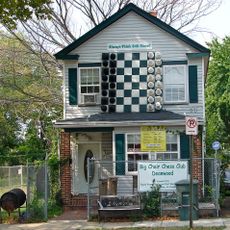
The neighborhood serves as a gathering place where residents connect through community organizations and local events that shape daily life. Neighbors often engage in shared activities that strengthen their bonds and sense of belonging.

Practical

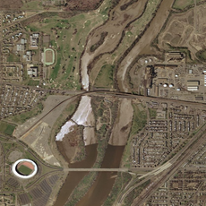
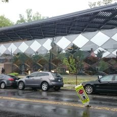
Benning Road Metro station connects the area directly to downtown Washington, and several bus lines run along East Capitol Street for easy transit. Most locations are walkable and neighborhoods are laid out for convenient neighborhood exploration.

Did you know?

A major redevelopment project in the 2000s brought new housing options for residents at different income levels to the neighborhood. The project carefully balanced bringing in fresh development while ensuring longtime residents could remain and benefit.

Location
GPS coordinates
38.88981,-76.92490
Latest update
December 10, 2025 16:21

AroundUs brings together thousands of curated places, local tips, and hidden gems, enriched daily by 60,000 contributors worldwide. Discover all places nearby (Washington).

Around this place
United States National Arboretum
United States of America

United States National Arboretum

4.2 km
Deanwood
United States of America

Deanwood

1.8 km
Goshin
United States of America

Goshin

4.2 km
Kingman Island
United States of America

Kingman Island

3.6 km
Langston Golf Course
United States of America

Langston Golf Course

4 km
H.D. Woodson High School
United States of America

H.D. Woodson High School

765 m
Fort Dupont Park
United States of America

Fort Dupont Park

2.6 km
Dupont Park
United States of America

Dupont Park

3.8 km
Benning
United States of America

Benning

2.1 km
Benning Ridge
United States of America

Benning Ridge

1.5 km
Fairfax Village
United States of America

Fairfax Village

3.8 km
Whitney Young Memorial Bridge
United States of America

Whitney Young Memorial Bridge

3.5 km
Francis A. Gregory Neighborhood Library
United States of America

Francis A. Gregory Neighborhood Library

3.8 km
Kenilworth Park and Aquatic Gardens
United States of America

Kenilworth Park and Aquatic Gardens

2.9 km
Ethel Kennedy Bridge
United States of America

Ethel Kennedy Bridge

3.5 km
Amtrak Railroad Anacostia Bridge
United States of America

Amtrak Railroad Anacostia Bridge

3.4 km
Mayfair Mansions Apartments
United States of America

Mayfair Mansions Apartments

2.5 km
Anacostia Railroad Bridge
United States of America

Anacostia Railroad Bridge

4.2 km
Strand Theater
United States of America

Strand Theater

955 m
St. Matthew's Church
United States of America

St. Matthew's Church

1.9 km
New York Avenue Bridge
United States of America

New York Avenue Bridge

3.5 km
Benning / Dorothy I. Height Neighborhood Library
United States of America

Benning / Dorothy I. Height Neighborhood Library

2 km
Deanwood Neighborhood Library
United States of America

Deanwood Neighborhood Library

2.2 km
Fairmount Heights Historic District
United States of America

Fairmount Heights Historic District

1.5 km
Nannie Helen Burroughs School
United States of America

Nannie Helen Burroughs School

829 m
Fort Dupont
United States of America

Fort Dupont

2.3 km
Fort Mahan
United States of America

Fort Mahan

1.8 km
Kingman Lake
United States of America

Kingman Lake

3.6 km
Show the full map
« Capitol View - Residential neighborhood in Southeast, Washington DC, United States » is provided by Around Us (aroundus.com). Images and texts are derived from Wikimedia project under a Creative Commons license. You are allowed to copy, distribute, and modify copies of this page, under the conditions set by the license, as long as this note is clearly visible.

Discover hidden gems everywhere you go!

From secret cafés to breathtaking viewpoints, skip the crowded tourist spots and find places that match your style. Our app makes it easy with voice search, smart filtering, route optimization, and insider tips from travelers worldwide. Download now for the complete mobile experience.

Around Us App Screenshot

A unique approach to discovering new places

Le Figaro

All the places worth exploring

France Info

A tailor-made excursion in just a few clicks

20 Minutes

Around Us
Travel Guide & Maps
Download

Send to your phone

QR Code
1

Open the camera app on your mobile.

2

Point at the QR code with your camera. A notification will appear.

3

Tap the notification to open the link.