Dundalk

Log in to your account

AroundUs is a community-driven map of interesting places, built by curious explorers like you. It grows with every review, story, and photo you share.
Connect to save your favorite spots, contribute locations, and create personalized routes.
By continuing, you accept our Terms and Conditions and our Privacy Policy
Add to collection
Map
Suggest a change
Share

Dundalk, Census-designated place in Baltimore County, Maryland, United States.
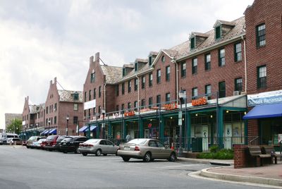
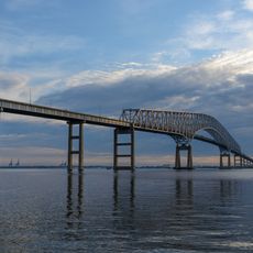
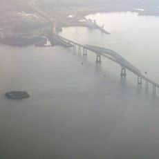
Located 7 miles east of Baltimore, Dundalk extends across residential neighborhoods with maritime-themed street layouts near Chesapeake Bay waters.

Henry McShane established a bell foundry in 1856, naming the area after his Irish birthplace when the Baltimore and Sparrows Point Railroad needed a depot designation.

The Dundalk-Patapsco Neck Historical Society Museum maintains exhibits of artifacts, photographs, and period rooms representing local heritage from the 1800s.

The Community College of Baltimore County campus provides educational programs while the seasonal farmers market operates from July through October.

Bethlehem Steel purchased 1000 acres in 1916 to create planned housing developments with designated areas for parks, schools, and commercial zones.

Location: Baltimore County

Inception: 1856

Elevation above the sea: 5 m

Shares border with: Rosedale

GPS coordinates: 39.26580,-76.50530

Latest update: June 13, 2025 11:48

Around this place
Show the full map
Fort McHenry
United States of America

Fort McHenry

6.4 km
NS Savannah
United States of America

NS Savannah

4.4 km
Francis Scott Key Bridge
United States of America

Francis Scott Key Bridge

5.8 km
SS John W. Brown
United States of America

SS John W. Brown

5.6 km
Fort Carroll
United States of America

Fort Carroll

5.8 km
Patterson Park
United States of America

Patterson Park

6.8 km
National Brewing Company
United States of America

National Brewing Company

5.4 km
Fort Howard
United States of America

Fort Howard

9.2 km
Greater Grace World Outreach
United States of America

Greater Grace World Outreach

6.3 km
Silo Point
United States of America

Silo Point

7.2 km
Hart-Miller Island State Park, Maryland
United States of America

Hart-Miller Island State Park, Maryland

11.2 km
Glenn L. Martin Maryland Aviation Museum
United States of America

Glenn L. Martin Maryland Aviation Museum

9.9 km
East Monument Historic District
United States of America

East Monument Historic District

7.5 km
Orpheus with the Awkward Foot
United States of America

Orpheus with the Awkward Foot

6.6 km
Fort Carroll Light
United States of America

Fort Carroll Light

5.8 km
Todd Farmhouse
United States of America

Todd Farmhouse

8.2 km
Craighill Channel Lower Range Rear Light
United States of America

Craighill Channel Lower Range Rear Light

10.4 km
Ballestone Mansion
United States of America

Ballestone Mansion

7.7 km
Lazaretto Point Light
United States of America

Lazaretto Point Light

5.7 km
Christ United Church of Christ
United States of America

Christ United Church of Christ

7.7 km
Craighill Channel Upper Range Front Light
United States of America

Craighill Channel Upper Range Front Light

9.1 km
Craighill Channel Upper Range Rear Light
United States of America

Craighill Channel Upper Range Rear Light

6.6 km
Bankard-Gunther Mansion
United States of America

Bankard-Gunther Mansion

7.6 km
North Point State Park
United States of America

North Point State Park

8.3 km
Wilson Point Mens' Club; Stansbury Beach Club
United States of America

Wilson Point Mens' Club; Stansbury Beach Club

9.1 km
Patterson Park Observatory
United States of America

Patterson Park Observatory

7.2 km
Statue of John O'Donnell
United States of America

Statue of John O'Donnell

6.2 km
Patterson Park-Highlandtown Historic District
United States of America

Patterson Park-Highlandtown Historic District

6.5 km
Show the full map

Reviews

Visited this place? Tap the stars to rate it and share your experience / photos with the community! Try now! You can cancel it anytime.

« Dundalk: Census-designated place in Baltimore County, Maryland, United States » is provided by Around Us (aroundus.com). Images and texts are derived from Wikimedia project under a Creative Commons license. You are allowed to copy, distribute, and modify copies of this page, under the conditions set by the license, as long as this note is clearly visible.

Discover hidden gems everywhere you go!

From secret cafés to breathtaking viewpoints, skip the crowded tourist spots and find places that match your style. Our app makes it easy with voice search, smart filtering, route optimization, and insider tips from travelers worldwide. Download now for the complete mobile experience.

Around Us App Screenshot

A unique approach to discovering new places

Le Figaro

All the places worth exploring

France Info

A tailor-made excursion in just a few clicks

20 Minutes