Chest opened
+${chestReward.xp} XP
Explorer
NOUVEAU ×${chestReward.collectible.quantity}
tapez pour fermer
Chest locked

Open chests in the app

Around Us is built for your phone — chests unlock when you walk, explore and capture nearby places.

Enable Location

We need your location to show you interesting places around you

Discover nearby places

Find interesting locations and hidden gems around you

Precise directions

Get accurate directions and distances to places

Your location is never shared with other users. It's only used when you tap the location button.

Forked River

Log in to your account

Start exploring — it's free

Trusted by 72,877 travelers worldwide

Continue with Google
Continue with Apple
or

We will send you a code to connect

By continuing, you accept our Terms and Conditions and our Privacy Policy

Check your inbox

We've sent a pincode in your inbox. Please enter the code below.

Discussion Reviews 1 Photos
14.3k Popularity

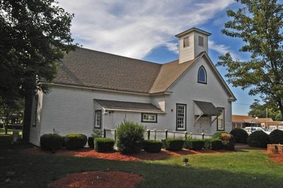
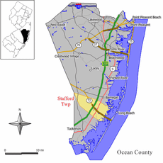
Forked River, Census-designated place in Lacey Township, New Jersey

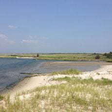
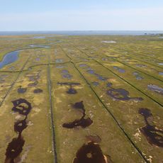
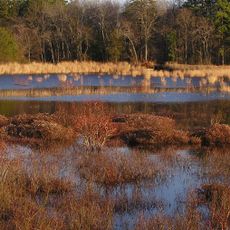
Forked River is a census-designated place in Lacey Township that spreads across several square miles along Barnegat Bay. The area blends residential neighborhoods with water and marsh zones all at sea level.

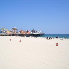
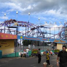
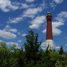
During the American Revolutionary War, this settlement became known for shipbuilding and maritime activities along the coast. This seafaring past shaped the area's early development and connection to the water.

Local residents maintain a distinctive way of saying the place name that marks those with deep roots in the community. This speech pattern reflects the area's long-established identity and sense of belonging.

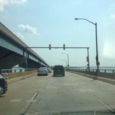
This area is accessible via U.S. Route 9 and Exit 74 of the Garden State Parkway, with additional bus connections through NJ Transit. Walking around the residential neighborhoods helps you get a feel for how people live here.

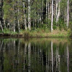
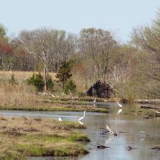
Wells Mills County Park, a nearby nature reserve spanning 900 acres of Pine Barrens forest, offers walking trails and learning programs about the local environment. The park was created to protect the original landscape of this coastal region and teach visitors about its ecosystems.

The community of curious travelers

AroundUs brings together thousands of curated places, local tips, and hidden gems, enriched daily by 60,000 contributors worldwide.

Start exploring
Location
Elevation above the sea
0 m
GPS coordinates
39.82583,-74.18333
Latest update
December 7, 2025 20:22
Around this place
Jersey Shore
United States of America

Jersey Shore

27.2 km
Star Jet
United States of America

Star Jet

16.3 km
Barnegat Lighthouse
United States of America

Barnegat Lighthouse

9.5 km
Casino Pier
United States of America

Casino Pier

16.2 km
Island Beach State Park
United States of America

Island Beach State Park

12.4 km
Hangar No. 1, Lakehurst Naval Air Station
United States of America

Hangar No. 1, Lakehurst Naval Air Station

25.3 km
Jet Star
United States of America

Jet Star

16.2 km
Hydrus
United States of America

Hydrus

16.1 km
Edwin B. Forsythe National Wildlife Refuge
United States of America

Edwin B. Forsythe National Wildlife Refuge

27.6 km
Double Trouble State Park
United States of America

Double Trouble State Park

8.7 km
Cattus Island Park
United States of America

Cattus Island Park

17.4 km
Manahawkin Bay Bridge
United States of America

Manahawkin Bay Bridge

18.4 km
Thomas A. Mathis and J. Stanley Tunney Bridges
United States of America

Thomas A. Mathis and J. Stanley Tunney Bridges

14.9 km
Barnegat Lighthouse State Park
United States of America

Barnegat Lighthouse State Park

9.5 km
Cathedral of the Air
United States of America

Cathedral of the Air

24 km
Tuckerton Seaport
United States of America

Tuckerton Seaport

28.4 km
L. Ron Hubbard Residence at Bay Head
United States of America

L. Ron Hubbard Residence at Bay Head

29 km
United States of America

Shore Region

16 km
Penn State Forest
United States of America

Penn State Forest

25.3 km
Little Egg Harbor Friends Meeting House
United States of America

Little Egg Harbor Friends Meeting House

28.2 km
Manahawkin Baptist Church
United States of America

Manahawkin Baptist Church

15.5 km
Ocean County Courthouse
United States of America

Ocean County Courthouse

14.2 km
Manahawkin Bottomland Hardwood Forest
United States of America

Manahawkin Bottomland Hardwood Forest

16 km
Barnegat Light Public School
United States of America

Barnegat Light Public School

9.9 km
Mary Etta Cox House
United States of America

Mary Etta Cox House

8.8 km
U.S. Life Saving Station No. 14
United States of America

U.S. Life Saving Station No. 14

15.3 km
Phare de Tucker's Beach
United States of America

Phare de Tucker's Beach

28.3 km
Insectropolis
United States of America

Insectropolis

21.2 km
Show the full map
Reviews
Share your experience

No review yet

Discussions
Start a discussion...

No discussion yet

« Forked River - Census-designated place in Lacey Township, New Jersey » is provided by Around Us (aroundus.com). Images and texts are derived from Wikimedia project under a Creative Commons license. You are allowed to copy, distribute, and modify copies of this page, under the conditions set by the license, as long as this note is clearly visible.

Discover hidden gems everywhere you go!

From secret cafés to breathtaking viewpoints, skip the crowded tourist spots and find places that match your style. Our app makes it easy with voice search, smart filtering, route optimization, and insider tips from travelers worldwide. Download now for the complete mobile experience.

Around Us App Screenshot

A unique approach to discovering new places

Le Figaro

All the places worth exploring

France Info

A tailor-made excursion in just a few clicks

20 Minutes

Around Us
Travel Guide & Maps
Download

Send to your phone

QR Code
1

Open the camera app on your mobile.

2

Point at the QR code with your camera. A notification will appear.

3

Tap the notification to open the link.