Chest opened
+${chestReward.xp} XP
Explorer
NOUVEAU ×${chestReward.collectible.quantity}
tapez pour fermer
Chest locked

Open chests in the app

Around Us is built for your phone — chests unlock when you walk, explore and capture nearby places.

Enable Location

We need your location to show you interesting places around you

Discover nearby places

Find interesting locations and hidden gems around you

Precise directions

Get accurate directions and distances to places

Your location is never shared with other users. It's only used when you tap the location button.

K-25

Log in to your account

Start exploring — it's free

Trusted by 72,986 travelers worldwide

Continue with Google
Continue with Apple
or

We will send you a code to connect

By continuing, you accept our Terms and Conditions and our Privacy Policy

Check your inbox

We've sent a pincode in your inbox. Please enter the code below.

K-25
Discussion Reviews 3 Photos
54.8k Popularity

K-25, Nuclear enrichment facility in Oak Ridge, Tennessee, United States

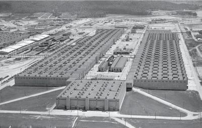
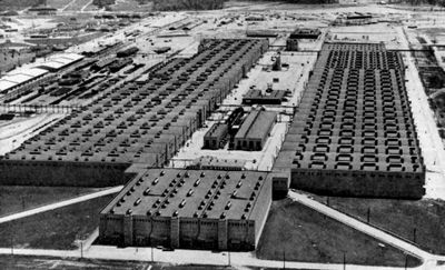
K-25 was a uranium separation facility in Oak Ridge, Tennessee, built during World War II as part of the Manhattan Project. The enormous U-shaped structure stretched across the wooded landscape and housed miles of piping systems that separated uranium through gaseous diffusion.

The factory was hastily built in 1943 to produce enriched material for the first atomic weapons and became operational by 1945. After the war ended, it remained in operation for decades and later became a center for nuclear material recycling and disposal before most of it was demolished in the 2010s.

The facility sheltered a secret community living and working in the Tennessee highlands, where most families did not know exactly what was being created. This artificially created town brought workers from across America who performed pioneering technical work under the strictest secrecy and became part of history after the war.

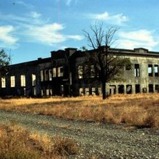
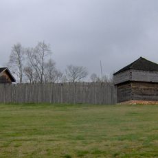
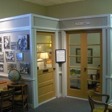
The site is now part of the Manhattan Project National Historical Park, where visitors can explore the small museum and exhibits that recall the industrial and scientific era. Since most buildings have been removed, focus on interpretive panels and reconstructed spaces to understand the scale of the facility.

The factory consumed so much electricity during the war that at times it required more power than entire cities like Boston or Philadelphia. Its existence remained such a closely guarded secret that even local residents and many of the employees did not know what was actually happening behind the fences.

The community of curious travelers

AroundUs brings together thousands of curated places, local tips, and hidden gems, enriched daily by 60,000 contributors worldwide.

Start exploring
Location
Part of
Manhattan Project
GPS coordinates
35.93222,-84.39500
Latest update
December 17, 2025 07:37
Around this place
Manhattan Project National Historical Park
United States of America

Manhattan Project National Historical Park

384 m
Fort Southwest Point
United States of America

Fort Southwest Point

14.5 km
George Jones Memorial Baptist Church
United States of America

George Jones Memorial Baptist Church

2.1 km
American Temperance University
United States of America

American Temperance University

14.1 km
Children's Museum of Oak Ridge
United States of America

Children's Museum of Oak Ridge

15 km
Cornstalk Heights
United States of America

Cornstalk Heights

13.7 km
New Bethel Baptist Church
United States of America

New Bethel Baptist Church

8.1 km
Roane County Courthouse
United States of America

Roane County Courthouse

12.8 km
Colonial Hall
United States of America

Colonial Hall

13.4 km
Col. Gideon Morgan House
United States of America

Col. Gideon Morgan House

12.8 km
Charles Vanden Bulck Bridge
United States of America

Charles Vanden Bulck Bridge

8.1 km
United States of America

Oak Ridge High School

15.3 km
United States of America

Jefferson Theatre

12.8 km
United States of America

Stubbs Bluff

12.9 km
United States of America

Stowe Bluff

13.6 km
United States of America

Webbo Theatre

14.2 km
United States of America

Bull Bluff

13.9 km
United States of America

Grove Theater

14.7 km
United States of America

Oliver Springs Theatre

13.3 km
United States of America

Wester Bluff

15.4 km
Oak Ridge Turnpike Checking Station
United States of America

Oak Ridge Turnpike Checking Station

7.7 km
Dr. Fred Stone, Sr., Hospital
United States of America

Dr. Fred Stone, Sr., Hospital

13.7 km
United States of America

Oak Ridge Country Club

7.7 km
United States of America

Avalon Golf & Country Club

14.9 km
United States of America

The Patch at The Preserve

2.9 km
United States of America

A.K. Bissel Park Amphitheater

15.1 km
United States of America

Work of art

14.1 km
United States of America

Work of art

12.8 km
Show the full map
Reviews
Share your experience

No review yet

Discussions
Start a discussion...

No discussion yet

« K-25 - Nuclear enrichment facility in Oak Ridge, Tennessee, United States » is provided by Around Us (aroundus.com). Images and texts are derived from Wikimedia project under a Creative Commons license. You are allowed to copy, distribute, and modify copies of this page, under the conditions set by the license, as long as this note is clearly visible.

Discover hidden gems everywhere you go!

From secret cafés to breathtaking viewpoints, skip the crowded tourist spots and find places that match your style. Our app makes it easy with voice search, smart filtering, route optimization, and insider tips from travelers worldwide. Download now for the complete mobile experience.

Around Us App Screenshot

A unique approach to discovering new places

Le Figaro

All the places worth exploring

France Info

A tailor-made excursion in just a few clicks

20 Minutes

Around Us
Travel Guide & Maps
Download

Send to your phone

QR Code
1

Open the camera app on your mobile.

2

Point at the QR code with your camera. A notification will appear.

3

Tap the notification to open the link.