Chest opened
+${chestReward.xp} XP
Explorer
NOUVEAU ×${chestReward.collectible.quantity}
tapez pour fermer
Chest locked

Open chests in the app

Around Us is built for your phone — chests unlock when you walk, explore and capture nearby places.

Enable Location

We need your location to show you interesting places around you

Discover nearby places

Find interesting locations and hidden gems around you

Precise directions

Get accurate directions and distances to places

Your location is never shared with other users. It's only used when you tap the location button.

Fire Island Pines

Log in to your account

Start exploring — it's free

Trusted by 72,877 travelers worldwide

Continue with Google
Continue with Apple
or

We will send you a code to connect

By continuing, you accept our Terms and Conditions and our Privacy Policy

Check your inbox

We've sent a pincode in your inbox. Please enter the code below.

Discussion Reviews 1 Photos
2.1k Popularity

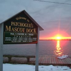
Fire Island Pines, Gay resort community on Fire Island, New York.

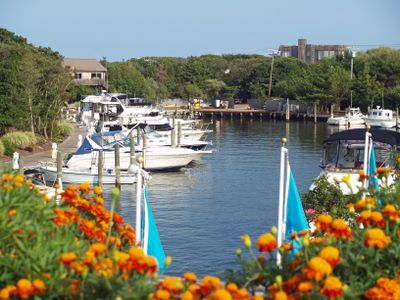
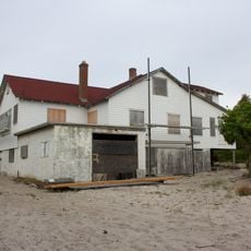
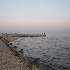
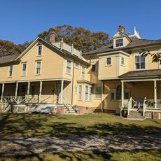
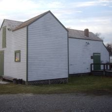
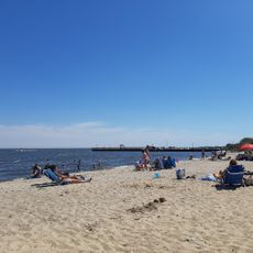
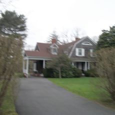
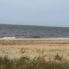
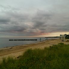
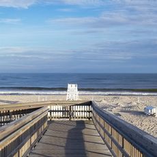
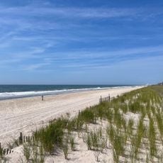
Fire Island Pines is a residential community on a barrier island off Long Island, New York, covering roughly 1.6 square kilometers with approximately 600 private homes and a large condominium building. The area borders wide sandy beaches with access to the Atlantic Ocean.

The land was purchased in 1924 by the Home Guardian Company and developed into a planned residential community between the 1920s and 1950s. This transformation marked the shift from an undeveloped barrier island to an organized settlement.

This community has served as a major gathering place for LGBTQ+ people for decades, shaping the social fabric of the island. Visitors experience an open and welcoming environment reflected in the local venues, events, and sense of community throughout the area.

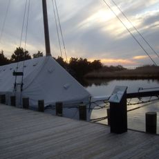
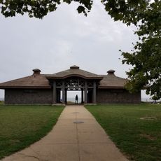
Access is available through regular ferry service from Sayville on the mainland, which can involve a lengthy journey depending on conditions. Within the community itself only boardwalks and footpaths exist, so walking is the main way to get around.

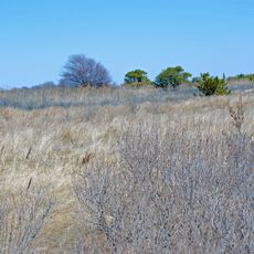
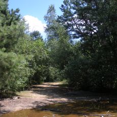
The name comes from pine trees that grew after a 19th-century shipwreck, when Christmas trees washed ashore and took root on the island. This unusual origin story explains how the area got its distinctive name.

The community of curious travelers

AroundUs brings together thousands of curated places, local tips, and hidden gems, enriched daily by 60,000 contributors worldwide.

Start exploring
Location
Inception
1952
GPS coordinates
40.66528,-73.06833
Latest update
December 14, 2025 09:46
Around this place
Heckscher State Park
United States of America

Heckscher State Park

9.1 km
Bayard Cutting Arboretum State Park
United States of America

Bayard Cutting Arboretum State Park

12.4 km
Bayport - Blue Point High School
United States of America

Bayport - Blue Point High School

8.7 km
Connetquot River State Park Preserve
United States of America

Connetquot River State Park Preserve

11.7 km
Patchogue Theatre
United States of America

Patchogue Theatre

12.1 km
Westbrook, Suffolk County, New York
United States of America

Westbrook, Suffolk County, New York

12.4 km
Bayport Aerodrome
United States of America

Bayport Aerodrome

10.4 km
Sayville National Wildlife Refuge
United States of America

Sayville National Wildlife Refuge

9.7 km
Carrington House
United States of America

Carrington House

861 m
Sandspit Park Beach & Marina
United States of America

Sandspit Park Beach & Marina

10.3 km
United States of America

Shorefront Park

10.6 km
United States of America

The Moorings, New York

12.2 km
Priscilla
United States of America

Priscilla

6.8 km
John Ellis Roosevelt Estate
United States of America

John Ellis Roosevelt Estate

8.3 km
Long Island Maritime Museum
United States of America

Long Island Maritime Museum

6.8 km
Modesty
United States of America

Modesty

6.8 km
Patchogue-Medford Library
United States of America

Patchogue-Medford Library

12.1 km
Cherry Grove Community House and Theatre
United States of America

Cherry Grove Community House and Theatre

2 km
Mascot Dock
United States of America

Mascot Dock

10.4 km
Rudolph Oyster House
United States of America

Rudolph Oyster House

6.8 km
Blue Point Beach
United States of America

Blue Point Beach

9.7 km
Jacob Ockers House
United States of America

Jacob Ockers House

9.4 km
Joseph Wood House
United States of America

Joseph Wood House

7.9 km
Foster Ave Beach
United States of America

Foster Ave Beach

6.5 km
West Beach
United States of America

West Beach

9.4 km
Sayville Bathing Beach
United States of America

Sayville Bathing Beach

6.6 km
Atlantique Beach
United States of America

Atlantique Beach

9.2 km
Great South Beach
United States of America

Great South Beach

1.2 km
Show the full map
Reviews
Share your experience

No review yet

Discussions
Start a discussion...

No discussion yet

« Fire Island Pines - Gay resort community on Fire Island, New York » is provided by Around Us (aroundus.com). Images and texts are derived from Wikimedia project under a Creative Commons license. You are allowed to copy, distribute, and modify copies of this page, under the conditions set by the license, as long as this note is clearly visible.

Discover hidden gems everywhere you go!

From secret cafés to breathtaking viewpoints, skip the crowded tourist spots and find places that match your style. Our app makes it easy with voice search, smart filtering, route optimization, and insider tips from travelers worldwide. Download now for the complete mobile experience.

Around Us App Screenshot

A unique approach to discovering new places

Le Figaro

All the places worth exploring

France Info

A tailor-made excursion in just a few clicks

20 Minutes

Around Us
Travel Guide & Maps
Download

Send to your phone

QR Code
1

Open the camera app on your mobile.

2

Point at the QR code with your camera. A notification will appear.

3

Tap the notification to open the link.