Enable Location

We need your location to show you interesting places around you

Discover nearby places

Find interesting locations and hidden gems around you

Precise directions

Get accurate directions and distances to places

Your location is never shared with other users. It's only used when you tap the location button.

Bayport Aerodrome

Log in to your account

Start exploring — it's free

Trusted by 62,501 travelers worldwide

Continue with Google
Continue with Apple
or

We will send you a code to connect

By continuing, you accept our Terms and Conditions and our Privacy Policy

Check your inbox

We've sent a pincode in your inbox. Please enter the code below.

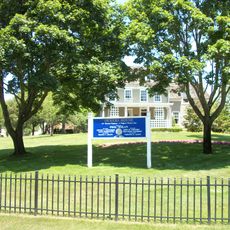
Bayport Aerodrome, airport in New York, United States of America

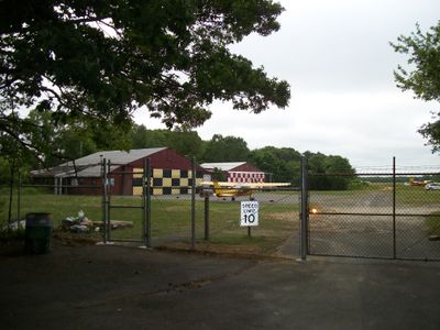
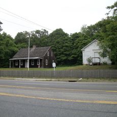
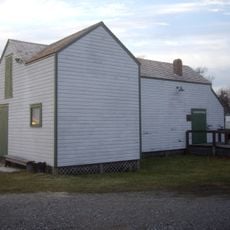
Bayport Aerodrome is a small airport near Islip on Long Island with a grass runway about 2,700 feet (820 m) long used by rare aircraft. The site features a row of 24 hangars housing restored planes from the early 20th century and operates without a control tower or modern navigation aids.

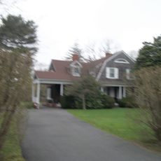
The airfield opened in 1945 shortly after World War II on farmland owned by Curtis Davis and initially operated as Davis Field. It was later sold to George Edwards, a Bayport resident, and renamed Edwards Airport until the 1970s when developers sought to convert the land into housing.

The name comes from the nearby town of Bayport, where early aviation enthusiasts settled on Long Island. Today it serves as a gathering place where pilots and collectors share their passion for vintage aircraft and swap stories about how flying began.

Visit during good weather, as landings and takeoffs depend on conditions and the grass runway has no modern navigation aids. Peak times are during Bayport Aerodrome Society events, when collectors display their restored aircraft and have time for conversations.

The site nearly disappeared in the 1970s but was saved by local residents led by John G. Rae, who founded the Bayport Aerodrome Society in 1972. Their advocacy led the town of Islip to purchase the property in 1978 and officially name it in 1980, preventing conversion to housing.

The community of curious travelers

AroundUs brings together thousands of curated places, local tips, and hidden gems, enriched daily by 60,000 contributors worldwide.

Start exploring
Location
GPS coordinates
40.75842,-73.05372
Latest update
February 9, 2026 08:22
Around this place
Heckscher State Park
United States of America

Heckscher State Park

10.7 km
Bayard Cutting Arboretum State Park
United States of America

Bayard Cutting Arboretum State Park

9.7 km
Bayport - Blue Point High School
United States of America

Bayport - Blue Point High School

1.7 km
Gateway Playhouse
United States of America

Gateway Playhouse

10.2 km
Connetquot River State Park Preserve
United States of America

Connetquot River State Park Preserve

8.2 km
Alfonse M. D'Amato United States Courthouse
United States of America

Alfonse M. D'Amato United States Courthouse

11.5 km
Patchogue Theatre
United States of America

Patchogue Theatre

3.5 km
Westbrook, Suffolk County, New York
United States of America

Westbrook, Suffolk County, New York

9.7 km
Sayville National Wildlife Refuge
United States of America

Sayville National Wildlife Refuge

4.5 km
Carrington House
United States of America

Carrington House

10.9 km
Sandspit Park Beach & Marina
United States of America

Sandspit Park Beach & Marina

3.5 km
United States of America

Shorefront Park

4.1 km
Priscilla
United States of America

Priscilla

5.3 km
John Ellis Roosevelt Estate
United States of America

John Ellis Roosevelt Estate

2.6 km
Long Island Maritime Museum
United States of America

Long Island Maritime Museum

5.3 km
Modesty
United States of America

Modesty

5.3 km
Patchogue-Medford Library
United States of America

Patchogue-Medford Library

3.5 km
Cherry Grove Community House and Theatre
United States of America

Cherry Grove Community House and Theatre

11.4 km
United States of America

Harold H. Malkmes Wildlife Education and Ecology Center

4.8 km
Bellport Village Historic District
United States of America

Bellport Village Historic District

9.9 km
United States of America

Swan Lake Park

5.3 km
Mascot Dock
United States of America

Mascot Dock

3.9 km
Bald Hill Schoolhouse
United States of America

Bald Hill Schoolhouse

8.6 km
Bellport Academy
United States of America

Bellport Academy

9.8 km
Rudolph Oyster House
United States of America

Rudolph Oyster House

5.3 km
Smith-Rourke House
United States of America

Smith-Rourke House

6.3 km
Jacob Ockers House
United States of America

Jacob Ockers House

6.2 km
Joseph Wood House
United States of America

Joseph Wood House

3.1 km
Show the full map
« Bayport Aerodrome - airport in New York, United States of America » is provided by Around Us (aroundus.com). Images and texts are derived from Wikimedia project under a Creative Commons license. You are allowed to copy, distribute, and modify copies of this page, under the conditions set by the license, as long as this note is clearly visible.

Discover hidden gems everywhere you go!

From secret cafés to breathtaking viewpoints, skip the crowded tourist spots and find places that match your style. Our app makes it easy with voice search, smart filtering, route optimization, and insider tips from travelers worldwide. Download now for the complete mobile experience.

Around Us App Screenshot

A unique approach to discovering new places

Le Figaro

All the places worth exploring

France Info

A tailor-made excursion in just a few clicks

20 Minutes

Around Us
Travel Guide & Maps
Download

Send to your phone

QR Code
1

Open the camera app on your mobile.

2

Point at the QR code with your camera. A notification will appear.

3

Tap the notification to open the link.