Enable Location

We need your location to show you interesting places around you

Discover nearby places

Find interesting locations and hidden gems around you

Precise directions

Get accurate directions and distances to places

Your location is never shared with other users. It's only used when you tap the location button.

Camp Hero State Park

Log in to your account

Start exploring — it's free

Trusted by 62,999 travelers worldwide

Continue with Google
Continue with Apple
or

We will send you a code to connect

By continuing, you accept our Terms and Conditions and our Privacy Policy

Check your inbox

We've sent a pincode in your inbox. Please enter the code below.

Camp Hero State Park
Discussion Reviews 1 Photos
45.7k Popularity

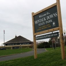
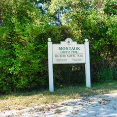
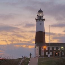
Camp Hero State Park, State park in Montauk, US

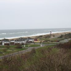
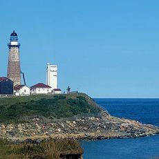
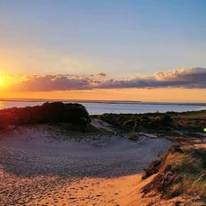
Camp Hero State Park is a protected area on the eastern tip of Long Island near Montauk in New York State. The site covers more than 750 acres of coastal forest, sandy bluffs, and several trails leading to the ocean.

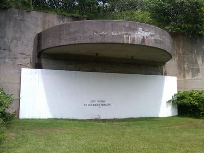
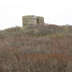
The site opened in 1942 as an Army coastal defense post and remained in military use through the 1980s. After that, the area was abandoned and later released to the public as a park.

The name comes from the site's military past, and visitors today notice concrete bunkers and gun emplacements scattered among the trees along coastal trails. The old structures now blend into the landscape, attracting hikers who enjoy combining nature with traces of the past.

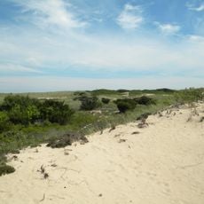
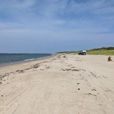
Trails run through forests and along bluffs, with some sections that may be sandy or uneven. Visitors in summer should bring water, as shade is limited and the sun near the ocean can feel intense.

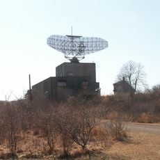
The large radar antenna from the Cold War era still rises above the trees, and its shape reminds many visitors of science fiction films from the 1950s. Few know that this system was once part of a nationwide early warning network and remains visible to the public today.

The community of curious travelers

AroundUs brings together thousands of curated places, local tips, and hidden gems, enriched daily by 60,000 contributors worldwide.

Start exploring
Location
GPS coordinates
41.06667,-71.86778
Latest update
December 14, 2025 20:07
Around this place
Hither Hills State Park
United States of America

Hither Hills State Park

13.5 km
AN/FPS-35, Montauk, New York State
United States of America

AN/FPS-35, Montauk, New York State

735 m
Montauk Downs State Park
United States of America

Montauk Downs State Park

6.5 km
Race Rock Light
United States of America

Race Rock Light

24.8 km
Pollock-Krasner House and Studio
United States of America

Pollock-Krasner House and Studio

24.6 km
Montauk Manor
United States of America

Montauk Manor

7.2 km
Montauk County Park
United States of America

Montauk County Park

3 km
Montauk Point Lighthouse
United States of America

Montauk Point Lighthouse

997 m
Shadmoor State Park
United States of America

Shadmoor State Park

5.8 km
Amagansett National Wildlife Refuge
United States of America

Amagansett National Wildlife Refuge

24.3 km
Coast Guard Station Montauk
United States of America

Coast Guard Station Montauk

5.6 km
Gardiners Island Windmill
United States of America

Gardiners Island Windmill

20.6 km
Caleb Bragg Estate
United States of America

Caleb Bragg Estate

5.6 km
Ambrose Parsons House
United States of America

Ambrose Parsons House

24.8 km
Montauk Point Light
United States of America

Montauk Point Light

1 km
Montauk Point State Park
United States of America

Montauk Point State Park

1.1 km
Napeague State Park
United States of America

Napeague State Park

19.5 km
Montauk County Park RV Campground
United States of America

Montauk County Park RV Campground

5.6 km
Pollock-Krasner House
United States of America

Pollock-Krasner House

24.6 km
South Beach
United States of America

South Beach

24.7 km
Chocomount Beach
United States of America

Chocomount Beach

24.7 km
Napeague Beach
United States of America

Napeague Beach

17.3 km
Montauk Playhouse
United States of America

Montauk Playhouse

7.2 km
Montauk Association Historic District
United States of America

Montauk Association Historic District

4.1 km
Black Rock Beach
United States of America

Black Rock Beach

24.5 km
Fishers Island Library
United States of America

Fishers Island Library

24.9 km
Isabella Beach
United States of America

Isabella Beach

24.1 km
Iodine Beach
United States of America

Iodine Beach

15.6 km
Show the full map
Reviews
Share your experience

No review yet

Discussions
Start a discussion...

No discussion yet

« Camp Hero State Park - State park in Montauk, US » is provided by Around Us (aroundus.com). Images and texts are derived from Wikimedia project under a Creative Commons license. You are allowed to copy, distribute, and modify copies of this page, under the conditions set by the license, as long as this note is clearly visible.

Discover hidden gems everywhere you go!

From secret cafés to breathtaking viewpoints, skip the crowded tourist spots and find places that match your style. Our app makes it easy with voice search, smart filtering, route optimization, and insider tips from travelers worldwide. Download now for the complete mobile experience.

Around Us App Screenshot

A unique approach to discovering new places

Le Figaro

All the places worth exploring

France Info

A tailor-made excursion in just a few clicks

20 Minutes

Around Us
Travel Guide & Maps
Download

Send to your phone

QR Code
1

Open the camera app on your mobile.

2

Point at the QR code with your camera. A notification will appear.

3

Tap the notification to open the link.