Enable Location

We need your location to show you interesting places around you

Discover nearby places

Find interesting locations and hidden gems around you

Precise directions

Get accurate directions and distances to places

Your location is never shared with other users. It's only used when you tap the location button.

Wyalusing State Park

Log in to your account

Start exploring — it's free

Trusted by 61,353 travelers worldwide

Continue with Google
Continue with Apple
or

We will send you a code to connect

By continuing, you accept our Terms and Conditions and our Privacy Policy

Check your inbox

We've sent a pincode in your inbox. Please enter the code below.

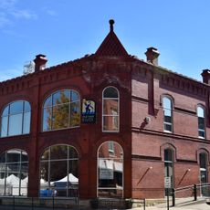
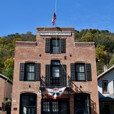
Wyalusing State Park, State park and National Natural Landmark in Grant County, Wisconsin.

Description

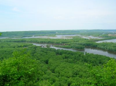
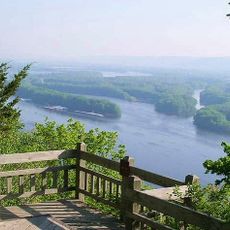
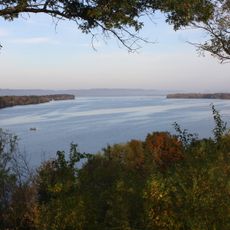
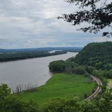
Wyalusing State Park sits where the Wisconsin River meets the Mississippi River and features high limestone cliffs along with multiple forest types covering the land. The landscape includes wooded areas, grasslands, and river valleys that support different plants and animals.

History

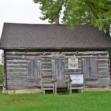
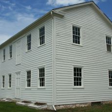
The area was first established as a park in 1917 under the name Nelson Dewey State Park and renamed in 1937 as its archaeological importance became clear. Ancient earthwork mounds found here date back to prehistoric times and represent earlier populations.

Culture

The name comes from the Lenape language meaning home of the warrior, reflecting ties to the Munsee-Delaware peoples who lived here. Today, visitors encounter this heritage through ancient earthwork mounds and memorials scattered across the landscape.

Practical

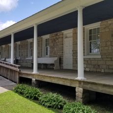
The park has a network of hiking trails with different difficulty levels and two campgrounds with many camping spots to choose from. Visitors can use the rivers for paddling and fishing, and in winter some paths are groomed for cross-country skiing.

Did you know?

The park houses an observatory with a large telescope for nighttime sky viewing and astronomical programs. There is also a memorial marker honoring the passenger pigeon, a bird species that once inhabited this region but is now gone.

Location
Inception
1917
GPS coordinates
42.97972,-91.10861
Latest update
December 8, 2025 19:41

AroundUs brings together thousands of curated places, local tips, and hidden gems, enriched daily by 60,000 contributors worldwide. Discover all places nearby (Grant County).

Around this place
Pikes Peak State Park
United States of America

Pikes Peak State Park

4.9 km
Villa Louis
United States of America

Villa Louis

9.4 km
Upper Mississippi River National Wildlife and Fish Refuge
United States of America

Upper Mississippi River National Wildlife and Fish Refuge

10.8 km
Fort Crawford
United States of America

Fort Crawford

7.8 km
American House
United States of America

American House

7.4 km
Brisbois House
United States of America

Brisbois House

9.3 km
Dousman Hotel
United States of America

Dousman Hotel

9.2 km
Pile–Pontoon Railroad Bridge
United States of America

Pile–Pontoon Railroad Bridge

9 km
Astor Fur Warehouse
United States of America

Astor Fur Warehouse

9.4 km
Peter Stauer House
United States of America

Peter Stauer House

7.4 km
W.H.C. Folsom House
United States of America

W.H.C. Folsom House

8.6 km
Francois Vertefeuille House
United States of America

Francois Vertefeuille House

12 km
Clayton School
United States of America

Clayton School

9.1 km
Old Rock School
United States of America

Old Rock School

6.6 km
Goedert Meat Market
United States of America

Goedert Meat Market

7.4 km
First Congregational Church
United States of America

First Congregational Church

16.3 km
Joseph "Diamond Jo" Reynolds Office Building and House
United States of America

Joseph "Diamond Jo" Reynolds Office Building and House

7.4 km
Effigy Mounds National Monument Visitor Center
United States of America

Effigy Mounds National Monument Visitor Center

13.7 km
St. Germain dit Gauthier House
United States of America

St. Germain dit Gauthier House

9.3 km
Crawford County Courthouse
United States of America

Crawford County Courthouse

8.9 km
Prairie du Chien City Hall
United States of America

Prairie du Chien City Hall

8.6 km
McGregor Commercial Historic District
United States of America

McGregor Commercial Historic District

7.4 km
I.O.O.F. Hall
United States of America

I.O.O.F. Hall

16.2 km
Strange Powers House
United States of America

Strange Powers House

9.1 km
Commercial Hotel
United States of America

Commercial Hotel

8.6 km
Christian Bloedel Wagon Works
United States of America

Christian Bloedel Wagon Works

7.4 km
Rolette House
United States of America

Rolette House

9.2 km
Fort Crawford Museum
United States of America

Fort Crawford Museum

7.7 km
Show the full map
« Wyalusing State Park - State park and National Natural Landmark in Grant County, Wisconsin » is provided by Around Us (aroundus.com). Images and texts are derived from Wikimedia project under a Creative Commons license. You are allowed to copy, distribute, and modify copies of this page, under the conditions set by the license, as long as this note is clearly visible.

Discover hidden gems everywhere you go!

From secret cafés to breathtaking viewpoints, skip the crowded tourist spots and find places that match your style. Our app makes it easy with voice search, smart filtering, route optimization, and insider tips from travelers worldwide. Download now for the complete mobile experience.

Around Us App Screenshot

A unique approach to discovering new places

Le Figaro

All the places worth exploring

France Info

A tailor-made excursion in just a few clicks

20 Minutes

Around Us
Travel Guide & Maps
Download

Send to your phone

QR Code
1

Open the camera app on your mobile.

2

Point at the QR code with your camera. A notification will appear.

3

Tap the notification to open the link.