Enable Location

We need your location to show you interesting places around you

Discover nearby places

Find interesting locations and hidden gems around you

Precise directions

Get accurate directions and distances to places

Your location is never shared with other users. It's only used when you tap the location button.

Grant County

Log in to your account

Start exploring — it's free

Trusted by 62,422 travelers worldwide

Continue with Google
Continue with Apple
or

We will send you a code to connect

By continuing, you accept our Terms and Conditions and our Privacy Policy

Check your inbox

We've sent a pincode in your inbox. Please enter the code below.

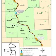
Grant County, Administrative county in southwestern Wisconsin, United States.

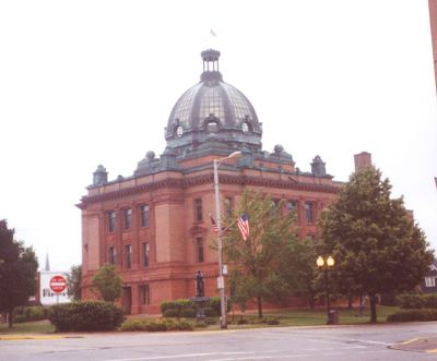
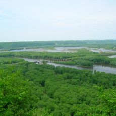
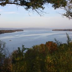
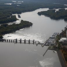
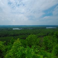
Grant County is an administrative county in southwestern Wisconsin, featuring rolling hills, forests, and rivers across its landscape. Lancaster functions as its administrative center, housing government offices and public services for residents and visitors.

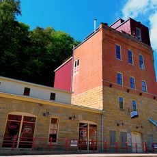
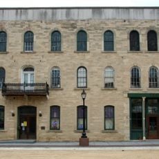
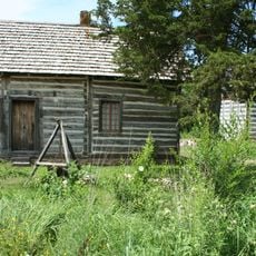
The county was established in 1836 from parts of neighboring Iowa County. Lead mining in the 19th century attracted numerous settlers and shaped the development of several towns across the region.

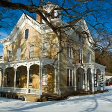
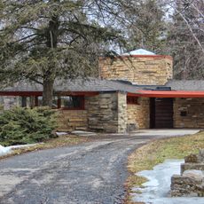
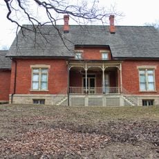
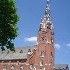
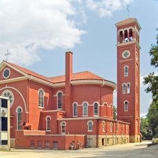
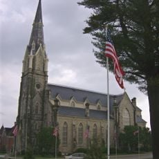
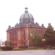
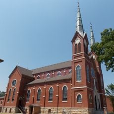
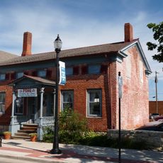
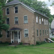
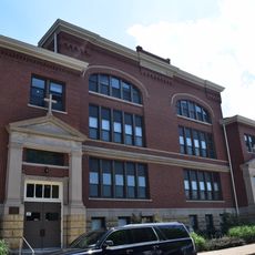
The county holds several historic churches and public buildings that reflect its heritage from early settlement times. Visitors walking through the towns can observe the different architectural styles brought by various immigrant communities who settled here.

Lancaster is easily accessible and offers essential public services in a central location. Visitors should plan for travel time between scattered towns, as the area is primarily rural in character.

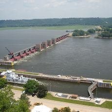
Lead mining in the 19th century created entire towns and left behind underground tunnel systems still visible today. These mines reveal the story of generations of workers and entrepreneurs who fundamentally changed the region.

The community of curious travelers

AroundUs brings together thousands of curated places, local tips, and hidden gems, enriched daily by 60,000 contributors worldwide.

Start exploring
Location
Inception
1836
Capital city
Lancaster
Shares border with
Crawford County, Lafayette County, Richland County, Iowa County, Jo Daviess County, Dubuque County, Clayton County
GPS coordinates
42.86000,-90.71000
Latest update
December 7, 2025 19:23
Around this place
Wyalusing State Park
United States of America

Wyalusing State Park

35.1 km
Upper Mississippi River National Wildlife and Fish Refuge
United States of America

Upper Mississippi River National Wildlife and Fish Refuge

31.9 km
Fort Crawford
United States of America

Fort Crawford

41.1 km
Potosi Brewery
United States of America

Potosi Brewery

20.4 km
Driftless Area National Wildlife Refuge
United States of America

Driftless Area National Wildlife Refuge

39.2 km
Lock and Dam No. 11
United States of America

Lock and Dam No. 11

36 km
Dickeyville Grotto
United States of America

Dickeyville Grotto

27.5 km
Mathias Ham House
United States of America

Mathias Ham House

36.9 km
Dubuque–Wisconsin Bridge
United States of America

Dubuque–Wisconsin Bridge

38.8 km
Lock and Dam No. 10
United States of America

Lock and Dam No. 10

32.5 km
Eagle Point Bridge
United States of America

Eagle Point Bridge

36.4 km
Eagle Point Park
United States of America

Eagle Point Park

36.1 km
Patrick and Margaret Kinney House
United States of America

Patrick and Margaret Kinney House

1.2 km
Nelson Dewey State Park
United States of America

Nelson Dewey State Park

29.1 km
Stonefield
United States of America

Stonefield

29.1 km
Saint Mary's Catholic Church
United States of America

Saint Mary's Catholic Church

39.3 km
Dubuque Arboretum and Botanical Gardens
United States of America

Dubuque Arboretum and Botanical Gardens

36.4 km
Holy Ghost Catholic Church
United States of America

Holy Ghost Catholic Church

37.5 km
Saint Boniface Church
United States of America

Saint Boniface Church

47.8 km
Central House Hotel
United States of America

Central House Hotel

30.6 km
Grant County Courthouse
United States of America

Grant County Courthouse

1.4 km
St. Mary's Catholic Church
United States of America

St. Mary's Catholic Church

32.8 km
Lakeside Ballroom
United States of America

Lakeside Ballroom

32.9 km
W.H.C. Folsom House
United States of America

W.H.C. Folsom House

41.5 km
Haberkorn House and Farmstead
United States of America

Haberkorn House and Farmstead

29.7 km
Francois Vertefeuille House
United States of America

Francois Vertefeuille House

43.5 km
Sacred Heart School
United States of America

Sacred Heart School

38.4 km
Four Mounds Estate Historic District
United States of America

Four Mounds Estate Historic District

34.3 km
Show the full map
Administrative divisions
« Grant County - Administrative county in southwestern Wisconsin, United States » is provided by Around Us (aroundus.com). Images and texts are derived from Wikimedia project under a Creative Commons license. You are allowed to copy, distribute, and modify copies of this page, under the conditions set by the license, as long as this note is clearly visible.

Discover hidden gems everywhere you go!

From secret cafés to breathtaking viewpoints, skip the crowded tourist spots and find places that match your style. Our app makes it easy with voice search, smart filtering, route optimization, and insider tips from travelers worldwide. Download now for the complete mobile experience.

Around Us App Screenshot

A unique approach to discovering new places

Le Figaro

All the places worth exploring

France Info

A tailor-made excursion in just a few clicks

20 Minutes

Around Us
Travel Guide & Maps
Download

Send to your phone

QR Code
1

Open the camera app on your mobile.

2

Point at the QR code with your camera. A notification will appear.

3

Tap the notification to open the link.