Enable Location

We need your location to show you interesting places around you

Discover nearby places

Find interesting locations and hidden gems around you

Precise directions

Get accurate directions and distances to places

Your location is never shared with other users. It's only used when you tap the location button.

Hot Springs National Park

Log in to your account

Start exploring — it's free

Trusted by 61,361 travelers worldwide

Continue with Google
Continue with Apple
or

We will send you a code to connect

By continuing, you accept our Terms and Conditions and our Privacy Policy

Check your inbox

We've sent a pincode in your inbox. Please enter the code below.

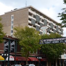
Hot Springs National Park, National Park in Arkansas, United States

Description

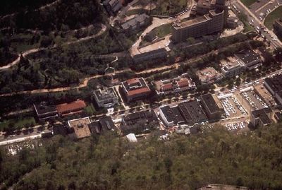
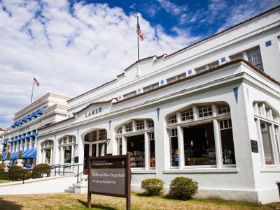
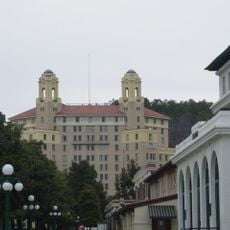
This protected area includes several spring sites at the base of a forested mountain and a historic early 20th-century row of eight ornately decorated bathhouses. Narrow trails wind up the slopes above the bathing facilities and pass through dense forest to overlooks above the town.

History

The government placed this area under federal protection in 1832 to prevent anyone from claiming or building on the springs privately. The modern system for distributing thermal water was completed in 1902 to feed the springs evenly to the various bathhouses.

Culture

Indigenous peoples called this place Valley of the Vapors because of the rising steam clouds above the springs. Visitors today can still see thermal water bubbling up through open fountains along the promenade, sending small wisps of steam into the air.

Practical

Several hiking trails access the slopes above the bathhouse row and offer easy to moderate climbs through shaded forest. Those who want to see the historic bathhouses from inside should note that only a few of the buildings are open for viewing.

Did you know?

The spring water takes about one year to rise from great depth after entering the ground as rainwater. A drop that surfaces today fell as precipitation in the surrounding mountains roughly twelve months ago.

Location
Inception
March 4, 1921
Operator
National Park Service
GPS coordinates
34.51361,-93.05361
Latest update
December 13, 2025 16:42

AroundUs brings together thousands of curated places, local tips, and hidden gems, enriched daily by 60,000 contributors worldwide. Discover all places nearby (Garland County).

Around this place
Bathhouse Row
United States of America

Bathhouse Row

0 m
Arlington Hotel
United States of America

Arlington Hotel

346 m
Hot Springs High School
United States of America

Hot Springs High School

928 m
Bill Clinton Boyhood Home
United States of America

Bill Clinton Boyhood Home

2.1 km
Arkansas Alligator Farm and Petting Zoo
United States of America

Arkansas Alligator Farm and Petting Zoo

1.8 km
Hot Springs Mountain Tower
United States of America

Hot Springs Mountain Tower

796 m
Medical Arts Building
United States of America

Medical Arts Building

310 m
Malco Theatre
United States of America

Malco Theatre

344 m
Aristocrat Motor Inn
United States of America

Aristocrat Motor Inn

309 m
Park Hotel
United States of America

Park Hotel

509 m
Jack Tar Hotel and Bathhouse
United States of America

Jack Tar Hotel and Bathhouse

1.8 km
Wade Building
United States of America

Wade Building

371 m
Mountainaire Hotel Historic District
United States of America

Mountainaire Hotel Historic District

2.2 km
First Presbyterian Church
United States of America

First Presbyterian Church

581 m
Hamp Williams Building
United States of America

Hamp Williams Building

860 m
St. Luke's Episcopal Church
United States of America

St. Luke's Episcopal Church

373 m
Hot Springs Confederate Monument
United States of America

Hot Springs Confederate Monument

639 m
Woodmen of Union Building
United States of America

Woodmen of Union Building

835 m
Stitt House
United States of America

Stitt House

1.7 km
Federal Building-U.S. Post Office and Court House
United States of America

Federal Building-U.S. Post Office and Court House

218 m
Riviera Hotel
United States of America

Riviera Hotel

528 m
Ouachita Avenue Historic District
United States of America

Ouachita Avenue Historic District

829 m
Orange Street Presbyterian Church
United States of America

Orange Street Presbyterian Church

926 m
Hill Wheatley Downtowner Motor Inn
United States of America

Hill Wheatley Downtowner Motor Inn

481 m
Parkway Courts Historic District
United States of America

Parkway Courts Historic District

1.4 km
Bellaire Court Historic District
United States of America

Bellaire Court Historic District

1.2 km
Passmore House
United States of America

Passmore House

1.8 km
Doherty House
United States of America

Doherty House

1.1 km
Show the full map
« Hot Springs National Park - National Park in Arkansas, United States » is provided by Around Us (aroundus.com). Images and texts are derived from Wikimedia project under a Creative Commons license. You are allowed to copy, distribute, and modify copies of this page, under the conditions set by the license, as long as this note is clearly visible.

Discover hidden gems everywhere you go!

From secret cafés to breathtaking viewpoints, skip the crowded tourist spots and find places that match your style. Our app makes it easy with voice search, smart filtering, route optimization, and insider tips from travelers worldwide. Download now for the complete mobile experience.

Around Us App Screenshot

A unique approach to discovering new places

Le Figaro

All the places worth exploring

France Info

A tailor-made excursion in just a few clicks

20 Minutes

Around Us
Travel Guide & Maps
Download

Send to your phone

QR Code
1

Open the camera app on your mobile.

2

Point at the QR code with your camera. A notification will appear.

3

Tap the notification to open the link.