Houston Ship Channel

Log in to your account

AroundUs is a community-driven map of interesting places, built by curious explorers like you. It grows with every review, story, and photo you share.
Connect to save your favorite spots, contribute locations, and create personalized routes.
Continue with Google
Continue with Apple
Continue with X
Continue with Facebook
Continue with email
By continuing, you accept our Terms and Conditions and our Privacy Policy
Create an account
Add to collection
Map
Suggest a change
Share

Houston Ship Channel, Waterway in Houston, United States

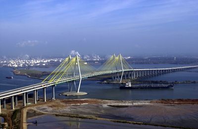
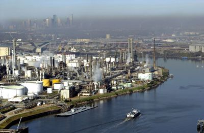
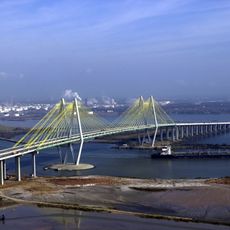
The Houston Ship Channel is an artificial waterway carved through Buffalo Bayou to link Houston's port directly to the Gulf of Mexico. The channel was engineered wide and deep enough to handle ocean-going cargo vessels moving goods in and out of the city.

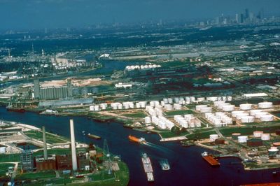
The waterway was completed in 1914 after dredging transformed the shallow bayou into a passage for seagoing ships. This project opened Houston to international commerce and marked the start of the city's growth as a major port.

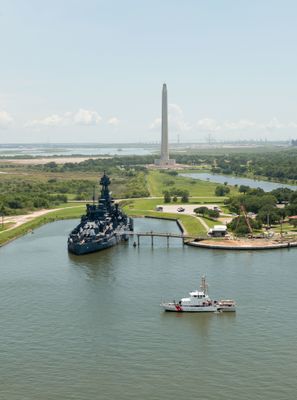
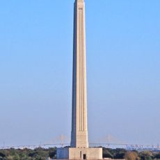
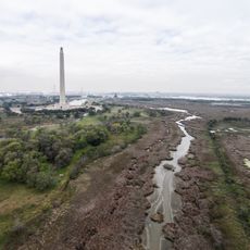
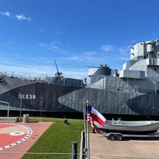
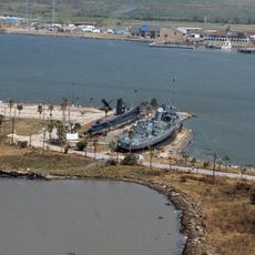
The waterway shaped how Houston developed as a port city, with loading facilities and industrial areas lining its banks as reminders of the trade that built the region. Workers and mariners have used these waters for generations, making it central to local identity.

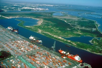
The channel operates year-round and is actively dredged to keep routes clear for ships. Visitors can watch commercial traffic and port activity from public viewpoints and parks along the banks without special permits.

The waterway was engineered with remarkable precision and today ranks among the busiest shipping routes in North America. Hundreds of vessels pass through daily, making it one of the world's most important yet often overlooked ports.

Location: Chambers County

GPS coordinates: 29.70833,-95.00500

Latest update: December 17, 2025 08:15

Photos
Around this place
USS Texas
United States of America

USS Texas

9.7 km
Christopher C. Kraft Jr. Mission Control Center
United States of America

Christopher C. Kraft Jr. Mission Control Center

18.6 km
San Jacinto Monument
United States of America

San Jacinto Monument

8.6 km
Space Center Houston
United States of America

Space Center Houston

19.6 km
Kemah Boardwalk
United States of America

Kemah Boardwalk

17.9 km
San Jacinto Battleground State Historic Site
United States of America

San Jacinto Battleground State Historic Site

8.5 km
Fred Hartman Bridge
United States of America

Fred Hartman Bridge

1.3 km
USS Stewart
United States of America

USS Stewart

46.9 km
Seawolf Park
United States of America

Seawolf Park

46.9 km
Washburn Tunnel
United States of America

Washburn Tunnel

20.1 km
Sam Houston Ship Channel Bridge
United States of America

Sam Houston Ship Channel Bridge

14 km
Boardwalk Bullet
United States of America

Boardwalk Bullet

18.1 km
1940 Air Terminal Museum
United States of America

1940 Air Terminal Museum

28 km
Bolivar Bridge
United States of America

Bolivar Bridge

45.2 km
Vince's Bridge
United States of America

Vince's Bridge

20.8 km
United States of America

Challenger Columbia Stadium

24.6 km
Fort Travis
United States of America

Fort Travis

45.1 km
United States of America

Sidney Sherman Bridge

25.3 km
Point Bolivar Lighthouse
United States of America

Point Bolivar Lighthouse

44.5 km
United States of America

Armand Bayou Nature Center

15.5 km
United States of America

Baytown Nature Center

6.4 km
NASA Mission Control Center
United States of America

NASA Mission Control Center

18.6 km
Space Environment Simulation Laboratory
United States of America

Space Environment Simulation Laboratory

18.3 km
Pine Gully Park, Seabrook, Texas
United States of America

Pine Gully Park, Seabrook, Texas

15.6 km
Lone Star Flight Museum
United States of America

Lone Star Flight Museum

20.1 km
United States of America

Texas City Prairie Preserve

29.2 km
United States of America

Raul Yzaguirre School for Success

26.5 km
United States of America

Fort Point Light

47.2 km
Show the full map
Reviews

Visited this place? Tap the stars to rate it and share your experience / photos with the community! Try now! You can cancel it anytime.

« Houston Ship Channel - Waterway in Houston, United States » is provided by Around Us (aroundus.com). Images and texts are derived from Wikimedia project under a Creative Commons license. You are allowed to copy, distribute, and modify copies of this page, under the conditions set by the license, as long as this note is clearly visible.

Discover hidden gems everywhere you go!

From secret cafés to breathtaking viewpoints, skip the crowded tourist spots and find places that match your style. Our app makes it easy with voice search, smart filtering, route optimization, and insider tips from travelers worldwide. Download now for the complete mobile experience.

Around Us App Screenshot

A unique approach to discovering new places

Le Figaro

All the places worth exploring

France Info

A tailor-made excursion in just a few clicks

20 Minutes