Chest opened
+${chestReward.xp} XP
Explorer
NOUVEAU ×${chestReward.collectible.quantity}
tapez pour fermer
Chest locked

Open chests in the app

Around Us is built for your phone — chests unlock when you walk, explore and capture nearby places.

Enable Location

We need your location to show you interesting places around you

Discover nearby places

Find interesting locations and hidden gems around you

Precise directions

Get accurate directions and distances to places

Your location is never shared with other users. It's only used when you tap the location button.

Log in to your account

Start exploring — it's free

Trusted by 72,901 travelers worldwide

Continue with Google
Continue with Apple
or

We will send you a code to connect

By continuing, you accept our Terms and Conditions and our Privacy Policy

Check your inbox

We've sent a pincode in your inbox. Please enter the code below.

Michiana
Discussion Reviews Photo
22.4k Popularity

Michiana, Regional territory across Indiana and Michigan, United States.

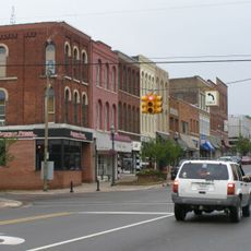
Michiana is a cross-border region spanning northern Indiana and southwestern Michigan, with South Bend serving as its main city. The area covers seven counties and is coordinated by a regional development council.

The name Michiana came from a 1934 naming contest run by local merchants who combined Michigan and Indiana into one word. This helped identify the cross-border region as a single area.

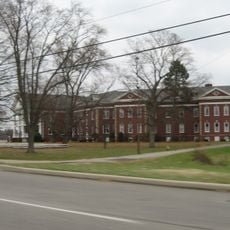
The region's economy grew from car manufacturing and now centers on recreational vehicles, healthcare, and education. These industries shape how people work and live across the communities here.

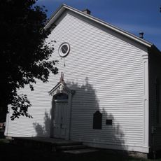
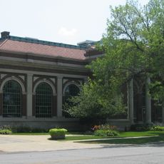
The region is best explored by car, moving between towns based on your interests and destinations. The St. Joseph River and local landmarks help with navigation.

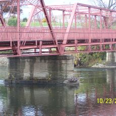
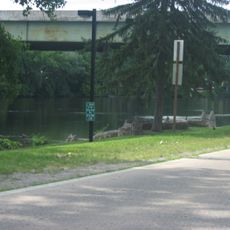
The St. Joseph River winds through the region's heart, connecting Mishawaka and South Bend along its path. This waterway has shaped how communities developed and remains a natural anchor for local geography.

The community of curious travelers

AroundUs brings together thousands of curated places, local tips, and hidden gems, enriched daily by 60,000 contributors worldwide.

Start exploring
Location
Location
GPS coordinates
41.76000,-86.19000
Latest update
March 5, 2026 18:16
Around this place
Notre Dame Stadium
United States of America

Notre Dame Stadium

7.8 km
Basilica of the Sacred Heart, University of Notre Dame
United States of America

Basilica of the Sacred Heart, University of Notre Dame

7.6 km
Main Building
United States of America

Main Building

7.5 km
Compton Family Ice Arena
United States of America

Compton Family Ice Arena

8.1 km
Fort St. Joseph
United States of America

Fort St. Joseph

8.5 km
Frank Eck Stadium
United States of America

Frank Eck Stadium

7.8 km
Snite Museum of Art
United States of America

Snite Museum of Art

7.7 km
Alumni Hall
United States of America

Alumni Hall

7.9 km
Bond Hall
United States of America

Bond Hall

7.8 km
Log Chapel, University of Notre Dame
United States of America

Log Chapel, University of Notre Dame

7.6 km
Clarke Memorial Fountain
United States of America

Clarke Memorial Fountain

7.5 km
Washington Hall
United States of America

Washington Hall

7.6 km
Joyce Center
United States of America

Joyce Center

7.7 km
LaFortune Student Center
United States of America

LaFortune Student Center

7.6 km
Smith's Chapel
United States of America

Smith's Chapel

3.8 km
North Pumping Station
United States of America

North Pumping Station

9.6 km
Water Street/Darden Road Bridge
United States of America

Water Street/Darden Road Bridge

7.3 km
St. Joseph County Infirmary
United States of America

St. Joseph County Infirmary

8.9 km
Niles Downtown Historic District
United States of America

Niles Downtown Historic District

9.5 km
Normain Heights Historic District
United States of America

Normain Heights Historic District

8.5 km
Samuel Leeper Jr. House
United States of America

Samuel Leeper Jr. House

9.4 km
Ring Lardner House
United States of America

Ring Lardner House

8.8 km
Notre Dame Old Fieldhouse
United States of America

Notre Dame Old Fieldhouse

7.4 km
Northside Boulevard Riverwall
United States of America

Northside Boulevard Riverwall

9.6 km
Maurice Egan House
United States of America

Maurice Egan House

8.7 km
Word of Life
United States of America

Word of Life

7.4 km
Henry A. Chapin House
United States of America

Henry A. Chapin House

9.3 km
Fort Saint Joseph Historical Marker
United States of America

Fort Saint Joseph Historical Marker

8.3 km
Show the full map
Reviews
Share your experience

No review yet

Discussions
Start a discussion...

No discussion yet

« Michiana - Regional territory across Indiana and Michigan, United States » is provided by Around Us (aroundus.com). Images and texts are derived from Wikimedia project under a Creative Commons license. You are allowed to copy, distribute, and modify copies of this page, under the conditions set by the license, as long as this note is clearly visible.

Discover hidden gems everywhere you go!

From secret cafés to breathtaking viewpoints, skip the crowded tourist spots and find places that match your style. Our app makes it easy with voice search, smart filtering, route optimization, and insider tips from travelers worldwide. Download now for the complete mobile experience.

Around Us App Screenshot

A unique approach to discovering new places

Le Figaro

All the places worth exploring

France Info

A tailor-made excursion in just a few clicks

20 Minutes

Around Us
Travel Guide & Maps
Download

Send to your phone

QR Code
1

Open the camera app on your mobile.

2

Point at the QR code with your camera. A notification will appear.

3

Tap the notification to open the link.