Enable Location

We need your location to show you interesting places around you

Discover nearby places

Find interesting locations and hidden gems around you

Precise directions

Get accurate directions and distances to places

Your location is never shared with other users. It's only used when you tap the location button.

Minneapolis BNSF Rail Bridge

Log in to your account

Start exploring — it's free

Trusted by 61,478 travelers worldwide

Continue with Google
Continue with Apple
or

We will send you a code to connect

By continuing, you accept our Terms and Conditions and our Privacy Policy

Check your inbox

We've sent a pincode in your inbox. Please enter the code below.

Minneapolis BNSF Rail Bridge

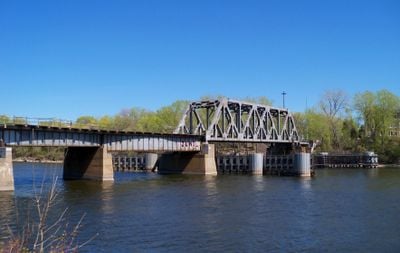
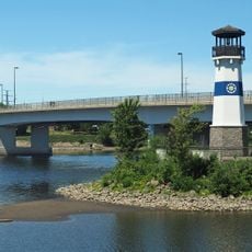
Minneapolis BNSF Rail Bridge, Railway bridge in downtown Minneapolis, US.

Description

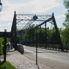
The Minneapolis BNSF Rail Bridge is a combination of plate girder and truss construction that spans the Mississippi between downtown and Nicollet Island. The structure carries two tracks used by both freight operations and the Northstar Commuter Rail line, which terminates at Target Field.

History

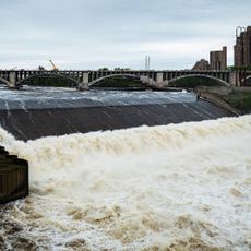
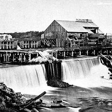
Completed in 1893 by the Great Northern Railway, this was the first railroad crossing of the Mississippi in Minneapolis. It replaced an earlier bridge from 1867 that had served the growing rail network of the young city.

Culture

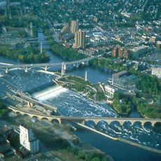
The bridge symbolizes Minneapolis industrial heritage, with trains crossing the Mississippi daily as part of the city's modern transit system. For commuters, it has become an ordinary part of their journey on the Northstar line.

Practical

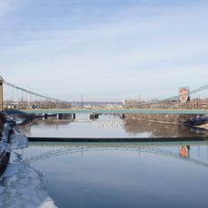
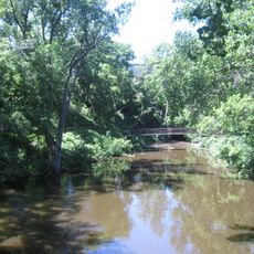
The bridge is best viewed from nearby riverbanks or accessible paths, as it carries active rail traffic throughout the day. Stay at a safe distance from the tracks and be aware of train schedules when planning a viewing time.

Did you know?

The bridge features a distinctive structural bulge from a former curved section that once connected to Minneapolis Union Depot. This remnant remains visible today even though the depot was demolished in 1978 and that connection is no longer in use.

Location
Official opening
1893
GPS coordinates
44.98780,-93.26580
Latest update
December 14, 2025 12:27

AroundUs brings together thousands of curated places, local tips, and hidden gems, enriched daily by 60,000 contributors worldwide. Discover all places nearby (Minneapolis).

Around this place
Saint Anthony Falls
United States of America

Saint Anthony Falls

887 m
Nicollet Island
United States of America

Nicollet Island

197 m
Metropolitan Building
United States of America

Metropolitan Building

923 m
Northwestern National Life Building
United States of America

Northwestern National Life Building

692 m
Hennepin Avenue Bridge
United States of America

Hennepin Avenue Bridge

316 m
Lumber Exchange Building
United States of America

Lumber Exchange Building

990 m
Minneapolis Central Library
United States of America

Minneapolis Central Library

872 m
Marquette Plaza
United States of America

Marquette Plaza

784 m
Our Lady of Lourdes Catholic Church
United States of America

Our Lady of Lourdes Catholic Church

662 m
100 Washington Square
United States of America

100 Washington Square

746 m
Third Avenue Bridge
United States of America

Third Avenue Bridge

739 m
The Carlyle
United States of America

The Carlyle

690 m
Industrial Exposition Building
United States of America

Industrial Exposition Building

750 m
Churchill Apartments
United States of America

Churchill Apartments

582 m
Plymouth Avenue Bridge
United States of America

Plymouth Avenue Bridge

824 m
Traffic Zone Center for Visual Art
United States of America

Traffic Zone Center for Visual Art

830 m
La Rive Condominiums
United States of America

La Rive Condominiums

690 m
Globe Building
United States of America

Globe Building

904 m
Merriam Street Bridge
United States of America

Merriam Street Bridge

546 m
Minnesota Planetarium
United States of America

Minnesota Planetarium

922 m
Bassett Creek
United States of America

Bassett Creek

621 m
Boom Island Park
United States of America

Boom Island Park

577 m
Upper Saint Anthony Falls
United States of America

Upper Saint Anthony Falls

765 m
Saint Anthony Falls Upper Lock and Dam
United States of America

Saint Anthony Falls Upper Lock and Dam

887 m
Saint Anthony Falls Historic District
United States of America

Saint Anthony Falls Historic District

799 m
Dickman Park
United States of America

Dickman Park

790 m
St. Anthony Main Theatre
United States of America

St. Anthony Main Theatre

874 m
Nicollet Island Park
United States of America

Nicollet Island Park

516 m
Show the full map
« Minneapolis BNSF Rail Bridge - Railway bridge in downtown Minneapolis, US » is provided by Around Us (aroundus.com). Images and texts are derived from Wikimedia project under a Creative Commons license. You are allowed to copy, distribute, and modify copies of this page, under the conditions set by the license, as long as this note is clearly visible.

Discover hidden gems everywhere you go!

From secret cafés to breathtaking viewpoints, skip the crowded tourist spots and find places that match your style. Our app makes it easy with voice search, smart filtering, route optimization, and insider tips from travelers worldwide. Download now for the complete mobile experience.

Around Us App Screenshot

A unique approach to discovering new places

Le Figaro

All the places worth exploring

France Info

A tailor-made excursion in just a few clicks

20 Minutes

Around Us
Travel Guide & Maps
Download

Send to your phone

QR Code
1

Open the camera app on your mobile.

2

Point at the QR code with your camera. A notification will appear.

3

Tap the notification to open the link.