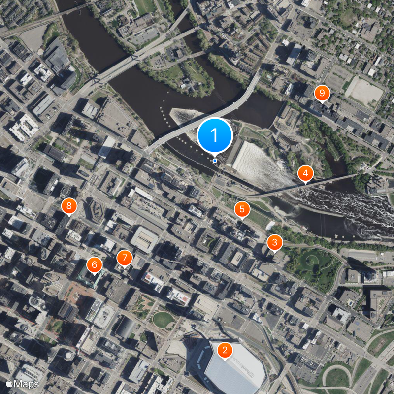
Saint Anthony Falls, Waterfall complex in downtown Minneapolis, United States.
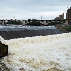
The Saint Anthony Falls stretch across the Mississippi River with a system of concrete barriers and spillways controlling water flow at the northeastern edge of downtown. The construction distributes water across several artificial steps and channels that have replaced the original natural drop.
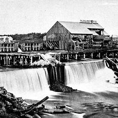
French explorer Father Louis Hennepin documented this waterfall in 1680, measuring its original height at roughly 15 meters (50 feet) above the Mississippi level. The falls moved upstream for thousands of years until engineering structures in the 19th century halted their natural migration.
The Dakota called this place Owámniyomni and gathered here regularly to fish and trade with other indigenous groups. The name translates roughly to whirling water, referring to the motion of the river at this point.
Visitors can view the falls from the Stone Arch Bridge and Mill Ruins Park, where interpretive signs explain the history of the site. The park is easily reachable on foot or by bicycle and offers several lookout points along the riverbank.
The falls migrated upstream at a rate of roughly 1.2 meters (4 feet) per year over thousands of years before engineering structures halted their natural movement. This process occurred because of constant erosion of soft sandstone beneath the harder limestone layer forming the riverbed.
The community of curious travelers
AroundUs brings together thousands of curated places, local tips, and hidden gems, enriched daily by 60,000 contributors worldwide.