Lowell-Dracut-Tyngsboro State Forest

Log in to your account

AroundUs is a community-driven map of interesting places, built by curious explorers like you. It grows with every review, story, and photo you share.
Connect to save your favorite spots, contribute locations, and create personalized routes.
By continuing, you accept our Terms and Conditions and our Privacy Policy

Lowell-Dracut-Tyngsboro State Forest

Add to collection
Map
Suggest a change
Share

Lowell-Dracut-Tyngsboro State Forest, State forest in Middlesex County, Massachusetts, United States.

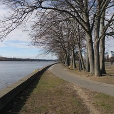
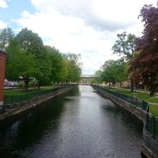
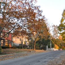
Lowell-Dracut-Tyngsboro State Forest covers approximately 450 acres of land with about 70 acres of ponds, swamps, and wetlands spread across three towns in Massachusetts. The wooded area features mixed tree stands interspersed with water features and a network of natural habitats.

Thomas Varnum transferred several hundred acres of Hawk Valley Farm to Massachusetts in 1941 for the creation of this state forest. The land shifted from private ownership to public conservation.

The land once belonged to Mohawk, Huron, and Wowenocks peoples and later served as the Pawtucket Falls Indian Reservation. Visitors walk through a landscape with deep roots in Native American history and presence.

The forest offers more than 9 kilometers of marked trails for hiking, mountain biking, horseback riding, cross-country skiing, and snowmobiling depending on the season. Visitors should bring appropriate footwear and weather protection since trails pass through varied terrain and water areas.

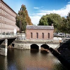
Granite extraction in the forest supplied materials for canal construction and building foundations during industrial expansion. Abandoned quarry sites today shape the landscape and reveal the area's mining heritage.

Location: Massachusetts

Inception: 1910

Website: https://mass.gov/locations/lowell-dracut-tyngsboro-state-forest

GPS coordinates: 42.66310,-71.36760

Latest update: December 12, 2025 09:00

Photos
Around this place
Show the full map
Tsongas Center
United States of America

Tsongas Center

4.7 km
Pawtucket Falls
United States of America

Pawtucket Falls

3.3 km
American Textile History Museum
United States of America

American Textile History Museum

4.8 km
Lowell Power Canal System
United States of America

Lowell Power Canal System

4.4 km
Whistler House Museum of Art
United States of America

Whistler House Museum of Art

4.8 km
Lowell Heritage State Park
United States of America

Lowell Heritage State Park

2.5 km
Pollard Memorial Library
United States of America

Pollard Memorial Library

4.7 km
New England Quilt Museum
United States of America

New England Quilt Museum

5 km
Tyngsborough Bridge
United States of America

Tyngsborough Bridge

4.6 km
Merrimack Canal
United States of America

Merrimack Canal

4.9 km
Wannalancit Mills
United States of America

Wannalancit Mills

4.4 km
Jonathan Bowers House
United States of America

Jonathan Bowers House

3.7 km
St. Joseph's Convent and School
United States of America

St. Joseph's Convent and School

4 km
Jerathmell Bowers House
United States of America

Jerathmell Bowers House

3.8 km
Allen House
United States of America

Allen House

3.4 km
St. George Antiochian Orthodox Church
United States of America

St. George Antiochian Orthodox Church

3.9 km
City Hall Historic District
United States of America

City Hall Historic District

4.8 km
The Worthen House
United States of America

The Worthen House

4.8 km
Old Town Hall
United States of America

Old Town Hall

4.9 km
Stony Brook
United States of America

Stony Brook

2.8 km
Chelmsford Glass Works' Long House
United States of America

Chelmsford Glass Works' Long House

3.6 km
North Town Hall
United States of America

North Town Hall

3.1 km
Winslow School and Littlefield Library
United States of America

Winslow School and Littlefield Library

4.9 km
Tyler Park Historic District
United States of America

Tyler Park Historic District

4.2 km
Saint Joseph's Roman Catholic College for Boys
United States of America

Saint Joseph's Roman Catholic College for Boys

4.2 km
Wilder Street Historic District
United States of America

Wilder Street Historic District

4.2 km
Wannalancit Street Historic District
United States of America

Wannalancit Street Historic District

3.6 km
National Streetcar Museum
United States of America

National Streetcar Museum

4.9 km
Show the full map
Reviews

Visited this place? Tap the stars to rate it and share your experience / photos with the community! Try now! You can cancel it anytime.

« Lowell-Dracut-Tyngsboro State Forest - State forest in Middlesex County, Massachusetts, United States » is provided by Around Us (aroundus.com). Images and texts are derived from Wikimedia project under a Creative Commons license. You are allowed to copy, distribute, and modify copies of this page, under the conditions set by the license, as long as this note is clearly visible.

Discover hidden gems everywhere you go!

From secret cafés to breathtaking viewpoints, skip the crowded tourist spots and find places that match your style. Our app makes it easy with voice search, smart filtering, route optimization, and insider tips from travelers worldwide. Download now for the complete mobile experience.

Around Us App Screenshot

A unique approach to discovering new places

Le Figaro

All the places worth exploring

France Info

A tailor-made excursion in just a few clicks

20 Minutes