Chest opened
+${chestReward.xp} XP
Explorer
NOUVEAU ×${chestReward.collectible.quantity}
tapez pour fermer
Chest locked

Open chests in the app

Around Us is built for your phone — chests unlock when you walk, explore and capture nearby places.

Enable Location

We need your location to show you interesting places around you

Discover nearby places

Find interesting locations and hidden gems around you

Precise directions

Get accurate directions and distances to places

Your location is never shared with other users. It's only used when you tap the location button.

Blountville

Log in to your account

Start exploring — it's free

Trusted by 72,886 travelers worldwide

Continue with Google
Continue with Apple
or

We will send you a code to connect

By continuing, you accept our Terms and Conditions and our Privacy Policy

Check your inbox

We've sent a pincode in your inbox. Please enter the code below.

Discussion Reviews 1 Photos
15.6k Popularity

Blountville, County seat in Sullivan County, Tennessee

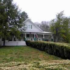
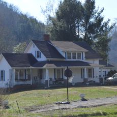
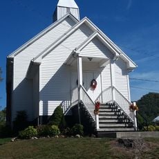
Blountville is the county seat of Sullivan County in northeastern Tennessee, spreading across residential areas and administrative buildings. The town sits at an elevation of about 469 meters (1,538 feet) with the appearance of a small historic community.

The town was founded in 1795 when James Brigham donated land to establish the county seat. During the Civil War in 1863, the place saw fighting between Confederate and Union forces that caused serious damage to buildings and streets.

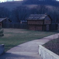
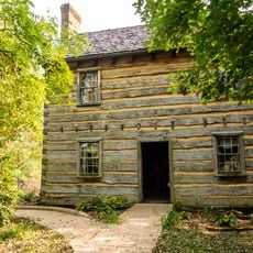
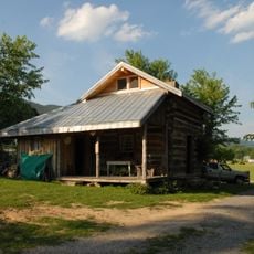
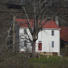
The town holds buildings from the 18th and 19th centuries that reflect how early settlers shaped this community. The Old Deery Inn from the late 1700s shows where travelers and traders once stopped during their journeys.

Getting there is easy by using U.S. Route 11W, which connects this place to nearby Bristol and Kingsport. The Tri-Cities Regional Airport offers air travel options for visitors arriving from other regions.

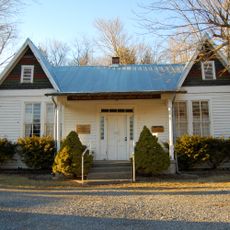
The courthouse was burned during fighting in 1863 and later rebuilt, showing how the community recovered after the war. The story of this destruction and rebuilding remains part of local memory today.

The community of curious travelers

AroundUs brings together thousands of curated places, local tips, and hidden gems, enriched daily by 60,000 contributors worldwide.

Start exploring
Location
Inception
1795
Elevation above the sea
469 m
GPS coordinates
36.53331,-82.32647
Latest update
December 7, 2025 19:29
Around this place
Bristol Motor Speedway
United States of America

Bristol Motor Speedway

6.5 km
Virginia Intermont College
United States of America

Virginia Intermont College

15.6 km
Bristol Virginia-Tennessee Slogan Sign
United States of America

Bristol Virginia-Tennessee Slogan Sign

14.8 km
Sycamore Shoals
United States of America

Sycamore Shoals

22.2 km
South Holston Lake
United States of America

South Holston Lake

21.4 km
Boone Lake
United States of America

Boone Lake

14.4 km
Long Island
United States of America

Long Island

21.5 km
United States of America

Birthplace of Country Music Museum

14.6 km
Sycamore Shoals State Historic Area
United States of America

Sycamore Shoals State Historic Area

22 km
Maybelle and Ezra Carter House
United States of America

Maybelle and Ezra Carter House

17.1 km
A. P. and Sara Carter House
United States of America

A. P. and Sara Carter House

16.8 km
Rocky Mount, Tennessee
United States of America

Rocky Mount, Tennessee

14.2 km
A. P. Carter Homeplace
United States of America

A. P. Carter Homeplace

16.1 km
A. P. Carter Store
United States of America

A. P. Carter Store

16.9 km
Bristol Municipal Stadium
United States of America

Bristol Municipal Stadium

13.9 km
Mt. Vernon Methodist Church
United States of America

Mt. Vernon Methodist Church

16.8 km
East Hill Cemetery
United States of America

East Hill Cemetery

15.5 km
Sycamore Shoals State Historic Park
United States of America

Sycamore Shoals State Historic Park

22.1 km
Solar Hill Historic District
United States of America

Solar Hill Historic District

14.6 km
Virginia Middle School
United States of America

Virginia Middle School

15 km
Walnut Grove
United States of America

Walnut Grove

22 km
Yancey's Tavern
United States of America

Yancey's Tavern

11.9 km
Euclid Avenue Historic District (Bristol, Virginia)
United States of America

Euclid Avenue Historic District (Bristol, Virginia)

14.9 km
Bristol Commercial Historic District
United States of America

Bristol Commercial Historic District

14.4 km
Holiday Lanes
United States of America

Holiday Lanes

21.4 km
Douglass School
United States of America

Douglass School

15.9 km
Fulkerson-Hilton House
United States of America

Fulkerson-Hilton House

16.7 km
Virginia Hill Historic District
United States of America

Virginia Hill Historic District

14.3 km
Show the full map
Reviews
Share your experience

No review yet

Discussions
Start a discussion...

No discussion yet

« Blountville - County seat in Sullivan County, Tennessee » is provided by Around Us (aroundus.com). Images and texts are derived from Wikimedia project under a Creative Commons license. You are allowed to copy, distribute, and modify copies of this page, under the conditions set by the license, as long as this note is clearly visible.

Discover hidden gems everywhere you go!

From secret cafés to breathtaking viewpoints, skip the crowded tourist spots and find places that match your style. Our app makes it easy with voice search, smart filtering, route optimization, and insider tips from travelers worldwide. Download now for the complete mobile experience.

Around Us App Screenshot

A unique approach to discovering new places

Le Figaro

All the places worth exploring

France Info

A tailor-made excursion in just a few clicks

20 Minutes

Around Us
Travel Guide & Maps
Download

Send to your phone

QR Code
1

Open the camera app on your mobile.

2

Point at the QR code with your camera. A notification will appear.

3

Tap the notification to open the link.