Chest opened
+${chestReward.xp} XP
Explorer
NOUVEAU ×${chestReward.collectible.quantity}
tapez pour fermer
Chest locked

Open chests in the app

Around Us is built for your phone — chests unlock when you walk, explore and capture nearby places.

Enable Location

We need your location to show you interesting places around you

Discover nearby places

Find interesting locations and hidden gems around you

Precise directions

Get accurate directions and distances to places

Your location is never shared with other users. It's only used when you tap the location button.

Nassawadox

Log in to your account

Start exploring — it's free

Trusted by 72,882 travelers worldwide

Continue with Google
Continue with Apple
or

We will send you a code to connect

By continuing, you accept our Terms and Conditions and our Privacy Policy

Check your inbox

We've sent a pincode in your inbox. Please enter the code below.

Discussion Reviews 1 Photos
15.3k Popularity

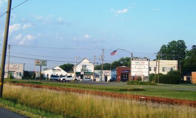
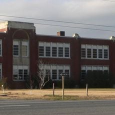
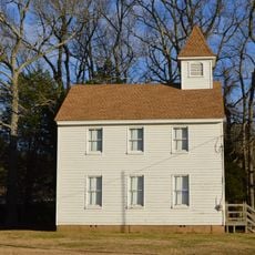
Nassawadox, Rural municipality in Northampton County, Virginia, United States.

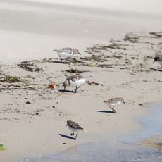
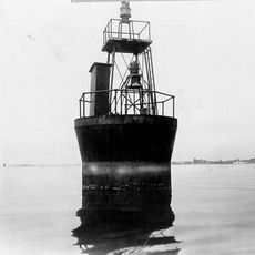
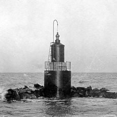
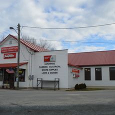
Nassawadox is a small administrative community in Northampton County on Virginia's Eastern Shore, located on the strip of land between the Atlantic Ocean and Chesapeake Bay. The area is defined by farmland and waterfront features that are typical of this coastal region.

The Pennsylvania Railroad arrived in Nassawadox in 1884 and set up a mail hook system for handling post instead of building a traditional station. This arrangement allowed the community to remain connected to the growing rail network.

The name Nassawadox comes from the Pocomoke people and means "between the waters," a reference that still shapes how locals think about their location. This geographical identity has always been central to daily life here.

The area is best reached by car since public transportation is limited and the community is spread out. Visitors should plan for any supplies or services they might need ahead of time, as local infrastructure is modest.

Every October, the Between the Waters Bike Tour passes through here, a multi-day cycling event that showcases the area's special position. The route connects Atlantic and Chesapeake coastal systems, bringing attention to the geography that inspired the community's name.

The community of curious travelers

AroundUs brings together thousands of curated places, local tips, and hidden gems, enriched daily by 60,000 contributors worldwide.

Start exploring
GPS coordinates
37.47486,-75.85826
Latest update
December 7, 2025 19:31
Around this place
Wolf Trap Light
United States of America

Wolf Trap Light

30.8 km
Custis Tombs
United States of America

Custis Tombs

30.3 km
Eyre Hall
United States of America

Eyre Hall

21.1 km
Coast Guard Station Cobb Island
United States of America

Coast Guard Station Cobb Island

21.3 km
Savage Neck Dunes Natural Area Preserve
United States of America

Savage Neck Dunes Natural Area Preserve

21.4 km
Hog Island Light
United States of America

Hog Island Light

16.6 km
Debtors' Prison
United States of America

Debtors' Prison

31.9 km
Almshouse Farm at Machipongo
United States of America

Almshouse Farm at Machipongo

8.9 km
Central High School
United States of America

Central High School

15.5 km
Cape Charles Historic District
United States of America

Cape Charles Historic District

26.8 km
Vaucluse
United States of America

Vaucluse

11.8 km
Pear Valley
United States of America

Pear Valley

10.5 km
Cherrystone Bar Light
United States of America

Cherrystone Bar Light

28.8 km
Northampton County Courthouse Historical District
United States of America

Northampton County Courthouse Historical District

15.7 km
Cokesbury Church
United States of America

Cokesbury Church

28.2 km
Brownsville
United States of America

Brownsville

2.9 km
Winona
United States of America

Winona

7.5 km
Pungoteague Creek Light
United States of America

Pungoteague Creek Light

21.2 km
Onancock Historic District
United States of America

Onancock Historic District

28.2 km
Eastville Historical District
United States of America

Eastville Historical District

15.7 km
Accomac Historic District
United States of America

Accomac Historic District

31.9 km
Kerr Place
United States of America

Kerr Place

28.2 km
Locustville Academy
United States of America

Locustville Academy

26 km
Grapeland
United States of America

Grapeland

8 km
Shepherd's Plain
United States of America

Shepherd's Plain

17.2 km
John W. Chandler House
United States of America

John W. Chandler House

7.1 km
Northampton Lumber Company Historic District
United States of America

Northampton Lumber Company Historic District

236 m
Benjamin's Department Store
United States of America

Benjamin's Department Store

7.3 km
Show the full map
Reviews
Share your experience

No review yet

Discussions
Start a discussion...

No discussion yet

« Nassawadox - Rural municipality in Northampton County, Virginia, United States » is provided by Around Us (aroundus.com). Images and texts are derived from Wikimedia project under a Creative Commons license. You are allowed to copy, distribute, and modify copies of this page, under the conditions set by the license, as long as this note is clearly visible.

Discover hidden gems everywhere you go!

From secret cafés to breathtaking viewpoints, skip the crowded tourist spots and find places that match your style. Our app makes it easy with voice search, smart filtering, route optimization, and insider tips from travelers worldwide. Download now for the complete mobile experience.

Around Us App Screenshot

A unique approach to discovering new places

Le Figaro

All the places worth exploring

France Info

A tailor-made excursion in just a few clicks

20 Minutes

Around Us
Travel Guide & Maps
Download

Send to your phone

QR Code
1

Open the camera app on your mobile.

2

Point at the QR code with your camera. A notification will appear.

3

Tap the notification to open the link.