Enable Location

We need your location to show you interesting places around you

Discover nearby places

Find interesting locations and hidden gems around you

Precise directions

Get accurate directions and distances to places

Your location is never shared with other users. It's only used when you tap the location button.

Eyre Hall

Log in to your account

Start exploring — it's free

Trusted by 62,417 travelers worldwide

Continue with Google
Continue with Apple
or

We will send you a code to connect

By continuing, you accept our Terms and Conditions and our Privacy Policy

Check your inbox

We've sent a pincode in your inbox. Please enter the code below.

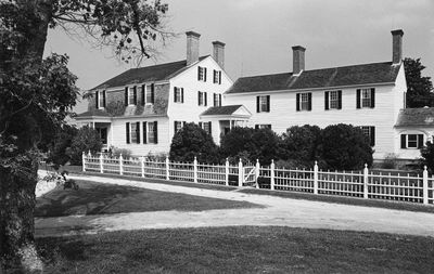
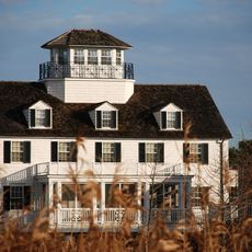
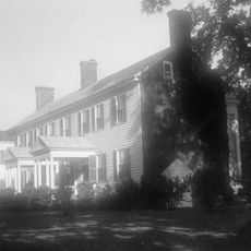
Eyre Hall, Colonial plantation in Northampton County, Virginia, United States.

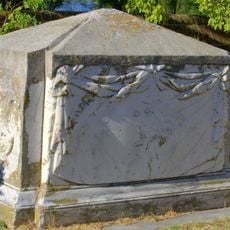
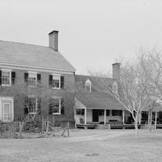
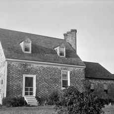
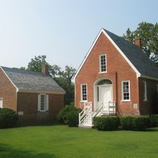
Eyre Hall is a Georgian mansion in Virginia featuring elaborate wood paneling and original furnishings throughout its interior rooms. French scenic wallpapers depicting Bosphorus shores adorn the walls, alongside preserved outbuildings, a formal garden from the 1800s, a family cemetery with table tombs, and remains of an 1819 orangery.

The property first received its land grant in 1668 to Thomas Eyre's sons, with the current main house constructed in 1760 by Littleton Eyre. The same family continued ownership and preservation across twelve generations, maintaining original furnishings, books, silver, and portraits from the colonial era.

The mansion's layout reveals how different people lived on the estate through its spatial divisions. The arrangement of rooms and passages shows clearly how owners, guests, and enslaved individuals occupied separate areas.

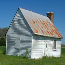
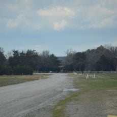
The estate is situated in a remote location, so it is helpful to check visiting hours and access details beforehand. Visitors should expect to walk between the main house and outlying buildings across the grounds.

The estate preserves a remarkably complete collection of colonial-era objects that remained in the same family's hands for generations. This continuous family relationship offers a rare glimpse into how people actually lived in this house across centuries.

The community of curious travelers

AroundUs brings together thousands of curated places, local tips, and hidden gems, enriched daily by 60,000 contributors worldwide.

Start exploring
Location
GPS coordinates
37.30970,-75.97470
Latest update
December 10, 2025 20:08
Around this place
Kiptopeke State Park
United States of America

Kiptopeke State Park

15.6 km
Wolf Trap Light
United States of America

Wolf Trap Light

21 km
Custis Tombs
United States of America

Custis Tombs

9.4 km
New Point Comfort Light
United States of America

New Point Comfort Light

26.9 km
Cape Charles Light
United States of America

Cape Charles Light

21.7 km
Eastern Shore of Virginia National Wildlife Refuge
United States of America

Eastern Shore of Virginia National Wildlife Refuge

20.2 km
Coast Guard Station Cobb Island
United States of America

Coast Guard Station Cobb Island

5.1 km
Savage Neck Dunes Natural Area Preserve
United States of America

Savage Neck Dunes Natural Area Preserve

3.7 km
Bethel Beach Natural Area Preserve
United States of America

Bethel Beach Natural Area Preserve

26.9 km
Hog Island Light
United States of America

Hog Island Light

26 km
Almshouse Farm at Machipongo
United States of America

Almshouse Farm at Machipongo

12.2 km
Old Plantation Flats Light
United States of America

Old Plantation Flats Light

11 km
Cape Charles Historic District
United States of America

Cape Charles Historic District

5.8 km
York Spit Light
United States of America

York Spit Light

27.2 km
Vaucluse
United States of America

Vaucluse

13.2 km
Pear Valley
United States of America

Pear Valley

10.6 km
Cherrystone Bar Light
United States of America

Cherrystone Bar Light

7.8 km
Northampton County Courthouse Historical District
United States of America

Northampton County Courthouse Historical District

5.4 km
Brownsville
United States of America

Brownsville

21.9 km
Winona
United States of America

Winona

15.5 km
Eastville Historical District
United States of America

Eastville Historical District

5.4 km
Grapeland
United States of America

Grapeland

27.4 km
Northampton Lumber Company Historic District
United States of America

Northampton Lumber Company Historic District

20.8 km
Fisherman Island National Wildlife Refuge
United States of America

Fisherman Island National Wildlife Refuge

23.9 km
Smith Beach
United States of America

Smith Beach

6.1 km
Smith Island Beach
United States of America

Smith Island Beach

21.5 km
Hungars Beach
United States of America

Hungars Beach

8 km
Bethel Beach
United States of America

Bethel Beach

27.3 km
Show the full map
« Eyre Hall - Colonial plantation in Northampton County, Virginia, United States » is provided by Around Us (aroundus.com). Images and texts are derived from Wikimedia project under a Creative Commons license. You are allowed to copy, distribute, and modify copies of this page, under the conditions set by the license, as long as this note is clearly visible.

Discover hidden gems everywhere you go!

From secret cafés to breathtaking viewpoints, skip the crowded tourist spots and find places that match your style. Our app makes it easy with voice search, smart filtering, route optimization, and insider tips from travelers worldwide. Download now for the complete mobile experience.

Around Us App Screenshot

A unique approach to discovering new places

Le Figaro

All the places worth exploring

France Info

A tailor-made excursion in just a few clicks

20 Minutes

Around Us
Travel Guide & Maps
Download

Send to your phone

QR Code
1

Open the camera app on your mobile.

2

Point at the QR code with your camera. A notification will appear.

3

Tap the notification to open the link.