Cape Charles Historic District

Log in to your account

AroundUs is a community-driven map of interesting places, built by curious explorers like you. It grows with every review, story, and photo you share.
Connect to save your favorite spots, contribute locations, and create personalized routes.
Continue with Google
Continue with Apple
Continue with X
Continue with Facebook
Continue with email
By continuing, you accept our Terms and Conditions and our Privacy Policy
Create an account
Add to collection
Map
Suggest a change
Share

Cape Charles Historic District, Historic district in Cape Charles, US.

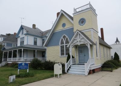
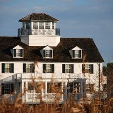
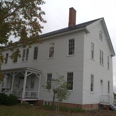
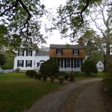
Cape Charles Historic District is a downtown area with many historic buildings arranged in a grid pattern around a central park. The residential and commercial structures from different eras shape the streetscape with their varied architectural forms.

The district began in 1883 as the southern end of a railroad line. The area grew steadily for several decades as an important hub before its development slowed in the mid-1900s.

The buildings show a variety of styles that visitors can experience today, from the ornate Victorian details to the straightforward Craftsman forms. Walking through the streets, you notice how these different approaches to building sit side by side and shape how the place looks.

The district is easy to walk around since the streets follow a grid pattern that is simple to navigate. You have free access to public pathways and can view the building exteriors from the street.

The area was frozen in time during the 1950s when ferry services stopped operating and the city stopped expanding. This accidental preservation means many of the original buildings and streets remain largely unchanged from their early 1900s appearance.

Location: Cape Charles

GPS coordinates: 37.26972,-76.01639

Latest update: December 14, 2025 14:22

Photos
Around this place
Chesapeake Bay Bridge-Tunnel
United States of America

Chesapeake Bay Bridge-Tunnel

27.3 km
Kiptopeke State Park
United States of America

Kiptopeke State Park

11.6 km
Wolf Trap Light
United States of America

Wolf Trap Light

20.4 km
Eyre Hall
United States of America

Eyre Hall

5.8 km
Plum Tree Island National Wildlife Refuge
United States of America

Plum Tree Island National Wildlife Refuge

31.1 km
New Point Comfort Light
United States of America

New Point Comfort Light

23.4 km
Cape Charles Light
United States of America

Cape Charles Light

19 km
Eastern Shore of Virginia National Wildlife Refuge
United States of America

Eastern Shore of Virginia National Wildlife Refuge

16.5 km
Coast Guard Station Cobb Island
United States of America

Coast Guard Station Cobb Island

8.6 km
Savage Neck Dunes Natural Area Preserve
United States of America

Savage Neck Dunes Natural Area Preserve

6.3 km
Bethel Beach Natural Area Preserve
United States of America

Bethel Beach Natural Area Preserve

26 km
Hog Island Light
United States of America

Hog Island Light

31.2 km
Back River Light
United States of America

Back River Light

30.3 km
Almshouse Farm at Machipongo
United States of America

Almshouse Farm at Machipongo

17.9 km
Old Plantation Flats Light
United States of America

Old Plantation Flats Light

5.3 km
York Spit Light
United States of America

York Spit Light

22.1 km
Vaucluse
United States of America

Vaucluse

18 km
Pear Valley
United States of America

Pear Valley

16.3 km
Poplar Grove Mill and House
United States of America

Poplar Grove Mill and House

31.4 km
Cherrystone Bar Light
United States of America

Cherrystone Bar Light

2.1 km
Northampton County Courthouse Historical District
United States of America

Northampton County Courthouse Historical District

11.1 km
Brownsville
United States of America

Brownsville

27.7 km
Winona
United States of America

Winona

20.8 km
Billups House
United States of America

Billups House

30.6 km
Eastville Historical District
United States of America

Eastville Historical District

11.1 km
Northampton Lumber Company Historic District
United States of America

Northampton Lumber Company Historic District

26.6 km
Springdale
United States of America

Springdale

32.4 km
Fisherman Island National Wildlife Refuge
United States of America

Fisherman Island National Wildlife Refuge

20.1 km
Show the full map
Reviews

Visited this place? Tap the stars to rate it and share your experience / photos with the community! Try now! You can cancel it anytime.

« Cape Charles Historic District - Historic district in Cape Charles, US » is provided by Around Us (aroundus.com). Images and texts are derived from Wikimedia project under a Creative Commons license. You are allowed to copy, distribute, and modify copies of this page, under the conditions set by the license, as long as this note is clearly visible.

Discover hidden gems everywhere you go!

From secret cafés to breathtaking viewpoints, skip the crowded tourist spots and find places that match your style. Our app makes it easy with voice search, smart filtering, route optimization, and insider tips from travelers worldwide. Download now for the complete mobile experience.

Around Us App Screenshot

A unique approach to discovering new places

Le Figaro

All the places worth exploring

France Info

A tailor-made excursion in just a few clicks

20 Minutes