Enable Location

We need your location to show you interesting places around you

Discover nearby places

Find interesting locations and hidden gems around you

Precise directions

Get accurate directions and distances to places

Your location is never shared with other users. It's only used when you tap the location button.

Kiptopeke State Park

Log in to your account

Start exploring — it's free

Trusted by 62,417 travelers worldwide

Continue with Google
Continue with Apple
or

We will send you a code to connect

By continuing, you accept our Terms and Conditions and our Privacy Policy

Check your inbox

We've sent a pincode in your inbox. Please enter the code below.

Kiptopeke State Park

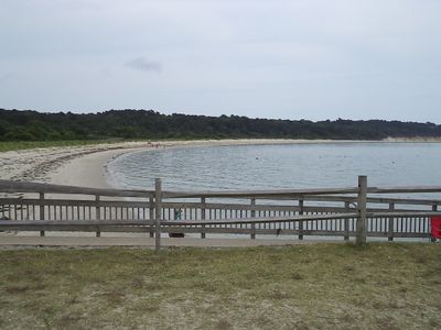
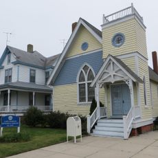
Kiptopeke State Park, State park in Cape Charles, Virginia, US

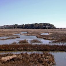
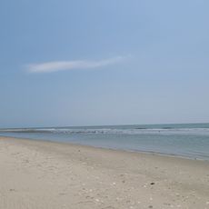
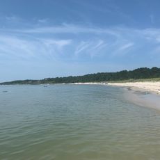
Kiptopeke State Park is a coastal park spanning roughly 560 acres along the Chesapeake Bay, offering hiking trails through forested areas, sandy beaches, and multiple fishing piers. The grounds include overnight stays from tent sites to lodges, boat ramps, picnic grounds, and designated swimming areas.

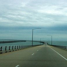
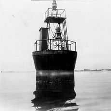
From 1949 to 1964, this location served as a ferry terminal that crossed the Chesapeake Bay, serving as a key transportation hub for the region. This use shaped the site's development before it became a recreational area.

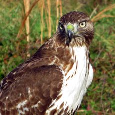
The hawk watch platform here draws bird watchers from across the region during migration seasons. Thousands of raptors pass through each year, making this a focal point for those interested in observing avian life.

The park is easy to navigate with distinct areas for different activities, so it helps to explore desired zones in advance or check with staff about current conditions. Early arrival and flexible timing work best for bird watching and water activities.

Several concrete ships from World War II rest submerged offshore, forming artificial reefs that provide nesting sites for seabirds and habitat for marine life. These unexpected underwater structures have evolved into a functioning ecosystem over the decades.

The community of curious travelers

AroundUs brings together thousands of curated places, local tips, and hidden gems, enriched daily by 60,000 contributors worldwide.

Start exploring
Location
Inception
1992
GPS coordinates
37.16940,-75.97940
Latest update
December 8, 2025 13:41
Around this place
Chesapeake Bay Bridge-Tunnel
United States of America

Chesapeake Bay Bridge-Tunnel

18.1 km
First Landing State Park
United States of America

First Landing State Park

29.5 km
Custis Tombs
United States of America

Custis Tombs

7 km
Eyre Hall
United States of America

Eyre Hall

15.6 km
Thimble Shoal Light
United States of America

Thimble Shoal Light

28.9 km
Cape Henry Memorial
United States of America

Cape Henry Memorial

27 km
New Point Comfort Light
United States of America

New Point Comfort Light

30.2 km
Cape Charles Light
United States of America

Cape Charles Light

8.3 km
Eastern Shore of Virginia National Wildlife Refuge
United States of America

Eastern Shore of Virginia National Wildlife Refuge

4.8 km
Coast Guard Station Cobb Island
United States of America

Coast Guard Station Cobb Island

14.4 km
Savage Neck Dunes Natural Area Preserve
United States of America

Savage Neck Dunes Natural Area Preserve

17.7 km
Back River Light
United States of America

Back River Light

27.4 km
Almshouse Farm at Machipongo
United States of America

Almshouse Farm at Machipongo

26.9 km
Old Plantation Flats Light
United States of America

Old Plantation Flats Light

8.9 km
Cape Charles Historic District
United States of America

Cape Charles Historic District

11.6 km
York Spit Light
United States of America

York Spit Light

24.8 km
Vaucluse
United States of America

Vaucluse

28.8 km
Pear Valley
United States of America

Pear Valley

25.8 km
Cherrystone Bar Light
United States of America

Cherrystone Bar Light

10.8 km
Northampton County Courthouse Historical District
United States of America

Northampton County Courthouse Historical District

20.6 km
Eastville Historical District
United States of America

Eastville Historical District

20.6 km
Fisherman Island National Wildlife Refuge
United States of America

Fisherman Island National Wildlife Refuge

8.5 km
Cape Henry Light
United States of America

Cape Henry Light

27.2 km
Smith Beach
United States of America

Smith Beach

21.6 km
Smith Island Beach
United States of America

Smith Island Beach

9.7 km
Hungars Beach
United States of America

Hungars Beach

23.6 km
Old Cape Henry Lighthouse
United States of America

Old Cape Henry Lighthouse

27.2 km
Salt Ponds Beach
United States of America

Salt Ponds Beach

29.5 km
Show the full map
« Kiptopeke State Park - State park in Cape Charles, Virginia, US » is provided by Around Us (aroundus.com). Images and texts are derived from Wikimedia project under a Creative Commons license. You are allowed to copy, distribute, and modify copies of this page, under the conditions set by the license, as long as this note is clearly visible.

Discover hidden gems everywhere you go!

From secret cafés to breathtaking viewpoints, skip the crowded tourist spots and find places that match your style. Our app makes it easy with voice search, smart filtering, route optimization, and insider tips from travelers worldwide. Download now for the complete mobile experience.

Around Us App Screenshot

A unique approach to discovering new places

Le Figaro

All the places worth exploring

France Info

A tailor-made excursion in just a few clicks

20 Minutes

Around Us
Travel Guide & Maps
Download

Send to your phone

QR Code
1

Open the camera app on your mobile.

2

Point at the QR code with your camera. A notification will appear.

3

Tap the notification to open the link.