Enable Location

We need your location to show you interesting places around you

Discover nearby places

Find interesting locations and hidden gems around you

Precise directions

Get accurate directions and distances to places

Your location is never shared with other users. It's only used when you tap the location button.

Monticello

Log in to your account

Start exploring — it's free

Trusted by 60,649 travelers worldwide

Continue with Google
Continue with Apple
or

We will send you a code to connect

By continuing, you accept our Terms and Conditions and our Privacy Policy

Check your inbox

We've sent a pincode in your inbox. Please enter the code below.

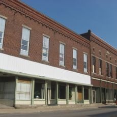
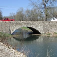
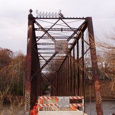
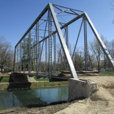
Monticello, County seat in north-central Indiana, United States

Description

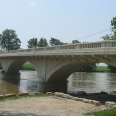
Monticello is the county seat of White County in north-central Indiana. The city features different residential neighborhoods connected by local streets and main roads that form the town's structure.

History

The city was established in 1834 and named after Thomas Jefferson's Virginia estate. This marked the beginning of its role as the administrative center for the county.

Culture

The Twin Lakes School Corporation maintains several educational institutions throughout Monticello, including Eastlawn, Oaklawn, Meadowlawn, and Roosevelt Middle School point.

Practical

Visitors can locate City Hall on North Main Street for information about public services and municipal operations. It serves as a helpful starting point for understanding how the city is organized.

Did you know?

A major tornado struck the city in April 1974, causing significant damage that left a lasting mark on the community. This event remains an important part of the city's story and character.

Location
Inception
1834
Elevation above the sea
207 m
GPS coordinates
40.74670,-86.76530
Latest update
December 7, 2025 10:07

AroundUs brings together thousands of curated places, local tips, and hidden gems, enriched daily by 60,000 contributors worldwide. Discover all places nearby (White County).

Around this place
United States of America

Indiana Beach

4.8 km
United States of America

Wabash and Erie Canal

18.7 km
Steel Hawg
United States of America

Steel Hawg

5 km
Lost Coaster of Superstition Mountain
United States of America

Lost Coaster of Superstition Mountain

4.7 km
Cornball Express
United States of America

Cornball Express

4.8 km
Hoosier Hurricane
United States of America

Hoosier Hurricane

4.9 km
Tig'rr Coaster
United States of America

Tig'rr Coaster

4.9 km
Carroll County Courthouse
United States of America

Carroll County Courthouse

19.4 km
Soldiers and Sailors Monument
United States of America

Soldiers and Sailors Monument

19.4 km
Carrollton Bridge
United States of America

Carrollton Bridge

14.3 km
James Culbertson Reynolds House
United States of America

James Culbertson Reynolds House

429 m
The Whistle Stop / Monon Connection Museum
United States of America

The Whistle Stop / Monon Connection Museum

19.5 km
Murphy Memorial Drinking Fountain
United States of America

Murphy Memorial Drinking Fountain

19.5 km
Pulaski County Bridge No. 31
United States of America

Pulaski County Bridge No. 31

19.5 km
Delphi Courthouse Square Historic District
United States of America

Delphi Courthouse Square Historic District

19.4 km
Monticello Carnegie Library
United States of America

Monticello Carnegie Library

477 m
White County Asylum
United States of America

White County Asylum

4.1 km
Barnett-Seawright-Wilson House
United States of America

Barnett-Seawright-Wilson House

19.3 km
South Grade School Building
United States of America

South Grade School Building

1 km
Delphi Methodist Episcopal Church
United States of America

Delphi Methodist Episcopal Church

19.3 km
Monon Commercial Historic District
United States of America

Monon Commercial Historic District

15.9 km
Wabash and Erie Canal Culvert No. 100
United States of America

Wabash and Erie Canal Culvert No. 100

17.4 km
Burnett's Creek Arch
United States of America

Burnett's Creek Arch

17.3 km
O'Connor Bridge
United States of America

O'Connor Bridge

18.6 km
Little Monon Creek Bridge
United States of America

Little Monon Creek Bridge

13.2 km
Tioga Road Bridge
United States of America

Tioga Road Bridge

1.9 km
Gray Bridge
United States of America

Gray Bridge

18.7 km
Lake Freeman
United States of America

Lake Freeman

6 km
Show the full map
« Monticello - County seat in north-central Indiana, United States » is provided by Around Us (aroundus.com). Images and texts are derived from Wikimedia project under a Creative Commons license. You are allowed to copy, distribute, and modify copies of this page, under the conditions set by the license, as long as this note is clearly visible.

Discover hidden gems everywhere you go!

From secret cafés to breathtaking viewpoints, skip the crowded tourist spots and find places that match your style. Our app makes it easy with voice search, smart filtering, route optimization, and insider tips from travelers worldwide. Download now for the complete mobile experience.

Around Us App Screenshot

A unique approach to discovering new places

Le Figaro

All the places worth exploring

France Info

A tailor-made excursion in just a few clicks

20 Minutes

Around Us
Travel Guide & Maps
Download

Send to your phone

QR Code
1

Open the camera app on your mobile.

2

Point at the QR code with your camera. A notification will appear.

3

Tap the notification to open the link.