Chest opened
+${chestReward.xp} XP
Explorer
NOUVEAU ×${chestReward.collectible.quantity}
tapez pour fermer
Chest locked

Open chests in the app

Around Us is built for your phone — chests unlock when you walk, explore and capture nearby places.

Enable Location

We need your location to show you interesting places around you

Discover nearby places

Find interesting locations and hidden gems around you

Precise directions

Get accurate directions and distances to places

Your location is never shared with other users. It's only used when you tap the location button.

Marion

Log in to your account

Start exploring — it's free

Trusted by 72,881 travelers worldwide

Continue with Google
Continue with Apple
or

We will send you a code to connect

By continuing, you accept our Terms and Conditions and our Privacy Policy

Check your inbox

We've sent a pincode in your inbox. Please enter the code below.

Discussion Reviews 1 Photos
17.7k Popularity

Marion, town in Plymouth County, Massachusetts, United States

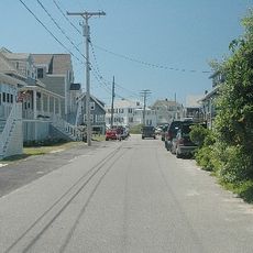
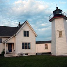
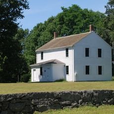
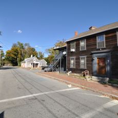
Marion is a small town in Plymouth County situated on the coast along Buzzards Bay in Massachusetts. The center features quiet streets lined with Cape Cod-style homes that slope toward the harbor, where sailboats remain year-round and create a forest of masts during warmer months.

Settlement began in 1679 under the name Sippican, taken from the local Wampanoag people. The town was formally incorporated and renamed Marion in 1852 to honor a hero of the American Revolution.

The name Marion honors Francis Marion, a hero from the American Revolution. The town's identity is rooted in its seafaring heritage, visible in the Cape Cod-style homes and the active harbor filled with sailboats throughout the year.

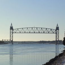
Access is straightforward with roads connecting to nearby highways and parking available near beaches and the harbor. The town has no train station, but nearby buses and airports serve the area, while the harbor provides water access for boat trips.

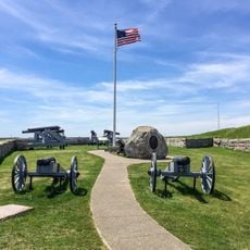
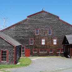
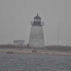
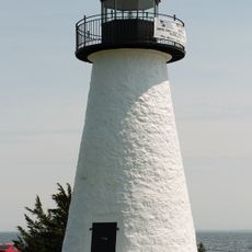
The town was historically known for its shipbuilders and sea captains who embarked on voyages and returned with stories from around the world. Small museums and plaques throughout the area tell these maritime tales from an era when the harbor was a center of seafaring activity.

The community of curious travelers

AroundUs brings together thousands of curated places, local tips, and hidden gems, enriched daily by 60,000 contributors worldwide.

Start exploring
Location
Inception
1679
Elevation above the sea
6 m
GPS coordinates
41.70000,-70.76333
Latest update
February 17, 2026 00:20
Around this place
Cape Cod Canal Railroad Bridge
United States of America

Cape Cod Canal Railroad Bridge

13.3 km
Fort Phoenix State Reservation
United States of America

Fort Phoenix State Reservation

14 km
New Silver Beach
United States of America

New Silver Beach

12.2 km
Cleveland East Ledge Light
United States of America

Cleveland East Ledge Light

9.6 km
East Over Reservation
United States of America

East Over Reservation

6.4 km
Millicent Library
United States of America

Millicent Library

13.7 km
United States of America

Tremont Nail Company

8.1 km
Clem Spillane Field
United States of America

Clem Spillane Field

7.3 km
Wing's Neck Light
United States of America

Wing's Neck Light

8.8 km
Tremont Nail Factory District
United States of America

Tremont Nail Factory District

8.1 km
Bird Island Light
United States of America

Bird Island Light

5.1 km
North Falmouth Village Historic District
United States of America

North Falmouth Village Historic District

13.5 km
Fairhaven Town Hall
United States of America

Fairhaven Town Hall

13.7 km
Riverside Cemetery
United States of America

Riverside Cemetery

13.5 km
Manomet Mills
United States of America

Manomet Mills

13.5 km
Whitman Mills
United States of America

Whitman Mills

13.6 km
Gypsy
United States of America

Gypsy

9.4 km
Third Meetinghouse
United States of America

Third Meetinghouse

6.4 km
H. R. Reed House
United States of America

H. R. Reed House

557 m
Elnathan Nye House
United States of America

Elnathan Nye House

13.9 km
Long Plain Friends Meetinghouse
United States of America

Long Plain Friends Meetinghouse

12.7 km
Tobey Homestead
United States of America

Tobey Homestead

7.5 km
Head of the River Historic District
United States of America

Head of the River Historic District

13.1 km
Long Plain School
United States of America

Long Plain School

11.9 km
Cataumet Schoolhouse
United States of America

Cataumet Schoolhouse

13.3 km
East Rochester Church and Cemetery Historic District
United States of America

East Rochester Church and Cemetery Historic District

9.5 km
Ezekiel Sawin House
United States of America

Ezekiel Sawin House

13.7 km
Ned Point Light
United States of America

Ned Point Light

6.1 km
Show the full map
Reviews
Share your experience

No review yet

Discussions
Start a discussion...

No discussion yet

« Marion - town in Plymouth County, Massachusetts, United States » is provided by Around Us (aroundus.com). Images and texts are derived from Wikimedia project under a Creative Commons license. You are allowed to copy, distribute, and modify copies of this page, under the conditions set by the license, as long as this note is clearly visible.

Discover hidden gems everywhere you go!

From secret cafés to breathtaking viewpoints, skip the crowded tourist spots and find places that match your style. Our app makes it easy with voice search, smart filtering, route optimization, and insider tips from travelers worldwide. Download now for the complete mobile experience.

Around Us App Screenshot

A unique approach to discovering new places

Le Figaro

All the places worth exploring

France Info

A tailor-made excursion in just a few clicks

20 Minutes

Around Us
Travel Guide & Maps
Download

Send to your phone

QR Code
1

Open the camera app on your mobile.

2

Point at the QR code with your camera. A notification will appear.

3

Tap the notification to open the link.