Enable Location

We need your location to show you interesting places around you

Discover nearby places

Find interesting locations and hidden gems around you

Precise directions

Get accurate directions and distances to places

Your location is never shared with other users. It's only used when you tap the location button.

Ware

Log in to your account

Start exploring — it's free

Trusted by 63,142 travelers worldwide

Continue with Google
Continue with Apple
or

We will send you a code to connect

By continuing, you accept our Terms and Conditions and our Privacy Policy

Check your inbox

We've sent a pincode in your inbox. Please enter the code below.

Discussion Reviews 1 Photos
19.9k Popularity

Ware, town in Hampshire County, Massachusetts, United States

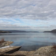
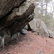
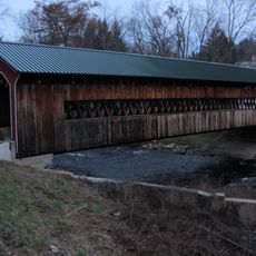
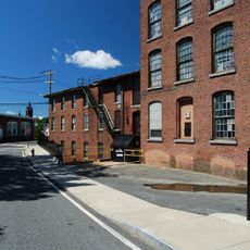
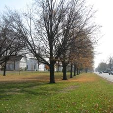
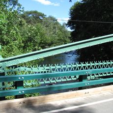
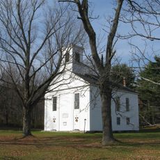
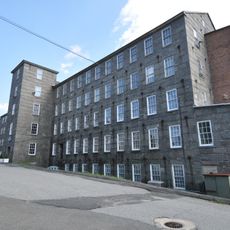
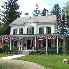
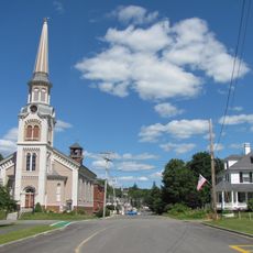
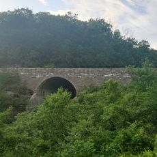
Ware is a small town in Hampshire County, Massachusetts, situated in a valley surrounded by forests and rivers. The town is home to about 10,000 residents and spreads across gentle hills featuring historic mill buildings along the Ware River and Swift River.

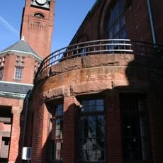
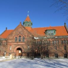
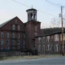
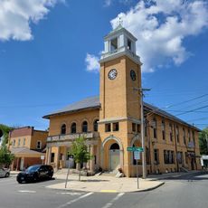
Ware was founded in 1717 and began as a farming settlement before developing into a mill and textile center. The Otis Company became its largest employer in the 1800s, making the town known for producing cotton products like denim and canvas.

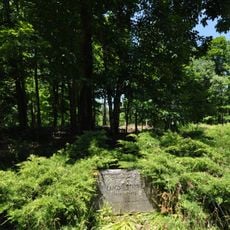
The name Ware comes from the fish traps, or weirs, that the Nipmuc people built along the Ware River centuries ago. Today residents walk through town and along the rivers, connected to the memory of the mills that once defined daily life.

Ware is accessible via Route 9 or Route 32, and sits near exit 63 of the Massachusetts Turnpike for easy arrival. The town lacks public transit within its borders, so having a car helps you move around freely and reach nearby attractions.

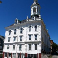
The Otis Company was once the town's major employer, earning it the nickname "The Town That Can't Be Licked" for bouncing back from hard times. In the 1930s, Ware gained additional land when nearby towns like Enfield and Greenwich were flooded to create the Quabbin Reservoir.

The community of curious travelers

AroundUs brings together thousands of curated places, local tips, and hidden gems, enriched daily by 60,000 contributors worldwide.

Start exploring
Location
Inception
1717
Elevation above the sea
145 m
GPS coordinates
42.25972,-72.24028
Latest update
February 16, 2026 22:20
Around this place
Quabbin Reservoir
United States of America

Quabbin Reservoir

12.1 km
Rock House Reservation
United States of America

Rock House Reservation

3.7 km
Ware–Hardwick Covered Bridge
United States of America

Ware–Hardwick Covered Bridge

6.1 km
Chicopee Valley Aqueduct
United States of America

Chicopee Valley Aqueduct

8.9 km
Lucy Stone Home Site
United States of America

Lucy Stone Home Site

4 km
John Payson Williston Observatory
United States of America

John Payson Williston Observatory

1.4 km
Ware Town Hall
United States of America

Ware Town Hall

231 m
Clapp Memorial Library
United States of America

Clapp Memorial Library

13.3 km
Warren Public Library
United States of America

Warren Public Library

6.5 km
Gilbertville Historic District
United States of America

Gilbertville Historic District

5.8 km
Ware Millyard Historic District
United States of America

Ware Millyard Historic District

193 m
Brookfield Cemetery
United States of America

Brookfield Cemetery

11.5 km
Palmer Memorial Hall
United States of America

Palmer Memorial Hall

13.6 km
Belchertown Center Historic District
United States of America

Belchertown Center Historic District

13.4 km
Warren First Congregational Church – Federated Church
United States of America

Warren First Congregational Church – Federated Church

6.5 km
Crossman Bridge
United States of America

Crossman Bridge

5.5 km
Warren Town Hall
United States of America

Warren Town Hall

6.4 km
Ware Center Historic District
United States of America

Ware Center Historic District

3.1 km
Otis Company Mill No. 1
United States of America

Otis Company Mill No. 1

168 m
North Brookfield Town House
United States of America

North Brookfield Town House

12.8 km
Jedediah Foster Homesite
United States of America

Jedediah Foster Homesite

9.7 km
United States Post Office–Palmer Main
United States of America

United States Post Office–Palmer Main

13.4 km
Elm Hill Farm Historic District
United States of America

Elm Hill Farm Historic District

13.4 km
Brookfield Common Historic District
United States of America

Brookfield Common Historic District

12.4 km
Wickaboag Valley Historic District
United States of America

Wickaboag Valley Historic District

6.7 km
West Brookfield Center Historic District
United States of America

West Brookfield Center Historic District

8.6 km
Hardwick Village Historic District
United States of America

Hardwick Village Historic District

10.5 km
Winsor Dam Bridge
United States of America

Winsor Dam Bridge

8.6 km
Show the full map
Reviews
Share your experience

No review yet

Discussions
Start a discussion...

No discussion yet

« Ware - town in Hampshire County, Massachusetts, United States » is provided by Around Us (aroundus.com). Images and texts are derived from Wikimedia project under a Creative Commons license. You are allowed to copy, distribute, and modify copies of this page, under the conditions set by the license, as long as this note is clearly visible.

Discover hidden gems everywhere you go!

From secret cafés to breathtaking viewpoints, skip the crowded tourist spots and find places that match your style. Our app makes it easy with voice search, smart filtering, route optimization, and insider tips from travelers worldwide. Download now for the complete mobile experience.

Around Us App Screenshot

A unique approach to discovering new places

Le Figaro

All the places worth exploring

France Info

A tailor-made excursion in just a few clicks

20 Minutes

Around Us
Travel Guide & Maps
Download

Send to your phone

QR Code
1

Open the camera app on your mobile.

2

Point at the QR code with your camera. A notification will appear.

3

Tap the notification to open the link.