Enable Location

We need your location to show you interesting places around you

Discover nearby places

Find interesting locations and hidden gems around you

Precise directions

Get accurate directions and distances to places

Your location is never shared with other users. It's only used when you tap the location button.

Toa Alta

Log in to your account

Start exploring — it's free

Trusted by 61,921 travelers worldwide

Continue with Google
Continue with Apple
or

We will send you a code to connect

By continuing, you accept our Terms and Conditions and our Privacy Policy

Check your inbox

We've sent a pincode in your inbox. Please enter the code below.

Toa Alta, Administrative district in San Juan metropolitan area, Puerto Rico

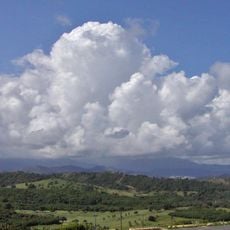
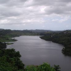
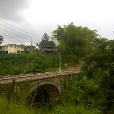
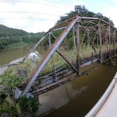
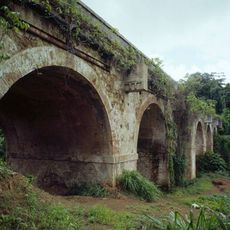
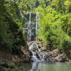
Toa Alta is an administrative municipality in the San Juan metropolitan area of Puerto Rico that spans nine barrios and a central administrative zone. The Rio de la Plata river flows through its northern section, shaping the local landscape.

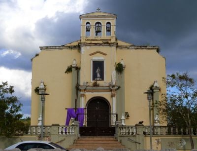
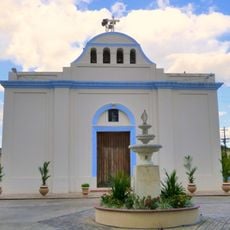
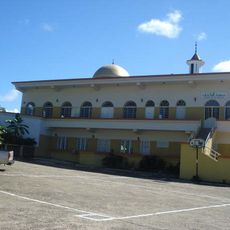
Toa Alta was founded in 1751 and ranks among Puerto Rico's earliest settlements, with the construction of San Fernando Rey Church beginning the following year. This early establishment shaped the region's development and community foundation.

The town earned the nickname 'Cradle of the Poets' for producing notable writers and artists over the centuries. Local residents take pride in this literary heritage, which remains visible in cultural events and public spaces dedicated to these figures.

The Town Hall is located at P.O. Box 82 and offers administrative support for visitors seeking services or information. For questions about local services, you can reach the municipality at +1 787-870-2100.

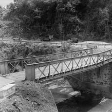
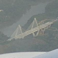
The area underwent a major flood control project completed in 2018 by the United States Army Corps of Engineers. This work addressed overflow issues from the Rio de la Plata and significantly altered the region's water management landscape.

The community of curious travelers

AroundUs brings together thousands of curated places, local tips, and hidden gems, enriched daily by 60,000 contributors worldwide.

Start exploring
GPS coordinates
18.38871,-66.24797
Latest update
December 7, 2025 20:45
Around this place
El Yunque National Forest
United States of America

El Yunque National Forest

49.7 km
La Fortaleza
United States of America

La Fortaleza

20.2 km
Caparra Ruins
United States of America

Caparra Ruins

14.3 km
Paseo del Morro
United States of America

Paseo del Morro

15.9 km
La Fortaleza and San Juan National Historic Site
United States of America

La Fortaleza and San Juan National Historic Site

16 km
Puerto Rico National Cemetery
United States of America

Puerto Rico National Cemetery

9 km
Paseo de la Princesa
United States of America

Paseo de la Princesa

16 km
El Cañuelo
United States of America

El Cañuelo

14.6 km
United States of America

San Patricio State Forest

16.5 km
La Plata Lake
United States of America

La Plata Lake

7.3 km
Bayamón Soccer Complex
United States of America

Bayamón Soccer Complex

9 km
Mavilla Bridge
United States of America

Mavilla Bridge

6.6 km
Old Plata Bridge
United States of America

Old Plata Bridge

10 km
Inmaculada Concepción Church
United States of America

Inmaculada Concepción Church

9.1 km
General Norzagaray Bridge
United States of America

General Norzagaray Bridge

17 km
Vega State Forest
United States of America

Vega State Forest

11.2 km
Museum of Transportation of Puerto Rico
United States of America

Museum of Transportation of Puerto Rico

14.4 km
Dr. Agustín Stahl Stamm House
United States of America

Dr. Agustín Stahl Stamm House

9.9 km
Bayamón City Hall
United States of America

Bayamón City Hall

9.8 km
Casa Alonso
United States of America

Casa Alonso

15.8 km
José Celso Barbosa House Museum
United States of America

José Celso Barbosa House Museum

9.9 km
Río Hondo Bridge
United States of America

Río Hondo Bridge

20 km
Al-Faruq Mosque
United States of America

Al-Faruq Mosque

11.3 km
Cascada Charco Prieto
Puerto Rico

Cascada Charco Prieto

13.5 km
Polvorín de Santa Elena (San Juan)
United States of America

Polvorín de Santa Elena (San Juan)

15.9 km
Jesús Izcoa Moure Bridge
United States of America

Jesús Izcoa Moure Bridge

8.3 km
Raíces Fountain
United States of America

Raíces Fountain

16 km
Place des Halles
United States of America

Place des Halles

17.7 km
Show the full map
« Toa Alta - Administrative district in San Juan metropolitan area, Puerto Rico » is provided by Around Us (aroundus.com). Images and texts are derived from Wikimedia project under a Creative Commons license. You are allowed to copy, distribute, and modify copies of this page, under the conditions set by the license, as long as this note is clearly visible.

Discover hidden gems everywhere you go!

From secret cafés to breathtaking viewpoints, skip the crowded tourist spots and find places that match your style. Our app makes it easy with voice search, smart filtering, route optimization, and insider tips from travelers worldwide. Download now for the complete mobile experience.

Around Us App Screenshot

A unique approach to discovering new places

Le Figaro

All the places worth exploring

France Info

A tailor-made excursion in just a few clicks

20 Minutes

Around Us
Travel Guide & Maps
Download

Send to your phone

QR Code
1

Open the camera app on your mobile.

2

Point at the QR code with your camera. A notification will appear.

3

Tap the notification to open the link.