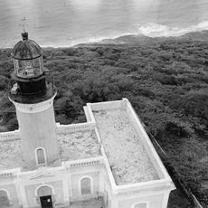
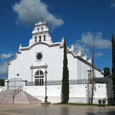
Santa Isabel, municipality in Puerto Rico
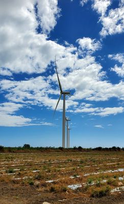
Santa Isabel is a municipality on the southern coast of Puerto Rico that hosts a major wind energy facility. The installation uses modern turbines to generate electricity while operating on agricultural land that continues to support farming nearby.
The wind energy facility was completed in 2012, marking a turning point for power generation on the island. This project launched Puerto Rico's transition toward renewable energy sources at an industrial scale.
The facility sits in a rural area and is visible from nearby public roads. Visitors can view the turbines from a distance, but should know this is an active industrial site that the public cannot enter.
The turbines operate with focus on peak electricity demand hours, providing steady power throughout the day. This strategic placement takes advantage of the local wind patterns that make the location ideal for consistent energy capture.
Location: Puerto Rico
Inception: October 5, 1842
Elevation above the sea: 8 m
Shares border with: Salinas, Coamo, Juana Díaz
Address: XJM2+XJV, Santa Isabel 00757, Puerto Rico
Opening Hours: Monday-Friday 07:00-16:00
Phone: +17879710030
Website: http://patternenergy.com
GPS coordinates: 17.96611,-66.40500
Latest update: December 6, 2025 16:03
Parque de la Ceiba
21.8 km
Letras de Ponce
18.7 km
Monumento al Jíbaro Puertorriqueño
23.1 km
Central Aguirre Historic District
19.1 km
Ponce Municipal Library
21.6 km
Puente de Los Leones
22.1 km
Casa Fernando Luis Toro
22 km
Parque del Tricentenario
22.1 km
Luis A. Wito Morales Park
21.7 km
Isla Caja de Muertos Lighthouse
14.7 km
Parque Familiar Julio Enrique Monagas
20.6 km
San Ramón Nonato Church
14.4 kmCaja de Muertos Nature Reserve
14.6 km
Museo Francisco "Pancho" Coimbre
22.3 km
San Blas de Illescas Church (Coamo)
13.8 km
Parque Pedro Albizu Campos
20.6 kmCerro El Bolo
24.4 km
Planadas-Yeyesa Nature Reserve
23.8 km
Punta Petrona
3.7 km
Puente de las Calabazas
16.7 km
Puente La Milagrosa
22.1 km
Pico Pomar Residence
13.9 km
General Méndez Vigo Bridge
11.4 km
Hacienda Los Maldonado
20.3 km
Carretera Central historic district
21.3 km
Lago Toa Vaca
16.7 km
Lago Guayabal
17.7 km
Lake Cerrillos
23 kmVisited this place? Tap the stars to rate it and share your experience / photos with the community! Try now! You can cancel it anytime.
Discover hidden gems everywhere you go!
From secret cafés to breathtaking viewpoints, skip the crowded tourist spots and find places that match your style. Our app makes it easy with voice search, smart filtering, route optimization, and insider tips from travelers worldwide. Download now for the complete mobile experience.
A unique approach to discovering new places❞
— Le Figaro
All the places worth exploring❞
— France Info
A tailor-made excursion in just a few clicks❞
— 20 Minutes