Chest opened
+${chestReward.xp} XP
Explorer
NOUVEAU ×${chestReward.collectible.quantity}
tapez pour fermer
Chest locked

Open chests in the app

Around Us is built for your phone — chests unlock when you walk, explore and capture nearby places.

Enable Location

We need your location to show you interesting places around you

Discover nearby places

Find interesting locations and hidden gems around you

Precise directions

Get accurate directions and distances to places

Your location is never shared with other users. It's only used when you tap the location button.

Charlestown

Log in to your account

Start exploring — it's free

Trusted by 72,938 travelers worldwide

Continue with Google
Continue with Apple
or

We will send you a code to connect

By continuing, you accept our Terms and Conditions and our Privacy Policy

Check your inbox

We've sent a pincode in your inbox. Please enter the code below.

Discussion Reviews 1 Photos
15.4k Popularity

Charlestown, Administrative division in Indiana, United States

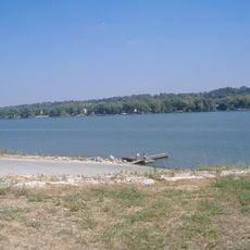
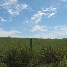
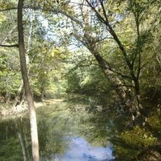
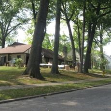
Charlestown is an administrative city in Indiana that lies along the Ohio River, with residential neighborhoods spreading through rolling hills and wooded valleys. The community covers roughly 34 square miles and features a mix of established and newer residential areas.

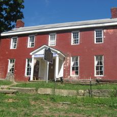
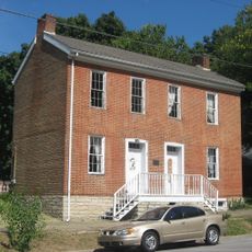
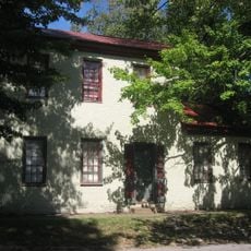
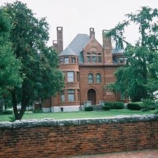
The settlement began in 1808 when families established farms near the Ohio River and was officially incorporated as a town in 1838. This founding period shaped how the community developed its early economy and land use patterns.

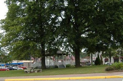
The annual Founder's Day celebration in June draws residents together for parades, live music, and traditional food events held throughout the city center. These gatherings reflect how the community honors its past and maintains local bonds.

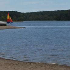
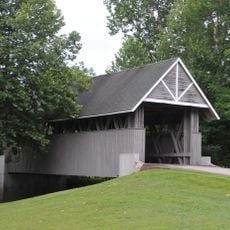
The city maintains multiple public parks, including the Family Sports Complex on Park Street with baseball fields, tennis courts, and children's playgrounds. Most facilities are easily accessible by car, and parking is generally available throughout these recreational spaces.

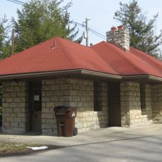
Local limestone deposits fostered a mining industry that supplied building materials for numerous structures throughout southern Indiana. This geological resource shaped the region's economic growth and left marks visible in local architecture.

The community of curious travelers

AroundUs brings together thousands of curated places, local tips, and hidden gems, enriched daily by 60,000 contributors worldwide.

Start exploring
GPS coordinates
38.45312,-85.67024
Latest update
December 7, 2025 19:30
Around this place
Rose Island
United States of America

Rose Island

5.3 km
United States of America

Indiana Army Ammunition Plant

8 km
Zachary Taylor National Cemetery
United States of America

Zachary Taylor National Cemetery

19.6 km
Louisville Water Tower
United States of America

Louisville Water Tower

19.4 km
Locust Grove
United States of America

Locust Grove

18.5 km
Zachary Taylor House
United States of America

Zachary Taylor House

19.5 km
Charlestown State Park
United States of America

Charlestown State Park

4.4 km
Lincliff
United States of America

Lincliff

17.5 km
United States of America

Jeffersonville Quartermaster Depot

19.2 km
Deam Lake State Recreation Area
United States of America

Deam Lake State Recreation Area

16.6 km
Derby Dinner Playhouse
United States of America

Derby Dinner Playhouse

20.6 km
Boxhill
United States of America

Boxhill

16.9 km
John Work House and Mill Site
United States of America

John Work House and Mill Site

5.1 km
Prather Site
United States of America

Prather Site

8.6 km
Lapping Park
United States of America

Lapping Park

15.5 km
Von Allmen Dairy Farm House
United States of America

Von Allmen Dairy Farm House

17.7 km
Patriots Peace Memorial
United States of America

Patriots Peace Memorial

18.3 km
Henry French House
United States of America

Henry French House

19.7 km
Midlands
United States of America

Midlands

17.9 km
Harrods Creek Baptist Church and Rev. William Kellar House
United States of America

Harrods Creek Baptist Church and Rev. William Kellar House

17.4 km
Thomas Downs House
United States of America

Thomas Downs House

1.3 km
Benjamin Ferguson House
United States of America

Benjamin Ferguson House

1.5 km
Watson House
United States of America

Watson House

1.2 km
Rogers Clark Ballard Memorial School
United States of America

Rogers Clark Ballard Memorial School

15.7 km
Hedden's Grove Historic District
United States of America

Hedden's Grove Historic District

20 km
Howard Steamboat Museum
United States of America

Howard Steamboat Museum

19.8 km
Wooded Glen Covered Bridge
United States of America

Wooded Glen Covered Bridge

14.6 km
Glenview Historic District
United States of America

Glenview Historic District

16.1 km
Show the full map
Reviews
Share your experience

No review yet

Discussions
Start a discussion...

No discussion yet

« Charlestown - Administrative division in Indiana, United States » is provided by Around Us (aroundus.com). Images and texts are derived from Wikimedia project under a Creative Commons license. You are allowed to copy, distribute, and modify copies of this page, under the conditions set by the license, as long as this note is clearly visible.

Discover hidden gems everywhere you go!

From secret cafés to breathtaking viewpoints, skip the crowded tourist spots and find places that match your style. Our app makes it easy with voice search, smart filtering, route optimization, and insider tips from travelers worldwide. Download now for the complete mobile experience.

Around Us App Screenshot

A unique approach to discovering new places

Le Figaro

All the places worth exploring

France Info

A tailor-made excursion in just a few clicks

20 Minutes

Around Us
Travel Guide & Maps
Download

Send to your phone

QR Code
1

Open the camera app on your mobile.

2

Point at the QR code with your camera. A notification will appear.

3

Tap the notification to open the link.