Enable Location

We need your location to show you interesting places around you

Discover nearby places

Find interesting locations and hidden gems around you

Precise directions

Get accurate directions and distances to places

Your location is never shared with other users. It's only used when you tap the location button.

Vega Alta

Log in to your account

Start exploring — it's free

Trusted by 63,226 travelers worldwide

Continue with Google
Continue with Apple
or

We will send you a code to connect

By continuing, you accept our Terms and Conditions and our Privacy Policy

Check your inbox

We've sent a pincode in your inbox. Please enter the code below.

Discussion Reviews 1 Photos
16.4k Popularity

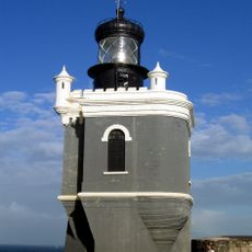
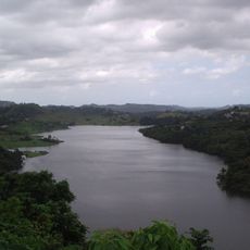
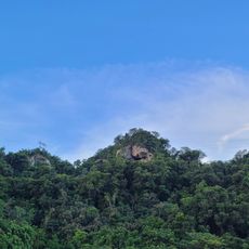
Vega Alta, Municipality on the northern coast in Puerto Rico, US.

Vega Alta is a municipality located along the Atlantic coast in northern Puerto Rico. The community is organized into several administrative barrios that together form the local jurisdiction.

Francisco de la Cruz founded the settlement in 1787, originally called La Vega de Espinosa, as part of colonial expansion in northern Puerto Rico. The town developed from this founding into the municipality it is today.

The December Fiesta Patronal de La Inmaculada Concepción de María draws residents and visitors to celebrate with traditional processions, craft displays, and regional cooking. The festivities shape community life through shared meals, music, and street celebrations.

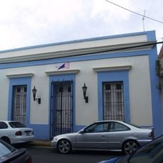
Administrative services are available at the Municipal Hall located at P.O. Box 1390, accessible by phone for information and procedures. The coastal location makes it accessible by road from other towns on the northern shore.

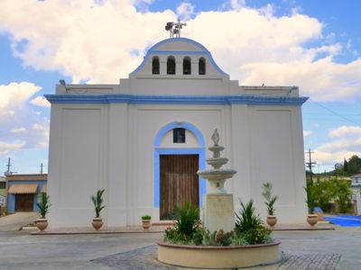
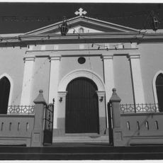
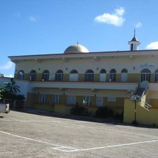
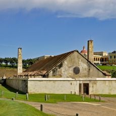
The Al-Faruq Mosque, built in 1992, is the largest Islamic place of worship on the entire island of Puerto Rico. This building stands as a notable testament to the area's religious diversity.

The community of curious travelers

AroundUs brings together thousands of curated places, local tips, and hidden gems, enriched daily by 60,000 contributors worldwide.

Start exploring
GPS coordinates
18.41199,-66.33012
Latest update
December 7, 2025 19:27
Around this place
Castillo San Felipe del Morro
United States of America

Castillo San Felipe del Morro

22.7 km
San Juan National Historic Site
United States of America

San Juan National Historic Site

22.9 km
Caparra Ruins
United States of America

Caparra Ruins

22.9 km
Casa Blanca
Puerto Rico

Casa Blanca

23 km
Paseo del Morro
United States of America

Paseo del Morro

22.8 km
Puerto Rico National Cemetery
United States of America

Puerto Rico National Cemetery

17.3 km
El Cañuelo
United States of America

El Cañuelo

21.3 km
El Morro or Port San Juan Light
United States of America

El Morro or Port San Juan Light

22.8 km
United States of America

Mar Bella Beach

11.4 km
La Plata Lake
United States of America

La Plata Lake

14.2 km
Nuestra Señora de la Candelaria y San Matías Church
United States of America

Nuestra Señora de la Candelaria y San Matías Church

17.3 km
Bayamón Soccer Complex
United States of America

Bayamón Soccer Complex

18 km
Mavilla Bridge
United States of America

Mavilla Bridge

7.5 km
Old Plata Bridge
United States of America

Old Plata Bridge

17.3 km
Inmaculada Concepción Church
United States of America

Inmaculada Concepción Church

212 m
Manatí Bridge at Mata de Plátano
United States of America

Manatí Bridge at Mata de Plátano

16.7 km
Vega State Forest
United States of America

Vega State Forest

2.2 km
Dr. Agustín Stahl Stamm House
United States of America

Dr. Agustín Stahl Stamm House

18.5 km
Bayamón City Hall
United States of America

Bayamón City Hall

18.5 km
Casa Alonso
United States of America

Casa Alonso

6.9 km
José Celso Barbosa House Museum
United States of America

José Celso Barbosa House Museum

18.6 km
Rafael Balseiro Maceira School
United States of America

Rafael Balseiro Maceira School

22.5 km
Al-Faruq Mosque
United States of America

Al-Faruq Mosque

2.9 km
Cascada Charco Prieto
Puerto Rico

Cascada Charco Prieto

21 km
Polvorín de Santa Elena (San Juan)
United States of America

Polvorín de Santa Elena (San Juan)

22.8 km
Jesús Izcoa Moure Bridge
United States of America

Jesús Izcoa Moure Bridge

16.1 km
Plaza de Ballajá
United States of America

Plaza de Ballajá

23 km
Place des Halles
United States of America

Place des Halles

8.6 km
Show the full map
Reviews
Share your experience

No review yet

Discussions
Start a discussion...

No discussion yet

« Vega Alta - Municipality on the northern coast in Puerto Rico, US » is provided by Around Us (aroundus.com). Images and texts are derived from Wikimedia project under a Creative Commons license. You are allowed to copy, distribute, and modify copies of this page, under the conditions set by the license, as long as this note is clearly visible.

Discover hidden gems everywhere you go!

From secret cafés to breathtaking viewpoints, skip the crowded tourist spots and find places that match your style. Our app makes it easy with voice search, smart filtering, route optimization, and insider tips from travelers worldwide. Download now for the complete mobile experience.

Around Us App Screenshot

A unique approach to discovering new places

Le Figaro

All the places worth exploring

France Info

A tailor-made excursion in just a few clicks

20 Minutes

Around Us
Travel Guide & Maps
Download

Send to your phone

QR Code
1

Open the camera app on your mobile.

2

Point at the QR code with your camera. A notification will appear.

3

Tap the notification to open the link.