Enable Location

We need your location to show you interesting places around you

Discover nearby places

Find interesting locations and hidden gems around you

Precise directions

Get accurate directions and distances to places

Your location is never shared with other users. It's only used when you tap the location button.

Hiwassee River

Log in to your account

Start exploring — it's free

Trusted by 65,462 travelers worldwide

Continue with Google
Continue with Apple
or

We will send you a code to connect

By continuing, you accept our Terms and Conditions and our Privacy Policy

Check your inbox

We've sent a pincode in your inbox. Please enter the code below.

Hiwassee River
Discussion Reviews 1 Photos
17.3k Popularity

Hiwassee River, Recreational river in Cherokee National Forest, Tennessee, United States

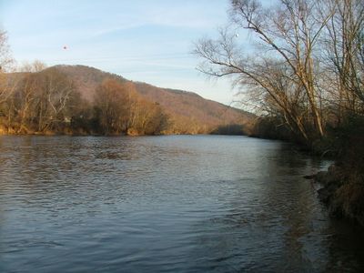
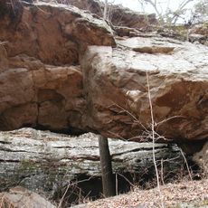
The Hiwassee River is a waterway flowing through Tennessee and adjacent mountain regions, passing through the Cherokee National Forest with diverse character throughout. Its upper sections contain rushing rapids while lower portions feature calm water, creating distinct zones for different activities.

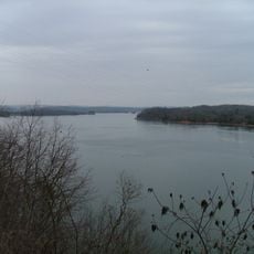
Four dams built between 1940 and 1980 by the Tennessee Valley Authority transformed the river into a regulated system for power generation. These structures changed how water flows through the valley and shaped the modern character of the waterway.

The name Hiwassee comes from the Cherokee language, meaning Ayuhwasi and showing the deep roots indigenous peoples have in this river valley. Walking along its banks, you can sense this connection through the landscape and the stories the river holds about the people who lived here long ago.

Multiple spots along the river allow you to enter for kayaking, fishing, or tubing, with different sections offering different conditions depending on water flow. Plan your visit around the type of activity you prefer, as some areas work better for certain pursuits than others.

The intensity of the rapids varies based on current water levels, meaning a visit during high flow can feel quite different from one during low flow. This variation means the same section can offer different challenges depending on when you go.

The community of curious travelers

AroundUs brings together thousands of curated places, local tips, and hidden gems, enriched daily by 60,000 contributors worldwide.

Start exploring
Location
GPS coordinates
35.41000,-85.01028
Latest update
December 7, 2025 19:25
Around this place
Watts Bar Lake
United States of America

Watts Bar Lake

31.3 km
Harrison Bay State Park
United States of America

Harrison Bay State Park

27.8 km
Rhea County Courthouse
United States of America

Rhea County Courthouse

9.5 km
Rattlesnake Springs
United States of America

Rattlesnake Springs

22.3 km
Hair Conrad Cabin
United States of America

Hair Conrad Cabin

28.9 km
United States of America

Laurel-Snow State Natural Area

13 km
Henegar House
United States of America

Henegar House

27 km
United States of America

Museum Center at Five Points

30.7 km
Broad Street United Methodist Church
United States of America

Broad Street United Methodist Church

31.2 km
Craigmiles Hall
United States of America

Craigmiles Hall

30.4 km
Centenary Avenue Historic District
United States of America

Centenary Avenue Historic District

29.7 km
Pikeville Chapel African Methodist Episcopal Zion Church
United States of America

Pikeville Chapel African Methodist Episcopal Zion Church

26.9 km
John Bridgman House
United States of America

John Bridgman House

26.5 km
Bledsoe County Courthouse
United States of America

Bledsoe County Courthouse

27.1 km
P.M. Craigmiles House
United States of America

P.M. Craigmiles House

30.7 km
Clear Springs Cumberland Presbyterian Church
United States of America

Clear Springs Cumberland Presbyterian Church

33 km
Ocoee Street Historic District
United States of America

Ocoee Street Historic District

29.6 km
Dr. James A. Ross House
United States of America

Dr. James A. Ross House

27.1 km
W.J. Hughes Business House
United States of America

W.J. Hughes Business House

30.5 km
Sequatchie County Courthouse
United States of America

Sequatchie County Courthouse

34.5 km
Broyles-Darwin House
United States of America

Broyles-Darwin House

8.4 km
Cleveland Commercial Historic District
United States of America

Cleveland Commercial Historic District

30.4 km
Dr. Walter Thomison House
United States of America

Dr. Walter Thomison House

8.5 km
Meigs County Courthouse
United States of America

Meigs County Courthouse

23.1 km
Gooch Creek Arch
United States of America

Gooch Creek Arch

15.4 km
Fillauer Brothers Building
United States of America

Fillauer Brothers Building

30.4 km
Rhea County Court House Historic landmark
United States of America

Rhea County Court House Historic landmark

9.5 km
Dobbs Ford Bridge
United States of America

Dobbs Ford Bridge

26.3 km
Show the full map
Reviews
Share your experience

No review yet

Discussions
Start a discussion...

No discussion yet

« Hiwassee River - Recreational river in Cherokee National Forest, Tennessee, United States » is provided by Around Us (aroundus.com). Images and texts are derived from Wikimedia project under a Creative Commons license. You are allowed to copy, distribute, and modify copies of this page, under the conditions set by the license, as long as this note is clearly visible.

Discover hidden gems everywhere you go!

From secret cafés to breathtaking viewpoints, skip the crowded tourist spots and find places that match your style. Our app makes it easy with voice search, smart filtering, route optimization, and insider tips from travelers worldwide. Download now for the complete mobile experience.

Around Us App Screenshot

A unique approach to discovering new places

Le Figaro

All the places worth exploring

France Info

A tailor-made excursion in just a few clicks

20 Minutes

Around Us
Travel Guide & Maps
Download

Send to your phone

QR Code
1

Open the camera app on your mobile.

2

Point at the QR code with your camera. A notification will appear.

3

Tap the notification to open the link.