Enable Location

We need your location to show you interesting places around you

Discover nearby places

Find interesting locations and hidden gems around you

Precise directions

Get accurate directions and distances to places

Your location is never shared with other users. It's only used when you tap the location button.

Log in to your account

Start exploring — it's free

Trusted by 65,245 travelers worldwide

Continue with Google
Continue with Apple
or

We will send you a code to connect

By continuing, you accept our Terms and Conditions and our Privacy Policy

Check your inbox

We've sent a pincode in your inbox. Please enter the code below.

Shackleford Banks
Discussion Reviews Photo
15.5k Popularity

Shackleford Banks, Barrier island in Carteret County, North Carolina

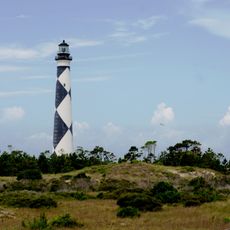
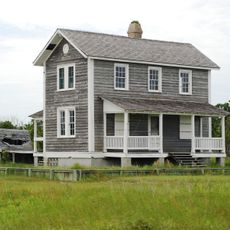
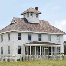
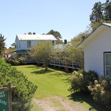
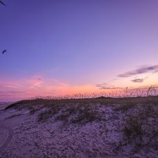
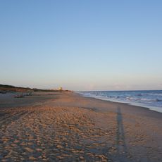
Shackleford Banks is a barrier island in Carteret County stretching approximately 9 miles with maritime forests, sandy beaches, and dunes positioned between Beaufort Inlet and Cape Lookout. This undeveloped island is accessible only by boat and has no facilities or services.

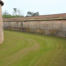
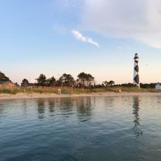
The island was named after John Shackleford, a Virginia planter who acquired land tracts in the region during 1713. A 1933 hurricane created Barden Inlet, separating this island from neighboring Core Banks.

Wild horse herds descended from Spanish Mustangs roam the island today and can be observed in their natural environment during a visit. These animals shape the landscape and represent an important part of the island's ecosystem.

Bring your own water, food, and sunscreen since there are no shops or facilities on the island. Boat access is required to reach this location, so plan accordingly and check weather and tidal conditions before visiting.

The island was physically separated from neighboring Core Banks when Barden Inlet was created by a 1933 hurricane, a geological change still visible in the coastline today. This dramatic reshaping demonstrates the enduring power of storms in this coastal region.

The community of curious travelers

AroundUs brings together thousands of curated places, local tips, and hidden gems, enriched daily by 60,000 contributors worldwide.

Start exploring
Location
GPS coordinates
34.66500,-76.58780
Latest update
December 7, 2025 19:30
Around this place
Fort Macon State Park
United States of America

Fort Macon State Park

9.9 km
Cape Lookout Lighthouse
United States of America

Cape Lookout Lighthouse

7.5 km
Cape Lookout National Seashore
United States of America

Cape Lookout National Seashore

29.1 km
North Carolina Maritime Museum
United States of America

North Carolina Maritime Museum

9.3 km
United States of America

Neusiok Trail

26.1 km
Theodore Roosevelt State Natural Area
United States of America

Theodore Roosevelt State Natural Area

22.7 km
Cape Lookout Village Historic District
United States of America

Cape Lookout Village Historic District

8 km
Old Burying Ground
United States of America

Old Burying Ground

9.2 km
Cape Lookout Coast Guard Station
United States of America

Cape Lookout Coast Guard Station

8.3 km
Professor Hacker's Lost Treasure Golf
United States of America

Professor Hacker's Lost Treasure Golf

26.8 km
Beaufort Historic District
United States of America

Beaufort Historic District

9.4 km
Morehead City Historic District
United States of America

Morehead City Historic District

13.2 km
Jacob Henry House
United States of America

Jacob Henry House

9.4 km
Gibbs House
United States of America

Gibbs House

8.5 km
Morehead City Municipal Building
United States of America

Morehead City Municipal Building

13 km
Carteret County Home
United States of America

Carteret County Home

9 km
Core Sound Waterfowl Museum
United States of America

Core Sound Waterfowl Museum

6 km
Cape Lookout Visitor's Center
United States of America

Cape Lookout Visitor's Center

6 km
Keepers' Quarters Museum
United States of America

Keepers' Quarters Museum

7.4 km
Beaufort Historic Site
United States of America

Beaufort Historic Site

9.2 km
Harkers Island Visitor Center
United States of America

Harkers Island Visitor Center

6.1 km
History Museum of Carteret County
United States of America

History Museum of Carteret County

13.4 km
Cape Lookout Lighthouse
United States of America

Cape Lookout Lighthouse

7.5 km
Fort Macon
United States of America

Fort Macon

9.2 km
Bare Sand Beach
United States of America

Bare Sand Beach

9.5 km
Indian Beach
United States of America

Indian Beach

27.9 km
Light Station Visitor Center
United States of America

Light Station Visitor Center

7.5 km
Lighthouse Area Oceanside Beach
United States of America

Lighthouse Area Oceanside Beach

7.8 km
Show the full map
Reviews
Share your experience

No review yet

Discussions
Start a discussion...

No discussion yet

« Shackleford Banks - Barrier island in Carteret County, North Carolina » is provided by Around Us (aroundus.com). Images and texts are derived from Wikimedia project under a Creative Commons license. You are allowed to copy, distribute, and modify copies of this page, under the conditions set by the license, as long as this note is clearly visible.

Discover hidden gems everywhere you go!

From secret cafés to breathtaking viewpoints, skip the crowded tourist spots and find places that match your style. Our app makes it easy with voice search, smart filtering, route optimization, and insider tips from travelers worldwide. Download now for the complete mobile experience.

Around Us App Screenshot

A unique approach to discovering new places

Le Figaro

All the places worth exploring

France Info

A tailor-made excursion in just a few clicks

20 Minutes

Around Us
Travel Guide & Maps
Download

Send to your phone

QR Code
1

Open the camera app on your mobile.

2

Point at the QR code with your camera. A notification will appear.

3

Tap the notification to open the link.