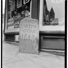
1767 Milestones, Colonial milestones near Boston, Massachusetts, US
The 1767 Milestones are granite stones placed along the Upper Boston Post Road between Boston and Springfield to show travelers the distances to their destinations. They run through several neighborhoods including Brookline, Allston, and Cambridge and remain visible at various street intersections today.
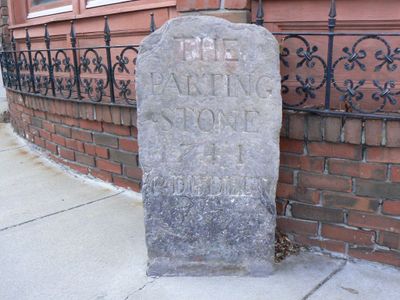
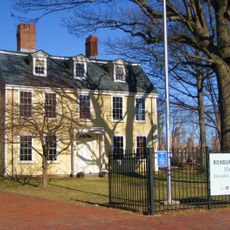
In 1767 the Province of Massachusetts Bay issued a directive to place these stones along the westbound route to improve the travel experience. Paul Dudley initiated this navigation system by setting the first marker in Roxbury.
Paul Dudley, a Massachusetts citizen, initiated this navigation system by placing the first stone in Roxbury, marking the beginning of structured road directions.
The stones are located along Washington Street, Harvard Street, and several intersections and can be explored on foot. It helps to plan your route beforehand since the markers are spread across a large area.
Many of the stones bear the initials 'PD' at their base as a mark of the system initiator. About forty of the original stones remain visible today, showing how well they have survived over the centuries.
The community of curious travelers
AroundUs brings together thousands of curated places, local tips, and hidden gems, enriched daily by 60,000 contributors worldwide.