Enable Location

We need your location to show you interesting places around you

Discover nearby places

Find interesting locations and hidden gems around you

Precise directions

Get accurate directions and distances to places

Your location is never shared with other users. It's only used when you tap the location button.

Blackburn's Ford

Log in to your account

Start exploring — it's free

Trusted by 61,527 travelers worldwide

Continue with Google
Continue with Apple
or

We will send you a code to connect

By continuing, you accept our Terms and Conditions and our Privacy Policy

Check your inbox

We've sent a pincode in your inbox. Please enter the code below.

Blackburn's Ford

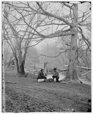
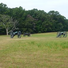
Blackburn's Ford, Civil War battlefield site near Centreville, Virginia

Description

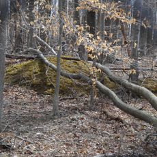
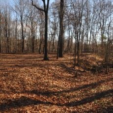
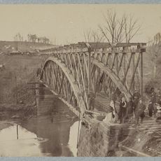
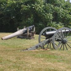
Blackburn's Ford is a Civil War battlefield located where the Bull Run Creek could be crossed, featuring preserved earthworks and defensive lines from 1861. The site displays how soldiers were positioned and how fortifications were built on both sides to protect their strategic positions.

History

This location saw one of the first major engagements of the war on July 18, 1861, when Union troops under General Daniel Tyler met Confederate soldiers commanded by James Longstreet. This clash suggested that the war would not be the brief conflict many had expected.

Culture

This ford served as a meeting point where Northern and Southern troops clashed directly, making it a pivotal location in the early stages of the conflict. The fighting here demonstrated to both sides that the war would be longer and more costly than many had anticipated.

Practical

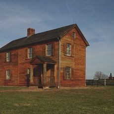
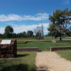
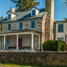
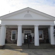
The grounds are accessible through marked trails and informational signs that describe troop movements and strategies. Visitors should expect uneven terrain and open ground, so appropriate footwear is important for comfortable exploration.

Did you know?

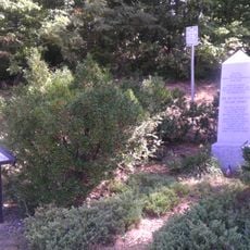
Two soldiers from the 12th New York regiment earned military honors for their exceptional courage during the intense fighting at this crossing. Their actions represent some of the earliest recognitions of valor during the war and are often overlooked by visitors.

GPS coordinates
38.80300,-77.44940
Latest update
December 14, 2025 15:01

AroundUs brings together thousands of curated places, local tips, and hidden gems, enriched daily by 60,000 contributors worldwide. Discover all places nearby (United States of America).

Around this place
Centreville High School
United States of America

Centreville High School

4.2 km
Henry House
United States of America

Henry House

6.5 km
Splash Down Waterpark
United States of America

Splash Down Waterpark

2.6 km
Fairfax County Government Center
United States of America

Fairfax County Government Center

9.8 km
Ox Hill Battlefield Park
United States of America

Ox Hill Battlefield Park

9.7 km
Hemlock Overlook Regional Park
United States of America

Hemlock Overlook Regional Park

5 km
Ellanor C. Lawrence Park
United States of America

Ellanor C. Lawrence Park

6.5 km
Stone Bridge
United States of America

Stone Bridge

5.3 km
St. Mary's Church
United States of America

St. Mary's Church

10.6 km
Robinson House
United States of America

Robinson House

6.3 km
Old Town Manassas
United States of America

Old Town Manassas

5.9 km
"A" Fort and Battery Hill Redoubt-Camp Early
United States of America

"A" Fort and Battery Hill Redoubt-Camp Early

2.4 km
Manassas Industrial School for Colored Youth
United States of America

Manassas Industrial School for Colored Youth

7.2 km
United States of America

Culpeper Basin

4.7 km
Prince William County Courthouse
United States of America

Prince William County Courthouse

5.9 km
Conner House
United States of America

Conner House

4.2 km
Cannon Branch Fort
United States of America

Cannon Branch Fort

9.5 km
Signal Hill
United States of America

Signal Hill

5.8 km
Manassas Water Tower
United States of America

Manassas Water Tower

5.9 km
Clifton Historic District
United States of America

Clifton Historic District

6.1 km
Orange and Alexandria Railroad Bridge Piers
United States of America

Orange and Alexandria Railroad Bridge Piers

3.8 km
Atoka Historic District
United States of America

Atoka Historic District

6.1 km
Mayfield Fortification
United States of America

Mayfield Fortification

5.6 km
Children's Science Center Lab
United States of America

Children's Science Center Lab

10.3 km
Henry Hill Visitor Center
United States of America

Henry Hill Visitor Center

6.4 km
Henry Hill
United States of America

Henry Hill

6.4 km
Centreville Regional Library
United States of America

Centreville Regional Library

3.9 km
Hope Park Mill and Miller's House Robey's Mill
United States of America

Hope Park Mill and Miller's House Robey's Mill

7.3 km
Show the full map
« Blackburn's Ford - Civil War battlefield site near Centreville, Virginia » is provided by Around Us (aroundus.com). Images and texts are derived from Wikimedia project under a Creative Commons license. You are allowed to copy, distribute, and modify copies of this page, under the conditions set by the license, as long as this note is clearly visible.

Discover hidden gems everywhere you go!

From secret cafés to breathtaking viewpoints, skip the crowded tourist spots and find places that match your style. Our app makes it easy with voice search, smart filtering, route optimization, and insider tips from travelers worldwide. Download now for the complete mobile experience.

Around Us App Screenshot

A unique approach to discovering new places

Le Figaro

All the places worth exploring

France Info

A tailor-made excursion in just a few clicks

20 Minutes

Around Us
Travel Guide & Maps
Download

Send to your phone

QR Code
1

Open the camera app on your mobile.

2

Point at the QR code with your camera. A notification will appear.

3

Tap the notification to open the link.