Enable Location

We need your location to show you interesting places around you

Discover nearby places

Find interesting locations and hidden gems around you

Precise directions

Get accurate directions and distances to places

Your location is never shared with other users. It's only used when you tap the location button.

Billy Goat Trail

Log in to your account

Start exploring — it's free

Trusted by 62,796 travelers worldwide

Continue with Google
Continue with Apple
or

We will send you a code to connect

By continuing, you accept our Terms and Conditions and our Privacy Policy

Check your inbox

We've sent a pincode in your inbox. Please enter the code below.

Billy Goat Trail

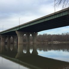
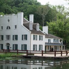
Billy Goat Trail, Hiking trail in Chesapeake and Ohio Canal National Historical Park, Maryland, US.

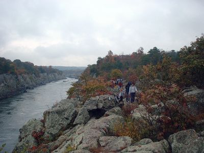
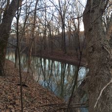
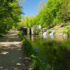
Billy Goat Trail is a hiking path in Chesapeake and Ohio Canal National Historical Park in Maryland that runs along steep rock walls for several miles. The route is divided into three sections, each with different difficulty levels and terrain types, passing through dense forest with occasional clearings.

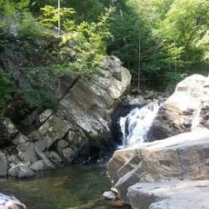
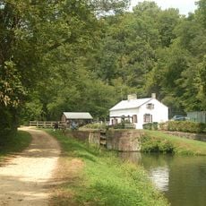
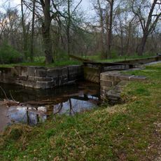
The area became accessible for recreation in the 20th century after the nearby canal lost its commercial function. The natural rock formations were created through millennia of river erosion that carved deep into the surrounding stone.

The name comes from the goats that once climbed the steep rocks and still appear in local folklore today. Hikers now follow the same narrow paths along the rock faces that offer a direct view of the rushing river water.

Section A requires experience climbing over rocks and sturdy footwear, while the other areas demand fewer technical skills. Dry weather is advisable, as wet stones become slippery and make the crossing considerably harder.

The rock blocks show clear traces of glacier movements from the last ice age that ended about ten thousand years ago. In some places you can spot fossil imprints in the stone layers that are millions of years old.

The community of curious travelers

AroundUs brings together thousands of curated places, local tips, and hidden gems, enriched daily by 60,000 contributors worldwide.

Start exploring
Location
GPS coordinates
38.99380,-77.24580
Latest update
December 20, 2025 00:11
Around this place
Congressional Country Club
United States of America

Congressional Country Club

6 km
Wolf Trap National Park for the Performing Arts
United States of America

Wolf Trap National Park for the Performing Arts

6.5 km
Great Falls
United States of America

Great Falls

749 m
Chesapeake and Ohio Canal National Historical Park
United States of America

Chesapeake and Ohio Canal National Historical Park

14.5 km
David Taylor Model Basin
United States of America

David Taylor Model Basin

5.1 km
TPC Potomac at Avenel Farm
United States of America

TPC Potomac at Avenel Farm

3.7 km
American Legion Memorial Bridge
United States of America

American Legion Memorial Bridge

6.3 km
Mather Gorge
United States of America

Mather Gorge

1.9 km
Scott's Run Nature Preserve
United States of America

Scott's Run Nature Preserve

5.4 km
Colvin Run Mill
United States of America

Colvin Run Mill

5 km
Virginia State Route 193
United States of America

Virginia State Route 193

5.8 km
United States of America

Olmsted Island

619 m
Plummers Island
United States of America

Plummers Island

6.6 km
Great Falls Tavern
United States of America

Great Falls Tavern

750 m
Swains Lock
United States of America

Swains Lock

4.2 km
William Gunnell House
United States of America

William Gunnell House

3.6 km
Carderock Springs Historic District
United States of America

Carderock Springs Historic District

6.8 km
Spring Hill Farm
United States of America

Spring Hill Farm

2.3 km
Cornwell Farm
United States of America

Cornwell Farm

2.3 km
Four Stairs
United States of America

Four Stairs

2.8 km
Great Falls Grange Hall and Forestville School
United States of America

Great Falls Grange Hall and Forestville School

3.5 km
Edward Beale House
United States of America

Edward Beale House

6.5 km
John Gunnell House
United States of America

John Gunnell House

4.5 km
Bedfordshire Park
United States of America

Bedfordshire Park

6.5 km
Filene Center
United States of America

Filene Center

6.6 km
Lock 14
United States of America

Lock 14

6.1 km
Lock 19
United States of America

Lock 19

579 m
Great Falls Community Library
United States of America

Great Falls Community Library

3.6 km
Show the full map
« Billy Goat Trail - Hiking trail in Chesapeake and Ohio Canal National Historical Park, Maryland, US » is provided by Around Us (aroundus.com). Images and texts are derived from Wikimedia project under a Creative Commons license. You are allowed to copy, distribute, and modify copies of this page, under the conditions set by the license, as long as this note is clearly visible.

Discover hidden gems everywhere you go!

From secret cafés to breathtaking viewpoints, skip the crowded tourist spots and find places that match your style. Our app makes it easy with voice search, smart filtering, route optimization, and insider tips from travelers worldwide. Download now for the complete mobile experience.

Around Us App Screenshot

A unique approach to discovering new places

Le Figaro

All the places worth exploring

France Info

A tailor-made excursion in just a few clicks

20 Minutes

Around Us
Travel Guide & Maps
Download

Send to your phone

QR Code
1

Open the camera app on your mobile.

2

Point at the QR code with your camera. A notification will appear.

3

Tap the notification to open the link.