Enable Location

We need your location to show you interesting places around you

Discover nearby places

Find interesting locations and hidden gems around you

Precise directions

Get accurate directions and distances to places

Your location is never shared with other users. It's only used when you tap the location button.

Buck's Pocket State Park

Log in to your account

Start exploring — it's free

Trusted by 61,360 travelers worldwide

Continue with Google
Continue with Apple
or

We will send you a code to connect

By continuing, you accept our Terms and Conditions and our Privacy Policy

Check your inbox

We've sent a pincode in your inbox. Please enter the code below.

Buck's Pocket State Park

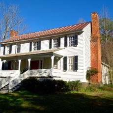
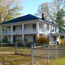
Buck's Pocket State Park, State park in Grove Oak, Alabama, United States

Description

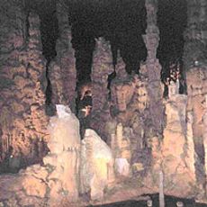
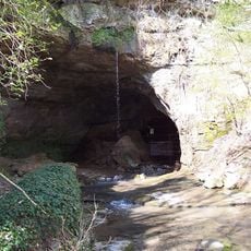
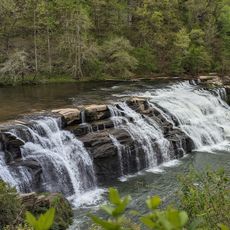
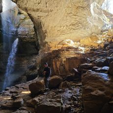
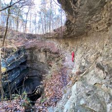
Buck's Pocket State Park is a natural area in Marshall County that spans Sand Mountain with canyons, hardwood forests, and South Sauty Creek flowing through it. The landscape features rocky terrain typical of the Appalachian chain with varied elevations and wooded sections throughout.

History

The park was established in 1966 when the Sand Mountain Booster's Club formed the Tri-County Park Authority and purchased land from a local farmer. This early initiative transformed private land into a public outdoor space for regional access.

Culture

The park's name carries local stories from Native American legends to a Civil War draft evader named Buck Berry, shaping how visitors understand and remember the place. These narratives remain part of how people experience and talk about the land today.

Practical

The park has 23 campsites with modern facilities, concrete pads, picnic tables, and fire rings for guests. An 8-mile off-road vehicle trail and hiking paths of varying difficulty are available throughout the grounds.

Did you know?

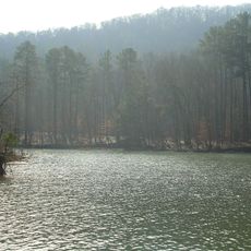
Point Rock Overlook offers sweeping views across the canyon and reveals the depth of the landscape formation from a special vantage point. Nearby Morgan's Cove with its boat launch and fishing opportunities on Lake Guntersville provides a different outdoor experience.

Location
GPS coordinates
34.47427,-86.04889
Latest update
December 9, 2025 18:46

AroundUs brings together thousands of curated places, local tips, and hidden gems, enriched daily by 60,000 contributors worldwide. Discover all places nearby (Marshall County).

Around this place
Cathedral Caverns State Park
United States of America

Cathedral Caverns State Park

19.3 km
Snead State Community College
United States of America

Snead State Community College

32.4 km
Lake Guntersville State Park
United States of America

Lake Guntersville State Park

17.2 km
Sauta Cave National Wildlife Refuge
United States of America

Sauta Cave National Wildlife Refuge

17.2 km
Comer Bridge
United States of America

Comer Bridge

19.7 km
Cherokee Plantation
United States of America

Cherokee Plantation

34.6 km
50 Taters
United States of America

50 Taters

19.3 km
W. B. Davis Hosiery Mill
United States of America

W. B. Davis Hosiery Mill

30.7 km
Fort Payne Opera House
United States of America

Fort Payne Opera House

30.4 km
High Falls Park
United States of America

High Falls Park

8.3 km
Dancy-Polk House
United States of America

Dancy-Polk House

16.6 km
Gurley Historic District
United States of America

Gurley Historic District

38.9 km
Julia Street Memorial United Methodist Church
United States of America

Julia Street Memorial United Methodist Church

32.2 km
Fort Payne Main Street Historic District
United States of America

Fort Payne Main Street Historic District

30.2 km
Vance C. Larmore House
United States of America

Vance C. Larmore House

36.4 km
Thomas A. Snellgrove Homestead
United States of America

Thomas A. Snellgrove Homestead

32.3 km
Edward Fenns Whitman House
United States of America

Edward Fenns Whitman House

32.2 km
Downtown Guntersville Historic District
United States of America

Downtown Guntersville Historic District

25.9 km
Fort Payne Boom Town Historic District
United States of America

Fort Payne Boom Town Historic District

30.4 km
Brown-Proctor House
United States of America

Brown-Proctor House

22 km
Skyline Commissary
United States of America

Skyline Commissary

38.3 km
Old Rock School
United States of America

Old Rock School

27.1 km
Henry-Jordan House
United States of America

Henry-Jordan House

25.6 km
Albert G. Henry, Jr., House
United States of America

Albert G. Henry, Jr., House

25.7 km
Fort Payne Residential Historic District
United States of America

Fort Payne Residential Historic District

30.1 km
Stephen's Gap Trail
United States of America

Stephen's Gap Trail

27.4 km
DeKalb Theatre
United States of America

DeKalb Theatre

30.5 km
Neversink Pit
United States of America

Neversink Pit

36.5 km
Show the full map
« Buck's Pocket State Park - State park in Grove Oak, Alabama, United States » is provided by Around Us (aroundus.com). Images and texts are derived from Wikimedia project under a Creative Commons license. You are allowed to copy, distribute, and modify copies of this page, under the conditions set by the license, as long as this note is clearly visible.

Discover hidden gems everywhere you go!

From secret cafés to breathtaking viewpoints, skip the crowded tourist spots and find places that match your style. Our app makes it easy with voice search, smart filtering, route optimization, and insider tips from travelers worldwide. Download now for the complete mobile experience.

Around Us App Screenshot

A unique approach to discovering new places

Le Figaro

All the places worth exploring

France Info

A tailor-made excursion in just a few clicks

20 Minutes

Around Us
Travel Guide & Maps
Download

Send to your phone

QR Code
1

Open the camera app on your mobile.

2

Point at the QR code with your camera. A notification will appear.

3

Tap the notification to open the link.