Enable Location

We need your location to show you interesting places around you

Discover nearby places

Find interesting locations and hidden gems around you

Precise directions

Get accurate directions and distances to places

Your location is never shared with other users. It's only used when you tap the location button.

Cass Lake

Log in to your account

Start exploring — it's free

Trusted by 62,959 travelers worldwide

Continue with Google
Continue with Apple
or

We will send you a code to connect

By continuing, you accept our Terms and Conditions and our Privacy Policy

Check your inbox

We've sent a pincode in your inbox. Please enter the code below.

Cass Lake
Discussion Reviews 1 Photos
8.6k Popularity

Cass Lake, Glacial lake in northern Minnesota, United States.

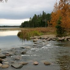
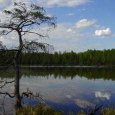
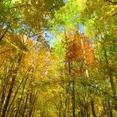
Cass Lake spreads across approximately 6,000 acres in northern Minnesota, straddling the boundary between Beltrami and Cass Counties. The water reaches depths of about 52 feet at its deepest points and forms a major natural body within a heavily forested landscape.

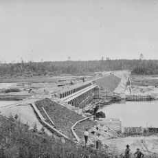
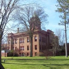
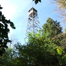
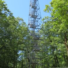
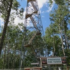
The area became part of the Minnesota Forest Reserve in 1902, when officials selected the lake site for the Forest Supervisor's Office. This decision established the location as a hub for land management and public activity in the region.

The shoreline is home to the Leech Lake Band of Ojibwe, whose presence and traditions shape community life in the region today. Visitors can observe how this heritage remains woven into local activities and the landscape itself.

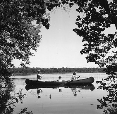
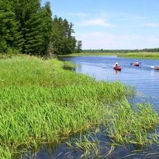
Multiple public access points around the shoreline allow visitors to launch boats and participate in fishing and water activities. Come prepared for changing weather and bring appropriate gear, especially if you plan to spend time on the water.

The lake connects to an extensive network of waterways and contains several islands, with Star Island featuring its own enclosed lake within. This creates a complex aquatic landscape worth exploring by boat.

The community of curious travelers

AroundUs brings together thousands of curated places, local tips, and hidden gems, enriched daily by 60,000 contributors worldwide.

Start exploring
Location
Location
GPS coordinates
47.41810,-94.53920
Latest update
December 10, 2025 16:01
Around this place
Paul Bunyan and Babe the Blue Ox
United States of America

Paul Bunyan and Babe the Blue Ox

26.2 km
Itasca State Park
United States of America

Itasca State Park

54.2 km
Lake Winnibigoshish
United States of America

Lake Winnibigoshish

27.3 km
Lake Bemidji State Park
United States of America

Lake Bemidji State Park

25.1 km
Waldsee
United States of America

Waldsee

21.7 km
United States of America

The Big Fish

21.8 km
Rabideau CCC Camp
United States of America

Rabideau CCC Camp

24.7 km
Schoolcraft State Park
United States of America

Schoolcraft State Park

59.8 km
Paul Bunyan State Forest
United States of America

Paul Bunyan State Forest

43.9 km
Bowstring State Forest
United States of America

Bowstring State Forest

33.7 km
Nevis Tiger Muskie
United States of America

Nevis Tiger Muskie

55.4 km
Bemidji Carnegie Library
United States of America

Bemidji Carnegie Library

26.3 km
Beltrami County Courthouse
United States of America

Beltrami County Courthouse

26.5 km
Nymore Bridge
United States of America

Nymore Bridge

26.1 km
David Park House
United States of America

David Park House

26.4 km
United States of America

Debs Consolidated School

56.3 km
White Earth State Forest
United States of America

White Earth State Forest

60.5 km
Lake Bemidji State Park CCC/NYA/Rustic Style Historic Resources
United States of America

Lake Bemidji State Park CCC/NYA/Rustic Style Historic Resources

25.2 km
Sandtrap Golf Course
United States of America

Sandtrap Golf Course

8.2 km
Aiton Heights Fire Tower
United States of America

Aiton Heights Fire Tower

55.4 km
Rabideau Civilian Conservation Corps Camp Picnic Shelter
United States of America

Rabideau Civilian Conservation Corps Camp Picnic Shelter

24.8 km
Cuba Hill Lookout Tower
United States of America

Cuba Hill Lookout Tower

9.2 km
Schoolcraft Fire Tower
United States of America

Schoolcraft Fire Tower

34.6 km
Blackduck Lookout Tower
United States of America

Blackduck Lookout Tower

29.9 km
Farley Hill Lookout Tower
United States of America

Farley Hill Lookout Tower

35.2 km
Pinewood Fire Tower
United States of America

Pinewood Fire Tower

30.1 km
Kabekona Lookout Tower
United States of America

Kabekona Lookout Tower

34 km
LaSalle Lookout Tower
United States of America

LaSalle Lookout Tower

50.3 km
Show the full map
Reviews
Share your experience

No review yet

Discussions
Start a discussion...

No discussion yet

« Cass Lake - Glacial lake in northern Minnesota, United States » is provided by Around Us (aroundus.com). Images and texts are derived from Wikimedia project under a Creative Commons license. You are allowed to copy, distribute, and modify copies of this page, under the conditions set by the license, as long as this note is clearly visible.

Discover hidden gems everywhere you go!

From secret cafés to breathtaking viewpoints, skip the crowded tourist spots and find places that match your style. Our app makes it easy with voice search, smart filtering, route optimization, and insider tips from travelers worldwide. Download now for the complete mobile experience.

Around Us App Screenshot

A unique approach to discovering new places

Le Figaro

All the places worth exploring

France Info

A tailor-made excursion in just a few clicks

20 Minutes

Around Us
Travel Guide & Maps
Download

Send to your phone

QR Code
1

Open the camera app on your mobile.

2

Point at the QR code with your camera. A notification will appear.

3

Tap the notification to open the link.