Chest opened
+${chestReward.xp} XP
Explorer
NOUVEAU ×${chestReward.collectible.quantity}
tapez pour fermer
Chest locked

Open chests in the app

Around Us is built for your phone — chests unlock when you walk, explore and capture nearby places.

Enable Location

We need your location to show you interesting places around you

Discover nearby places

Find interesting locations and hidden gems around you

Precise directions

Get accurate directions and distances to places

Your location is never shared with other users. It's only used when you tap the location button.

Cape Cod Space Force Station

Log in to your account

Start exploring — it's free

Trusted by 72,887 travelers worldwide

Continue with Google
Continue with Apple
or

We will send you a code to connect

By continuing, you accept our Terms and Conditions and our Privacy Policy

Check your inbox

We've sent a pincode in your inbox. Please enter the code below.

Cape Cod Space Force Station
Discussion Reviews 1 Photos
29.8k Popularity

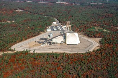
Cape Cod Space Force Station, Military radar facility in Bourne, Massachusetts, United States.

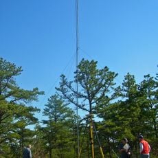
Cape Cod Space Force Station is a military installation near Bourne, Massachusetts, that monitors aircraft and projectiles over the Atlantic Ocean. It operates sophisticated radar equipment managed by trained military personnel who watch the skies above the eastern seaboard continuously.

This facility was built in the late 1970s as a radar outpost for air defense and began operations in the early 1980s. It became part of the Air Force's network for monitoring eastern airspace during the Cold War period.

The 6th Space Warning Squadron maintains continuous operations with military personnel working in shifts to ensure constant monitoring of potential threats.

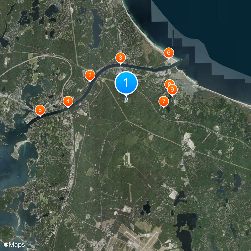
The facility sits on a hilltop with a clear view of surrounding waters, making it sometimes visible to visitors from outside. Access is restricted for security reasons, so you should stay in designated public areas if viewing from nearby.

The radar installation on this hilltop can detect objects at very long distances over the ocean, making it a critical point in regional air monitoring. Despite its military importance, the exact location remains unknown to most people who visit the area.

The community of curious travelers

AroundUs brings together thousands of curated places, local tips, and hidden gems, enriched daily by 60,000 contributors worldwide.

Start exploring
Location
Inception
April 4, 1980
GPS coordinates
41.75320,-70.53850
Latest update
December 20, 2025 03:02
Around this place
Cape Cod Canal
United States of America

Cape Cod Canal

2.9 km
Sagamore Bridge
United States of America

Sagamore Bridge

2.6 km
Bourne Bridge
United States of America

Bourne Bridge

4.3 km
Cape Cod Canal Railroad Bridge
United States of America

Cape Cod Canal Railroad Bridge

6.4 km
Scusset Beach State Reservation
United States of America

Scusset Beach State Reservation

4.3 km
Heritage Museums and Gardens
United States of America

Heritage Museums and Gardens

2.8 km
Sandwich Glass Museum
United States of America

Sandwich Glass Museum

3.2 km
Hoxie House
United States of America

Hoxie House

3.4 km
Fort Banks
United States of America

Fort Banks

5.5 km
Wing Fort House
United States of America

Wing Fort House

6.1 km
Shawme-Crowell State Forest
United States of America

Shawme-Crowell State Forest

1.3 km
Pine Hill
United States of America

Pine Hill

5.4 km
First Church, Sandwich Massachusetts
United States of America

First Church, Sandwich Massachusetts

3.3 km
Jonathan Bourne Public Library
United States of America

Jonathan Bourne Public Library

5.1 km
Bourne Town Hall
United States of America

Bourne Town Hall

5.3 km
Jarvesville Historic District
United States of America

Jarvesville Historic District

3.8 km
Forestdale School
United States of America

Forestdale School

7.5 km
John and Mary Waterman Jarves House
United States of America

John and Mary Waterman Jarves House

3.6 km
George I. Briggs House
United States of America

George I. Briggs House

5.1 km
Spring Hill Historic District (Sandwich, Massachusetts)
United States of America

Spring Hill Historic District (Sandwich, Massachusetts)

5.5 km
Town Hall Square Historic District
United States of America

Town Hall Square Historic District

3.2 km
Old Bourne High School building
United States of America

Old Bourne High School building

4.8 km
East Sandwich Beach
United States of America

East Sandwich Beach

7.6 km
Springhill Beach
United States of America

Springhill Beach

7.1 km
Monument Beach
United States of America

Monument Beach

7.6 km
Town Beach
United States of America

Town Beach

4.5 km
Scusset Beach
United States of America

Scusset Beach

4.2 km
Indian Mound Beach
United States of America

Indian Mound Beach

7.7 km
Show the full map
Reviews
Share your experience

No review yet

Discussions
Start a discussion...

No discussion yet

« Cape Cod Space Force Station - Military radar facility in Bourne, Massachusetts, United States » is provided by Around Us (aroundus.com). Images and texts are derived from Wikimedia project under a Creative Commons license. You are allowed to copy, distribute, and modify copies of this page, under the conditions set by the license, as long as this note is clearly visible.

Discover hidden gems everywhere you go!

From secret cafés to breathtaking viewpoints, skip the crowded tourist spots and find places that match your style. Our app makes it easy with voice search, smart filtering, route optimization, and insider tips from travelers worldwide. Download now for the complete mobile experience.

Around Us App Screenshot

A unique approach to discovering new places

Le Figaro

All the places worth exploring

France Info

A tailor-made excursion in just a few clicks

20 Minutes

Around Us
Travel Guide & Maps
Download

Send to your phone

QR Code
1

Open the camera app on your mobile.

2

Point at the QR code with your camera. A notification will appear.

3

Tap the notification to open the link.