Chest opened
+${chestReward.xp} XP
Explorer
NOUVEAU ×${chestReward.collectible.quantity}
tapez pour fermer
Chest locked

Open chests in the app

Around Us is built for your phone — chests unlock when you walk, explore and capture nearby places.

Enable Location

We need your location to show you interesting places around you

Discover nearby places

Find interesting locations and hidden gems around you

Precise directions

Get accurate directions and distances to places

Your location is never shared with other users. It's only used when you tap the location button.

Log in to your account

Start exploring — it's free

Trusted by 73,001 travelers worldwide

Continue with Google
Continue with Apple
or

We will send you a code to connect

By continuing, you accept our Terms and Conditions and our Privacy Policy

Check your inbox

We've sent a pincode in your inbox. Please enter the code below.

Camp Columbia State Park/State Forest
Discussion Reviews Photo
1.9k Popularity

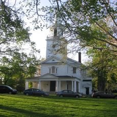
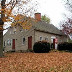
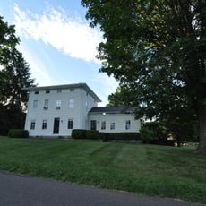
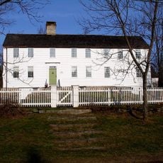
Camp Columbia State Park/State Forest, State park and forest in Morris, Litchfield County, United States.

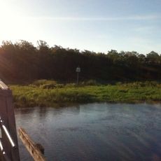
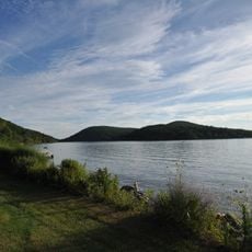
Camp Columbia State Park is a 600-acre protected area in Morris with forested sections, walking trails, and access to the South Bay of Bantam Lake. The grounds feature varied terrain that appeals to different seasons and visitor interests.

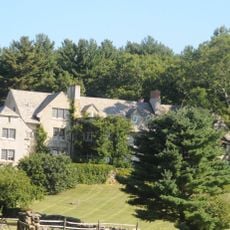
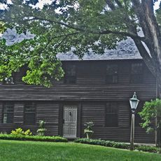
The site was established in 1903 by Columbia University as a training ground for engineering students focused on surveying methods. During World War I, the grounds served as a military training center before closing in 1983.

During World War I, the grounds transformed into a military training facility where students practiced combat exercises and constructed trenches still visible today.

Visitors can use over 3 miles of trails from the parking area on Route 109 suited for hiking, mountain biking, cross-country skiing, and snowshoeing. The varied routes accommodate different activities depending on season and skill level.

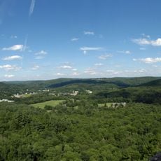
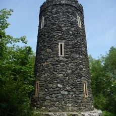
An observation tower made of local stone and built in 1942 by the Class of 1906 rises about 60 feet high and offers seasonal views across the surroundings. This structure remains a distinctive landmark on the grounds and draws visitors with historical interest.

The community of curious travelers

AroundUs brings together thousands of curated places, local tips, and hidden gems, enriched daily by 60,000 contributors worldwide.

Start exploring
Inception
2004
GPS coordinates
41.67694,-73.22389
Latest update
December 14, 2025 11:25
Around this place
Rye House
United States of America

Rye House

6.8 km
Litchfield Law School
United States of America

Litchfield Law School

8 km
Bellamy-Ferriday House and Garden
United States of America

Bellamy-Ferriday House and Garden

3.8 km
Black Rock State Park
United States of America

Black Rock State Park

10.1 km
Stillman House
United States of America

Stillman House

9.1 km
Mount Tom State Park
United States of America

Mount Tom State Park

4.9 km
Garbage Museum
United States of America

Garbage Museum

5.7 km
Topsmead
United States of America

Topsmead

9.4 km
Milton Center Historic District
United States of America

Milton Center Historic District

10.9 km
Oliver Wolcott House
United States of America

Oliver Wolcott House

8 km
White Memorial Foundation
United States of America

White Memorial Foundation

4.8 km
Litchfield Historic District
United States of America

Litchfield Historic District

8.3 km
First Congregational Church of Litchfield
United States of America

First Congregational Church of Litchfield

8.4 km
Humaston Brook State Park
United States of America

Humaston Brook State Park

10.1 km
Mount Bushnell State Park
United States of America

Mount Bushnell State Park

11.6 km
Christ Episcopal Church
United States of America

Christ Episcopal Church

4.5 km
The Hollister Homestead
United States of America

The Hollister Homestead

7.6 km
Trinity Church
United States of America

Trinity Church

11 km
Bethlehem Green Historic District
United States of America

Bethlehem Green Historic District

4.5 km
Henry B. Bissell House
United States of America

Henry B. Bissell House

6.8 km
Washington Green Historic District
United States of America

Washington Green Historic District

8.9 km
Roderick Bryan House
United States of America

Roderick Bryan House

8.3 km
Calhoun-Ives Historic District
United States of America

Calhoun-Ives Historic District

9.3 km
Skilton Road Bridge
United States of America

Skilton Road Bridge

7.6 km
David Welch House
United States of America

David Welch House

11 km
Caleb Martin House
United States of America

Caleb Martin House

5.4 km
Town Hall and District School No. 6
United States of America

Town Hall and District School No. 6

2.1 km
Mount Tom Tower
United States of America

Mount Tom Tower

4.5 km
Show the full map
Reviews
Share your experience

No review yet

Discussions
Start a discussion...

No discussion yet

« Camp Columbia State Park/State Forest - State park and forest in Morris, Litchfield County, United States » is provided by Around Us (aroundus.com). Images and texts are derived from Wikimedia project under a Creative Commons license. You are allowed to copy, distribute, and modify copies of this page, under the conditions set by the license, as long as this note is clearly visible.

Discover hidden gems everywhere you go!

From secret cafés to breathtaking viewpoints, skip the crowded tourist spots and find places that match your style. Our app makes it easy with voice search, smart filtering, route optimization, and insider tips from travelers worldwide. Download now for the complete mobile experience.

Around Us App Screenshot

A unique approach to discovering new places

Le Figaro

All the places worth exploring

France Info

A tailor-made excursion in just a few clicks

20 Minutes

Around Us
Travel Guide & Maps
Download

Send to your phone

QR Code
1

Open the camera app on your mobile.

2

Point at the QR code with your camera. A notification will appear.

3

Tap the notification to open the link.