Congress Heights

Log in to your account

AroundUs is a community-driven map of interesting places, built by curious explorers like you. It grows with every review, story, and photo you share.
Connect to save your favorite spots, contribute locations, and create personalized routes.
By continuing, you accept our Terms and Conditions and our Privacy Policy

Congress Heights

Add to collection
Map
Suggest a change
Share

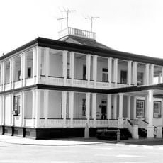
Congress Heights, Residential district in Southeast Washington DC, United States.

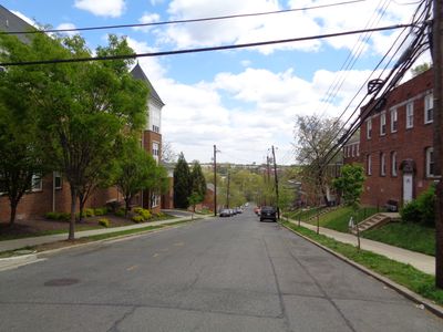
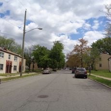
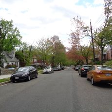
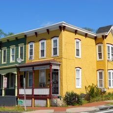
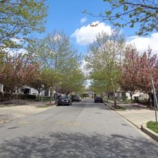
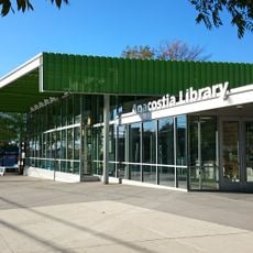
Congress Heights is a residential district in Southeast Washington located on elevated terrain east of the Anacostia River. The area mixes homes with commercial spaces along Martin Luther King Jr Avenue, with the Entertainment and Sports Arena serving as a major landmark.

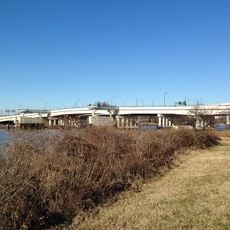
Colonel Arthur E. Randle founded the district in 1890, converting forest and farmland into housing after the Pennsylvania Avenue Bridge was completed. This development marked the start of settlement on the elevated terrain east of the river.

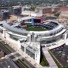
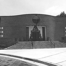
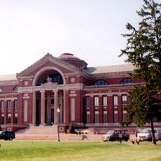
The Entertainment and Sports Arena serves as a gathering place where basketball fans watch home games of the Washington Mystics WNBA team and practice sessions of the Washington Wizards. This venue has become central to how locals connect and spend their time together.

The Congress Heights Metro station on the Green Line offers direct access to downtown Washington, while multiple bus routes serve the neighborhood. Getting around on foot or by public transit is straightforward for visitors.

The neighborhood was home to Washington DC's last operating farm, which the Lindner family ran until 1939 before it closed. This agricultural past is largely invisible today, yet it shaped the area's evolution for generations.

Location: Washington

GPS coordinates: 38.84057,-76.99603

Latest update: December 7, 2025 20:43

Photos
Around this place
Show the full map
Anacostia
United States of America

Anacostia

3 km
National Museum of the United States Navy
United States of America

National Museum of the United States Navy

3.6 km
Frederick Douglass National Historic Site
United States of America

Frederick Douglass National Historic Site

2.7 km
Southeast
United States of America

Southeast

3.2 km
Barry Farm
United States of America

Barry Farm

2 km
Navy Yard
United States of America

Navy Yard

3.7 km
Buzzard Point
United States of America

Buzzard Point

3.3 km
Douglas A. Munro Coast Guard Headquarters Building
United States of America

Douglas A. Munro Coast Guard Headquarters Building

1.5 km
11th Street Bridges
United States of America

11th Street Bridges

3.5 km
Bellevue
United States of America

Bellevue

1.9 km
Frederick Douglass Memorial Bridge
United States of America

Frederick Douglass Memorial Bridge

3.2 km
Anacostia Community Museum
United States of America

Anacostia Community Museum

2.5 km
The Big Chair
United States of America

The Big Chair

2.8 km
Anacostia Historic District
United States of America

Anacostia Historic District

3 km
Roosevelt Hall
United States of America

Roosevelt Hall

3.1 km
Douglass
United States of America

Douglass

1.5 km
Fort Stanton
United States of America

Fort Stanton

2.7 km
Coast Guard Station Washington, D.C.
United States of America

Coast Guard Station Washington, D.C.

2.5 km
Fort Greble
United States of America

Fort Greble

2.2 km
James C. Dent House
United States of America

James C. Dent House

3.7 km
Commandant's Office, Washington Navy Yard
United States of America

Commandant's Office, Washington Navy Yard

3.6 km
Church of the Assumption of the Blessed Virgin Mary
United States of America

Church of the Assumption of the Blessed Virgin Mary

708 m
Bellevue / William O. Lockridge Library
United States of America

Bellevue / William O. Lockridge Library

1.6 km
Carver Theater
United States of America

Carver Theater

2.5 km
Anacostia Neighborhood Library
United States of America

Anacostia Neighborhood Library

3.2 km
Bet Mishpachah Cemetery
United States of America

Bet Mishpachah Cemetery

1.3 km
Parklands-Turner Neighborhood Library
United States of America

Parklands-Turner Neighborhood Library

1.4 km
Buzzard Point Power Plant
United States of America

Buzzard Point Power Plant

3.1 km
Show the full map
Reviews

Visited this place? Tap the stars to rate it and share your experience / photos with the community! Try now! You can cancel it anytime.

« Congress Heights - Residential district in Southeast Washington DC, United States » is provided by Around Us (aroundus.com). Images and texts are derived from Wikimedia project under a Creative Commons license. You are allowed to copy, distribute, and modify copies of this page, under the conditions set by the license, as long as this note is clearly visible.

Discover hidden gems everywhere you go!

From secret cafés to breathtaking viewpoints, skip the crowded tourist spots and find places that match your style. Our app makes it easy with voice search, smart filtering, route optimization, and insider tips from travelers worldwide. Download now for the complete mobile experience.

Around Us App Screenshot

A unique approach to discovering new places

Le Figaro

All the places worth exploring

France Info

A tailor-made excursion in just a few clicks

20 Minutes