Chest opened
+${chestReward.xp} XP
Explorer
NOUVEAU ×${chestReward.collectible.quantity}
tapez pour fermer

See the monuments around you in AR Open chests in the app

Around Us is built for your phone — point your camera at the streets and discover the monuments and places around you in augmented reality. Around Us is built for your phone — chests unlock when you walk, explore and capture nearby places.

Enable Location

We need your location to show you interesting places around you

Discover nearby places

Find interesting locations and hidden gems around you

Precise directions

Get accurate directions and distances to places

Your location is never shared with other users. It's only used when you tap the location button.

Log in to your account

Start exploring — it's free

Trusted by 84,995 travelers worldwide

Continue with Google
Continue with Apple
or

We will send you a code to connect

By continuing, you accept our Terms and Conditions and our Privacy Policy

Check your inbox

We've sent a pincode in your inbox. Please enter the code below.

FV Pelican
Discussion Reviews Photo
4.2k Popularity

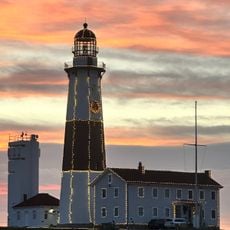
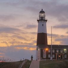
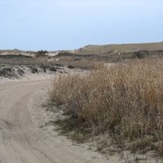
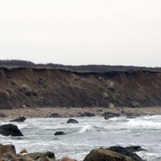
FV Pelican, Commercial fishing vessel in Montauk, New York, US.

FV Pelican was a 42-foot fishing vessel with an enclosed cabin that operated from the Fishangrila Dock at Fort Pond Bay in Montauk. The boat weighed approximately 14 gross register tons and was configured to carry passengers on fishing trips.

The vessel capsized on September 1, 1951, during a Labor Day weekend excursion near Montauk Point. The disaster claimed 45 lives and prompted the adoption of stricter passenger safety rules for commercial vessels.

The vessel served as a connection between New York City residents and recreational fishing, with visitors arriving on special trains to board for their excursions. It represented an important leisure activity for city dwellers seeking escape and outdoor recreation.

Visitors can learn about the vessel's history through local museums and memorials in Montauk. Most information about the ship is now preserved in historical records and commemorations accessible to those interested in maritime history.

The sinking of the vessel led to the adoption of passenger capacity regulations in 1957 that set strict limits for commercial ships. These rules marked a major shift in maritime safety standards and influenced vessel design practices for years to come.

The community of curious travelers

AroundUs brings together thousands of curated places, local tips, and hidden gems, enriched daily by 60,000 contributors worldwide.
Start exploring
Location
GPS coordinates
41.07080,-71.84210
Latest update
August 31, 2026 11:23
Around this place
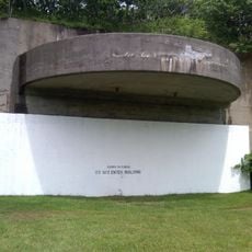
Camp Hero State Park
United States of America

Camp Hero State Park

1.4 mi
Hither Hills State Park
United States of America

Hither Hills State Park

9.7 mi
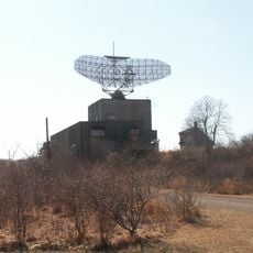
AN/FPS-35, Montauk, New York State
United States of America

AN/FPS-35, Montauk, New York State

1.8 mi
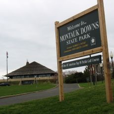
Montauk Downs State Park
United States of America

Montauk Downs State Park

5.4 mi
Lake Montauk
United States of America

Lake Montauk

4.5 mi
Montauk County Park
United States of America

Montauk County Park

3.2 mi
Montauk Point Lighthouse
United States of America

Montauk Point Lighthouse

0.8 mi
Shadmoor State Park
United States of America

Shadmoor State Park

4.9 mi
Amsterdam Beach State Park
United States of America

Amsterdam Beach State Park

3.4 mi
Gardiners Island Windmill
United States of America

Gardiners Island Windmill

14.1 mi
Big Reed Pond
United States of America

Big Reed Pond

3.6 mi
Caleb Bragg Estate
United States of America

Caleb Bragg Estate

4.8 mi
Montauk Point Light
United States of America

Montauk Point Light

0.8 mi
Montauk Point State Park
United States of America

Montauk Point State Park

0.7 mi
Napeague State Park
United States of America

Napeague State Park

13.5 mi
Montauk County Park RV Campground
United States of America

Montauk County Park RV Campground

4.7 mi
United States of America

Captain Kid Monument

15.2 mi
Napeague Beach
United States of America

Napeague Beach

12.1 mi
United States of America

Vaills Beach

15.1 mi
Montauk Association Historic District
United States of America

Montauk Association Historic District

3.8 mi
Black Rock Beach
United States of America

Black Rock Beach

13.9 mi
Scenic viewpoint
United States of America

Scenic viewpoint

1.6 mi
Iodine Beach
United States of America

Iodine Beach

11 mi
United States of America

Amsterdam Beach Trail

3.1 mi
United States of America

Montauk County Park RV Campground

4.4 mi
United States of America

Montauk Point East Overlook

2.9 mi
United States of America

Hither Hills West Overlook

9.5 mi
United States of America

Godman's Dock

5 mi
Show the full map
Reviews
Share your experience

No review yet

Discussions
Start a discussion...

No discussion yet

« FV Pelican - Commercial fishing vessel in Montauk, New York, US » is provided by Around Us (aroundus.com). Images and texts are derived from Wikimedia project under a Creative Commons license. You are allowed to copy, distribute, and modify copies of this page, under the conditions set by the license, as long as this note is clearly visible.

Discover hidden gems everywhere you go!

From secret cafés to breathtaking viewpoints, skip the crowded tourist spots and find places that match your style. Our app makes it easy with voice search, smart filtering, route optimization, and insider tips from travelers worldwide. Download now for the complete mobile experience.

Around Us App Screenshot

A unique approach to discovering new places

Le Figaro

All the places worth exploring

France Info

A tailor-made excursion in just a few clicks

20 Minutes

Around Us
Travel Guide & Maps
Download

Send to your phone

QR Code
1

Open the camera app on your mobile.

2

Point at the QR code with your camera. A notification will appear.

3

Tap the notification to open the link.