Enable Location

We need your location to show you interesting places around you

Discover nearby places

Find interesting locations and hidden gems around you

Precise directions

Get accurate directions and distances to places

Your location is never shared with other users. It's only used when you tap the location button.

Ferne Clyffe State Park

Log in to your account

Start exploring — it's free

Trusted by 61,940 travelers worldwide

Continue with Google
Continue with Apple
or

We will send you a code to connect

By continuing, you accept our Terms and Conditions and our Privacy Policy

Check your inbox

We've sent a pincode in your inbox. Please enter the code below.

Ferne Clyffe State Park

Ferne Clyffe State Park, State park in southern Illinois, United States.

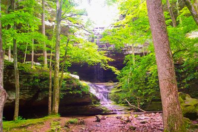
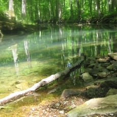
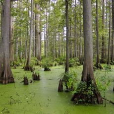
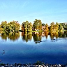
Ferne Clyffe State Park is a 2,430-acre park in southern Illinois featuring limestone bluffs, dense woodlands, and a 100-foot intermittent waterfall along the Big Rocky Hollow trail. The property offers 18 different hiking trails, multiple campgrounds for various camping styles, and a fishing lake that was created in 1960.

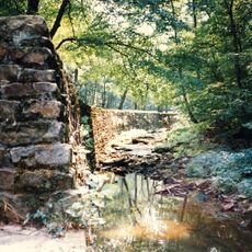
George Rogers Clark's troops crossed this territory in 1778 during the American Revolution. The land was later used by Cherokee people during their forced relocation on the Trail of Tears.

The park protects more than 700 plant species, including flowering dogwood, redbud trees, and woodland wildflowers that shift with each season. Visitors notice this diversity along the woodland paths, where blooming plants shape the landscape differently depending on the time of year.

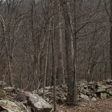
Most visitors find easy to moderate hikes suitable for day trips, with parking available at several entry points throughout the property. Spring and fall offer the best visiting conditions, when temperatures stay mild and wildflowers are in full bloom.

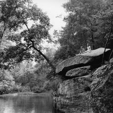
Hawks' Cave formation and Round Bluff Nature Preserve display distinct geological features carved by centuries of water erosion through limestone. These formations offer a rare view of how water has shaped the rock over thousands of years.

The community of curious travelers

AroundUs brings together thousands of curated places, local tips, and hidden gems, enriched daily by 60,000 contributors worldwide.

Start exploring
Location
Inception
1949
GPS coordinates
37.52944,-88.98278
Latest update
December 10, 2025 20:02
Around this place
Giant City State Park
United States of America

Giant City State Park

20 km
Saluki Stadium
United States of America

Saluki Stadium

28.7 km
Giant City Stone Fort Site
United States of America

Giant City Stone Fort Site

21.6 km
Panther Den Wilderness
United States of America

Panther Den Wilderness

10.8 km
Cache River State Natural Area
United States of America

Cache River State Natural Area

18.8 km
Shryock Auditorium
United States of America

Shryock Auditorium

29.3 km
Heron Pond – Little Black Slough Nature Preserve
United States of America

Heron Pond – Little Black Slough Nature Preserve

18.3 km
Faner Hall
United States of America

Faner Hall

29.3 km
Vienna Public Library
United States of America

Vienna Public Library

14.8 km
Altgeld Hall
United States of America

Altgeld Hall

29.4 km
Stinson Memorial Library
United States of America

Stinson Memorial Library

25 km
Bell Smith Springs
United States of America

Bell Smith Springs

28.9 km
Willis Allen House
United States of America

Willis Allen House

22.5 km
John Bridges Tavern and Store Site
United States of America

John Bridges Tavern and Store Site

10.9 km
Johnson County Courthouse
United States of America

Johnson County Courthouse

14.9 km
Goddard Chapel
United States of America

Goddard Chapel

24.2 km
Campground Church and Cemetery Site
United States of America

Campground Church and Cemetery Site

15.7 km
Thompson Brothers Rock Art
United States of America

Thompson Brothers Rock Art

20 km
Williamson County Courthouse
United States of America

Williamson County Courthouse

23.1 km
St. Anne's Episcopal Church
United States of America

St. Anne's Episcopal Church

25.1 km
St. Paulus Evangelisch Lutherischen Gemeinde
United States of America

St. Paulus Evangelisch Lutherischen Gemeinde

28.8 km
Reef House
United States of America

Reef House

30.1 km
Ed M. Stotlar House
United States of America

Ed M. Stotlar House

23 km
Carbondale Public Library
United States of America

Carbondale Public Library

30.4 km
John A. Logan College
United States of America

John A. Logan College

26.2 km
Varsity Center for the Arts
United States of America

Varsity Center for the Arts

29.9 km
AMC Classic Illinois Centre 8
United States of America

AMC Classic Illinois Centre 8

24.5 km
Campus Lake
United States of America

Campus Lake

29.4 km
Show the full map
« Ferne Clyffe State Park - State park in southern Illinois, United States » is provided by Around Us (aroundus.com). Images and texts are derived from Wikimedia project under a Creative Commons license. You are allowed to copy, distribute, and modify copies of this page, under the conditions set by the license, as long as this note is clearly visible.

Discover hidden gems everywhere you go!

From secret cafés to breathtaking viewpoints, skip the crowded tourist spots and find places that match your style. Our app makes it easy with voice search, smart filtering, route optimization, and insider tips from travelers worldwide. Download now for the complete mobile experience.

Around Us App Screenshot

A unique approach to discovering new places

Le Figaro

All the places worth exploring

France Info

A tailor-made excursion in just a few clicks

20 Minutes

Around Us
Travel Guide & Maps
Download

Send to your phone

QR Code
1

Open the camera app on your mobile.

2

Point at the QR code with your camera. A notification will appear.

3

Tap the notification to open the link.