Enable Location

We need your location to show you interesting places around you

Discover nearby places

Find interesting locations and hidden gems around you

Precise directions

Get accurate directions and distances to places

Your location is never shared with other users. It's only used when you tap the location button.

Cache River State Natural Area

Log in to your account

Start exploring — it's free

Trusted by 62,968 travelers worldwide

Continue with Google
Continue with Apple
or

We will send you a code to connect

By continuing, you accept our Terms and Conditions and our Privacy Policy

Check your inbox

We've sent a pincode in your inbox. Please enter the code below.

Cache River State Natural Area
Discussion Reviews 1 Photos 1 Collections
3k Popularity

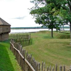
Cache River State Natural Area, Natural area and state park in southern Illinois, United States.

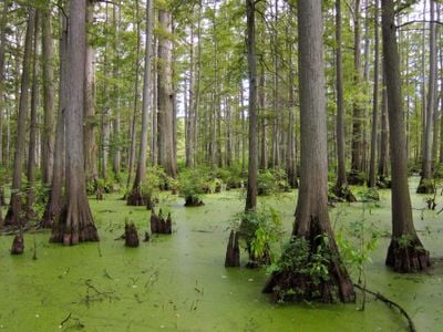
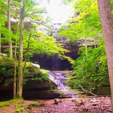
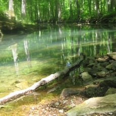
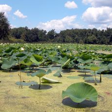
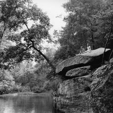
Cache River State Natural Area is a natural preserve in southern Illinois that encompasses thousands of acres of diverse habitats. The landscape includes swamps with bald cypress trees, floodplain forests, and hardwood stands that visitors can explore on foot, via boardwalk, or by canoe.

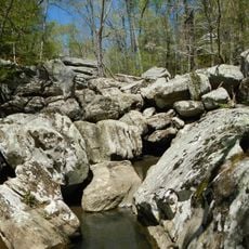
The valley was shaped long ago by glacial waters that carved channels from the Ohio River through the landscape. When the river eventually shifted its course, the Cache River remained and gradually filled with water, creating the wetland ecosystem that exists today.

The Barkhausen Wetlands Center offers exhibits that explain how this ecosystem works and how local communities have lived alongside these wetlands. The center helps visitors understand the deep connection between people and the natural world here.

The area is accessible year-round through multiple entry points and trailheads throughout the region. Wear sturdy shoes and prepare for wet conditions since much of the terrain passes through swampy ground.

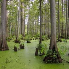
The area is home to some of the oldest trees in the region, with bald cypress trees that have lived for more than a thousand years. These ancient trees develop massive buttressed bases that support them in the soft swamp ground.

The community of curious travelers

AroundUs brings together thousands of curated places, local tips, and hidden gems, enriched daily by 60,000 contributors worldwide.

Start exploring
Location
Inception
1970
GPS coordinates
37.36220,-88.95560
Latest update
December 6, 2025 17:43
Historic and natural sites in Illinois

Illinois holds a rich collection of historical sites and natural landscapes. Visitors can explore prehistoric ruins like the Cahokia Mounds, where earthen structures reflect the achievements of ancient peoples. The region also features striking rock formations such as Garden of the Gods and natural...

Around this place
Olmsted Locks and Dam
United States of America

Olmsted Locks and Dam

22 km
Giant City State Park
United States of America

Giant City State Park

34 km
Fort Massac
United States of America

Fort Massac

34 km
Metropolis Bridge
United States of America

Metropolis Bridge

30.7 km
United States of America

Honeywell Uranium Hexafluoride Processing Facility

27.5 km
Ferne Clyffe State Park
United States of America

Ferne Clyffe State Park

18.8 km
Dixon Springs State Park
United States of America

Dixon Springs State Park

25.8 km
Panther Den Wilderness
United States of America

Panther Den Wilderness

27.8 km
Mermet Lake State Fish and Wildlife Area
United States of America

Mermet Lake State Fish and Wildlife Area

14.5 km
Lock and Dam Number 53
United States of America

Lock and Dam Number 53

19.5 km
Heron Pond – Little Black Slough Nature Preserve
United States of America

Heron Pond – Little Black Slough Nature Preserve

729 m
Mound City National Cemetery
United States of America

Mound City National Cemetery

35.9 km
Vienna Public Library
United States of America

Vienna Public Library

8.1 km
Elijah P. Curtis House
United States of America

Elijah P. Curtis House

30.6 km
Stinson Memorial Library
United States of America

Stinson Memorial Library

28.3 km
Bell Smith Springs
United States of America

Bell Smith Springs

31.7 km
John Bridges Tavern and Store Site
United States of America

John Bridges Tavern and Store Site

9.7 km
Johnson County Courthouse
United States of America

Johnson County Courthouse

7.8 km
Campground Church and Cemetery Site
United States of America

Campground Church and Cemetery Site

19.6 km
Pulaski County Courthouse
United States of America

Pulaski County Courthouse

35.4 km
Thompson Brothers Rock Art
United States of America

Thompson Brothers Rock Art

33.4 km
St. Anne's Episcopal Church
United States of America

St. Anne's Episcopal Church

28.4 km
St. Paulus Evangelisch Lutherischen Gemeinde
United States of America

St. Paulus Evangelisch Lutherischen Gemeinde

28.9 km
Barlow House
United States of America

Barlow House

35.5 km
Bass Hill Lookout Tower
United States of America

Bass Hill Lookout Tower

32.4 km
Massac Theatre
United States of America

Massac Theatre

30.7 km
Fort Massac State Park
United States of America

Fort Massac State Park

34 km
Atwood Lookout Tower
United States of America

Atwood Lookout Tower

34.2 km
Show the full map
Reviews
Share your experience

No review yet

Discussions
Start a discussion...

No discussion yet

« Cache River State Natural Area - Natural area and state park in southern Illinois, United States » is provided by Around Us (aroundus.com). Images and texts are derived from Wikimedia project under a Creative Commons license. You are allowed to copy, distribute, and modify copies of this page, under the conditions set by the license, as long as this note is clearly visible.

Discover hidden gems everywhere you go!

From secret cafés to breathtaking viewpoints, skip the crowded tourist spots and find places that match your style. Our app makes it easy with voice search, smart filtering, route optimization, and insider tips from travelers worldwide. Download now for the complete mobile experience.

Around Us App Screenshot

A unique approach to discovering new places

Le Figaro

All the places worth exploring

France Info

A tailor-made excursion in just a few clicks

20 Minutes

Around Us
Travel Guide & Maps
Download

Send to your phone

QR Code
1

Open the camera app on your mobile.

2

Point at the QR code with your camera. A notification will appear.

3

Tap the notification to open the link.