Enable Location

We need your location to show you interesting places around you

Discover nearby places

Find interesting locations and hidden gems around you

Precise directions

Get accurate directions and distances to places

Your location is never shared with other users. It's only used when you tap the location button.

Lock and Dam Number 53

Log in to your account

Start exploring — it's free

Trusted by 62,989 travelers worldwide

Continue with Google
Continue with Apple
or

We will send you a code to connect

By continuing, you accept our Terms and Conditions and our Privacy Policy

Check your inbox

We've sent a pincode in your inbox. Please enter the code below.

Lock and Dam Number 53
Discussion Reviews 1 Photos
2.2k Popularity

Lock and Dam Number 53, Navigation infrastructure on the Ohio River, Illinois and Kentucky, United States

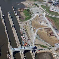
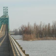
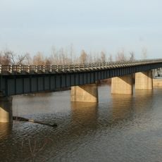
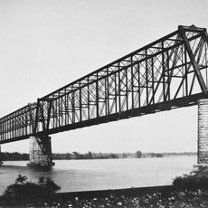
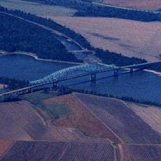
Lock and Dam Number 53 was a navigation structure on the Ohio River that moved commercial vessels upstream through two chambers of different sizes. The facility handled river traffic moving between the Mississippi River and points further north.

The structure was built in 1929 and served river traffic until its demolition in 2021. It was an important lock station for commercial barges moving between the lower and upper sections of the Ohio River.

The facility represented American engineering advancement in water transportation, processing over 72 million tonnes of cargo annually by 2015.

The site was primarily accessible to river traffic and not open to public visitors. The best time to observe commercial activity was during warmer months when shipping volume increased.

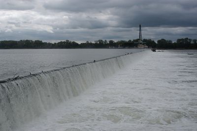
The dam was a wicket dam, a special design with hinged sections that could submerge during high water levels. This construction approach allowed operators to adjust water flow according to shipping and flood control needs.

The community of curious travelers

AroundUs brings together thousands of curated places, local tips, and hidden gems, enriched daily by 60,000 contributors worldwide.

Start exploring
Elevation above the sea
92 m
GPS coordinates
37.19930,-89.03730
Latest update
December 13, 2025 12:21
Around this place
Olmsted Locks and Dam
United States of America

Olmsted Locks and Dam

2.9 km
Cairo Mississippi River Bridge
United States of America

Cairo Mississippi River Bridge

26.5 km
Metropolis Bridge
United States of America

Metropolis Bridge

26.9 km
United States of America

Honeywell Uranium Hexafluoride Processing Facility

25 km
Wickliffe Mounds
United States of America

Wickliffe Mounds

25.9 km
Magnolia Manor
United States of America

Magnolia Manor

24.8 km
Cache River
United States of America

Cache River

19 km
Cairo Ohio River Bridge
United States of America

Cairo Ohio River Bridge

24.9 km
Cairo Rail Bridge
United States of America

Cairo Rail Bridge

23.1 km
Cache River State Natural Area
United States of America

Cache River State Natural Area

19.5 km
Cairo I-57 Bridge
United States of America

Cairo I-57 Bridge

25 km
Mermet Lake State Fish and Wildlife Area
United States of America

Mermet Lake State Fish and Wildlife Area

18 km
Cairo Historic District
United States of America

Cairo Historic District

24.8 km
Heron Pond – Little Black Slough Nature Preserve
United States of America

Heron Pond – Little Black Slough Nature Preserve

20.2 km
Mound City National Cemetery
United States of America

Mound City National Cemetery

16.9 km
Horseshoe Lake
United States of America

Horseshoe Lake

28.7 km
Vienna Public Library
United States of America

Vienna Public Library

27.3 km
Mound City Civil War Naval Hospital
United States of America

Mound City Civil War Naval Hospital

16.9 km
Elijah P. Curtis House
United States of America

Elijah P. Curtis House

27.4 km
John Bridges Tavern and Store Site
United States of America

John Bridges Tavern and Store Site

26.3 km
Johnson County Courthouse
United States of America

Johnson County Courthouse

27 km
Pulaski County Courthouse
United States of America

Pulaski County Courthouse

16.5 km
Ballard County Courthouse
United States of America

Ballard County Courthouse

26.5 km
Barlow House
United States of America

Barlow House

16.5 km
Trimble House
United States of America

Trimble House

25.8 km
Bass Hill Lookout Tower
United States of America

Bass Hill Lookout Tower

28.4 km
Massac Theatre
United States of America

Massac Theatre

27.6 km
Superman statue
United States of America

Superman statue

27.5 km
Show the full map
Reviews
Share your experience

No review yet

Discussions
Start a discussion...

No discussion yet

« Lock and Dam Number 53 - Navigation infrastructure on the Ohio River, Illinois and Kentucky, United States » is provided by Around Us (aroundus.com). Images and texts are derived from Wikimedia project under a Creative Commons license. You are allowed to copy, distribute, and modify copies of this page, under the conditions set by the license, as long as this note is clearly visible.

Discover hidden gems everywhere you go!

From secret cafés to breathtaking viewpoints, skip the crowded tourist spots and find places that match your style. Our app makes it easy with voice search, smart filtering, route optimization, and insider tips from travelers worldwide. Download now for the complete mobile experience.

Around Us App Screenshot

A unique approach to discovering new places

Le Figaro

All the places worth exploring

France Info

A tailor-made excursion in just a few clicks

20 Minutes

Around Us
Travel Guide & Maps
Download

Send to your phone

QR Code
1

Open the camera app on your mobile.

2

Point at the QR code with your camera. A notification will appear.

3

Tap the notification to open the link.